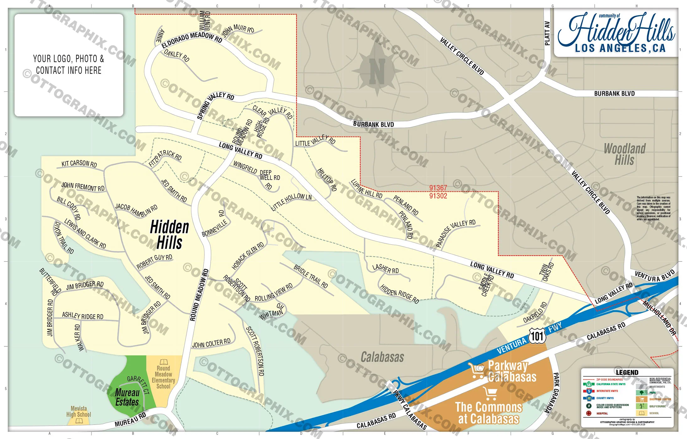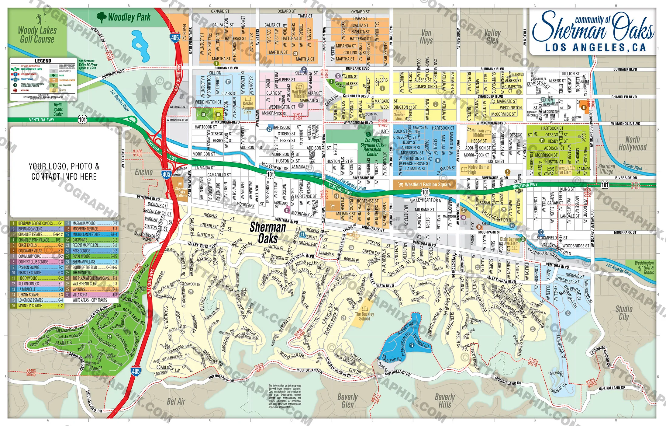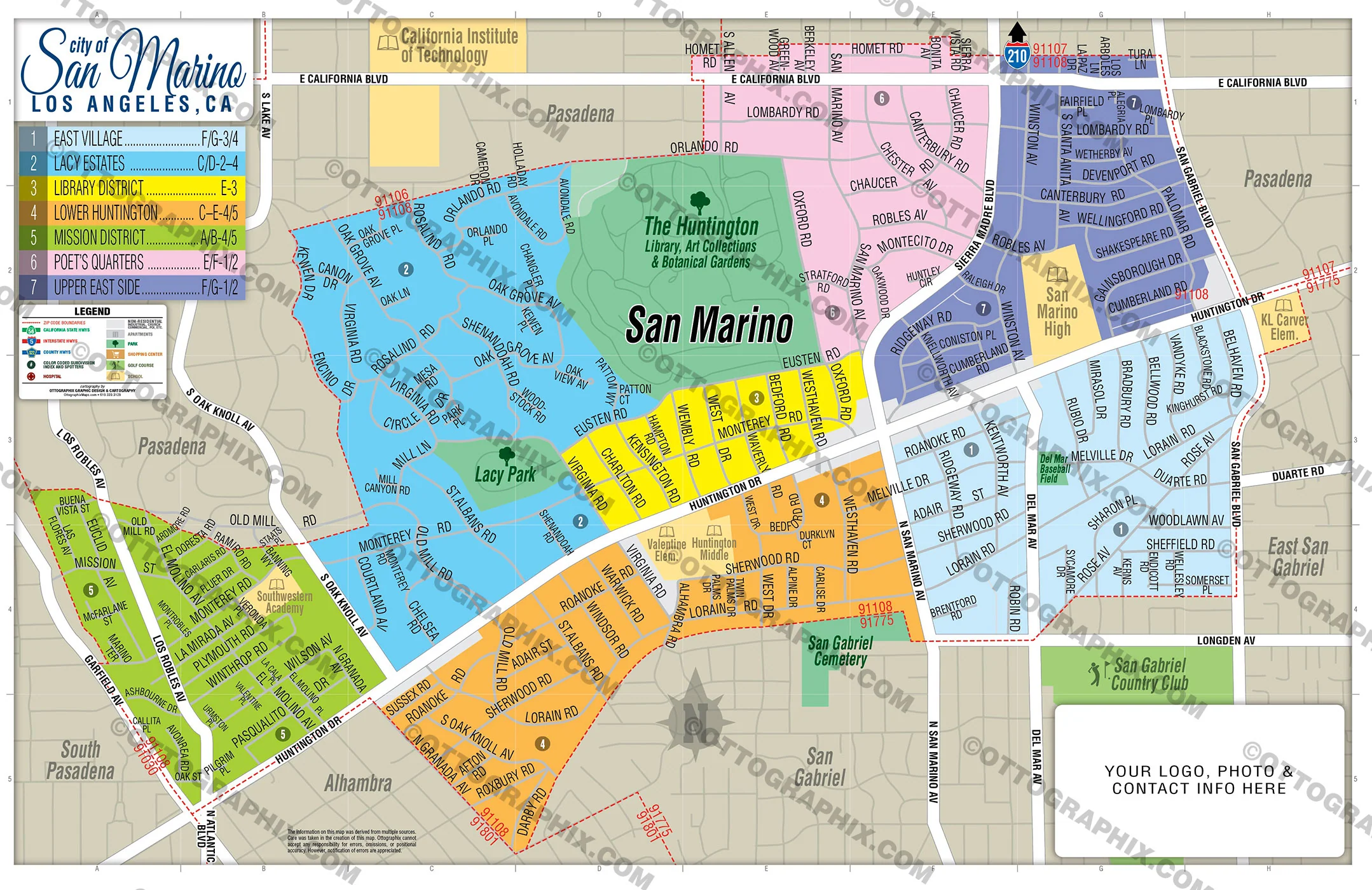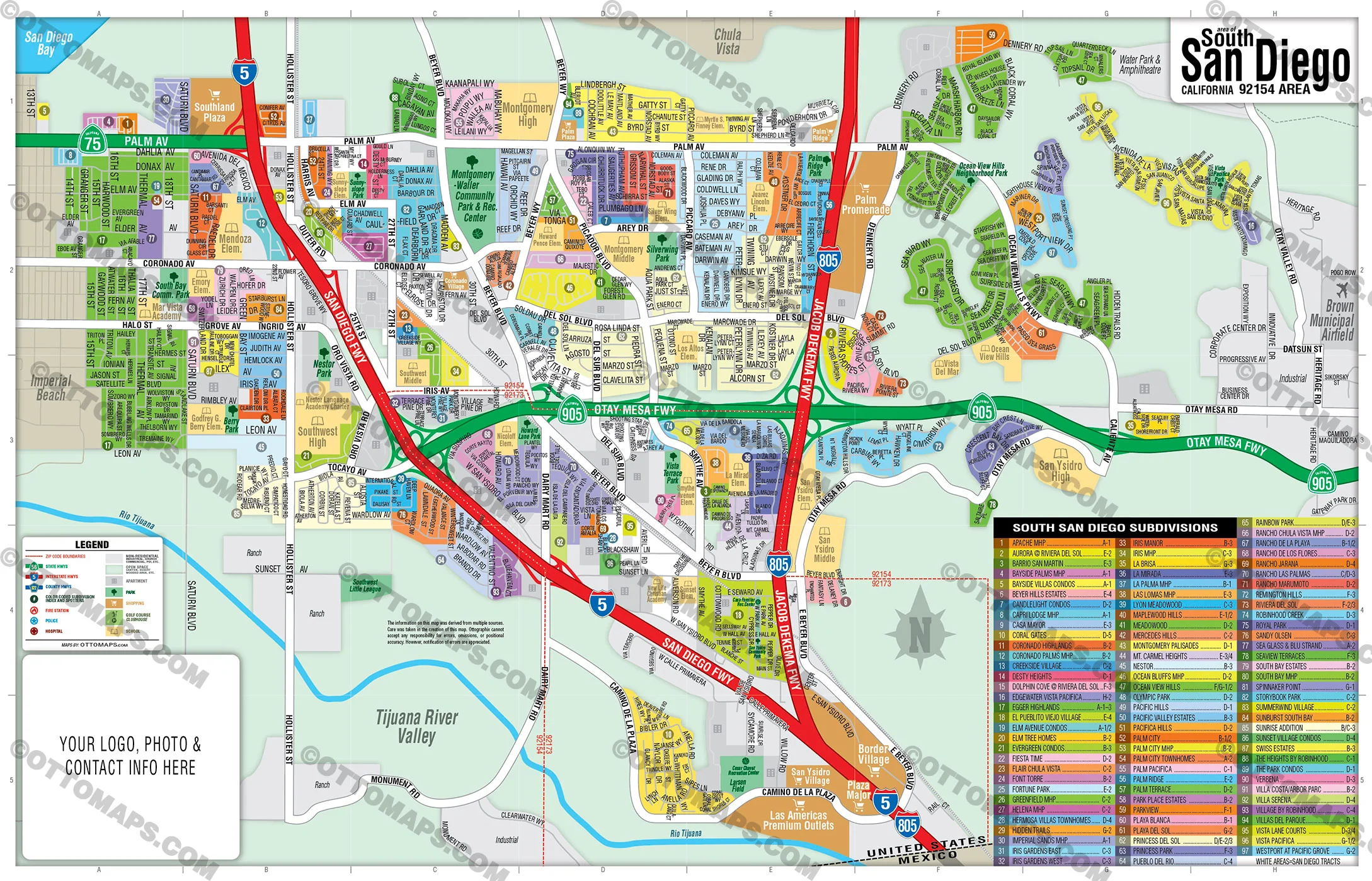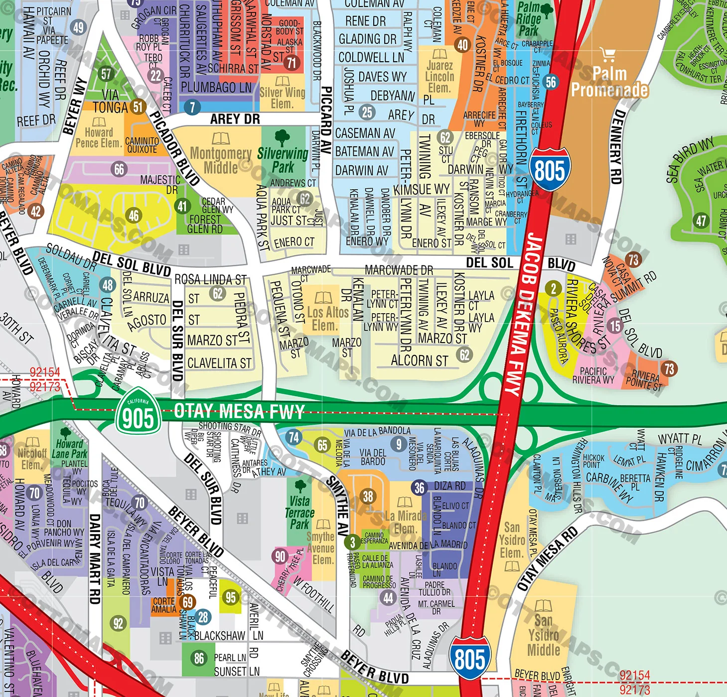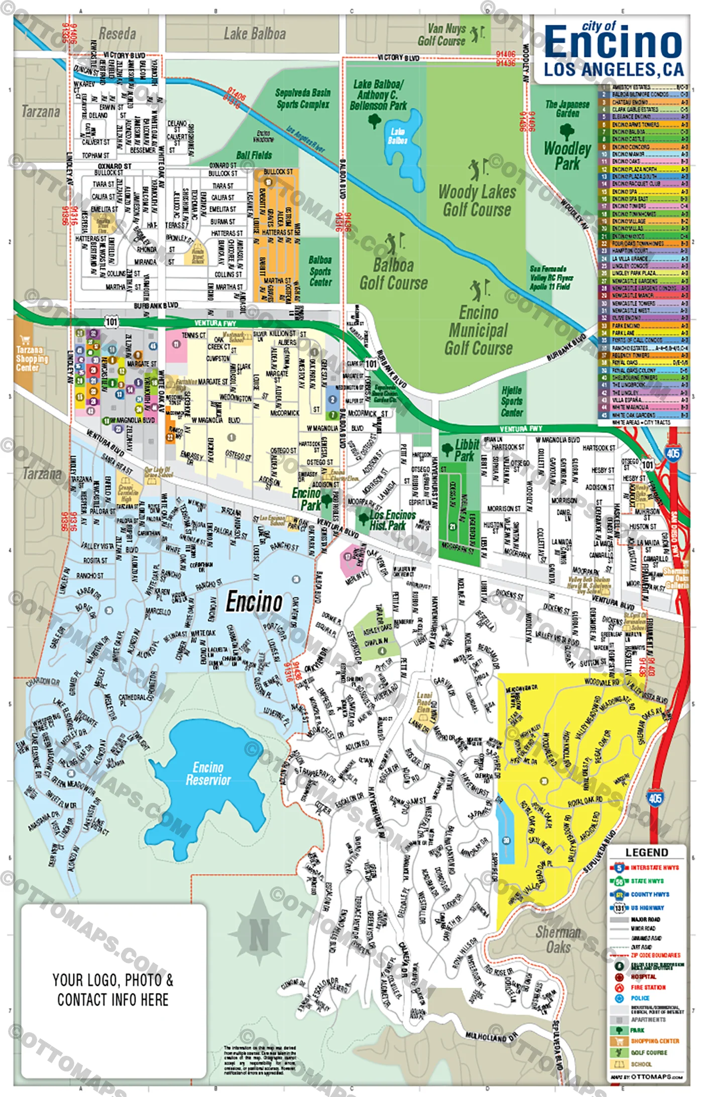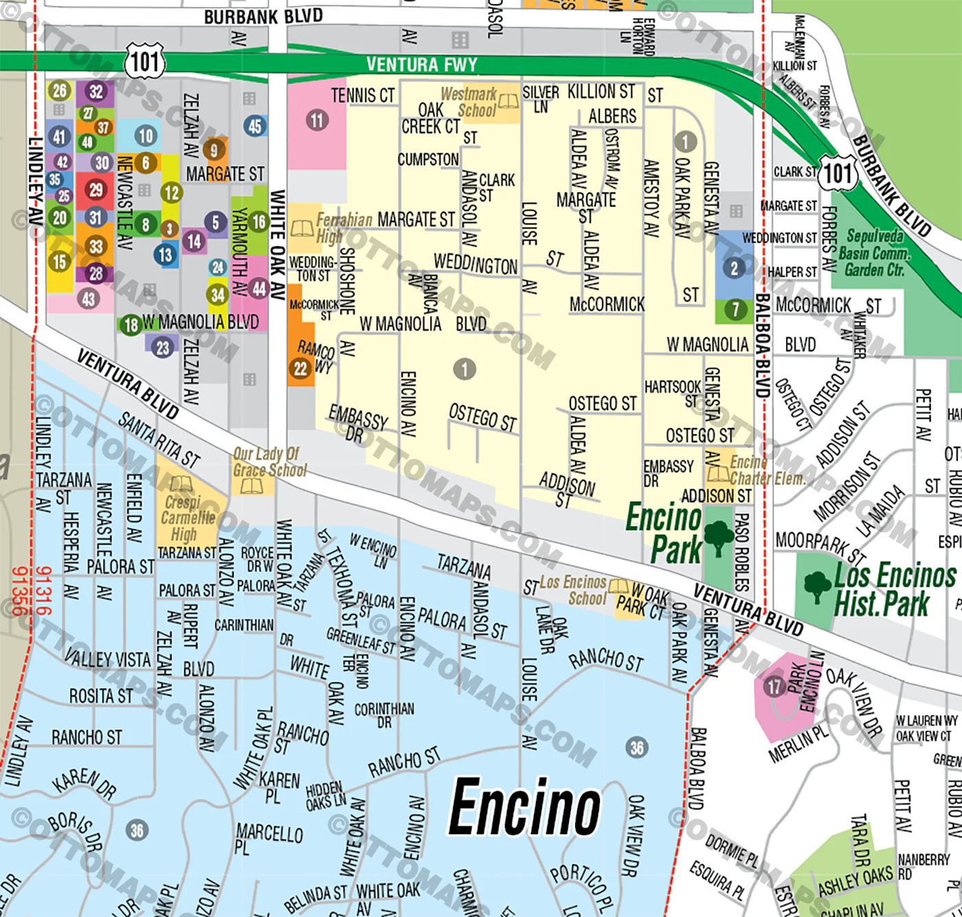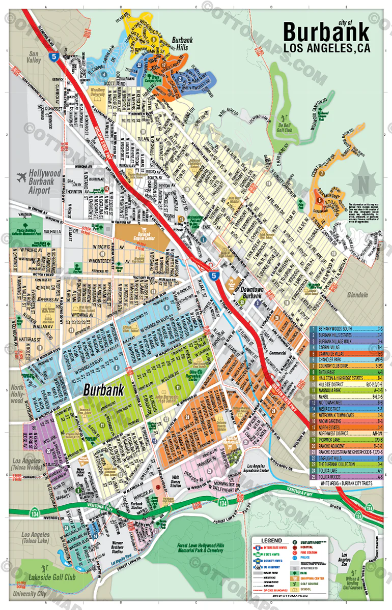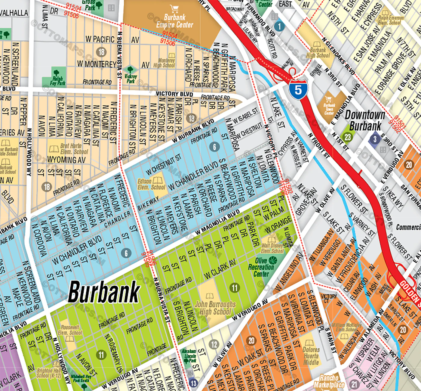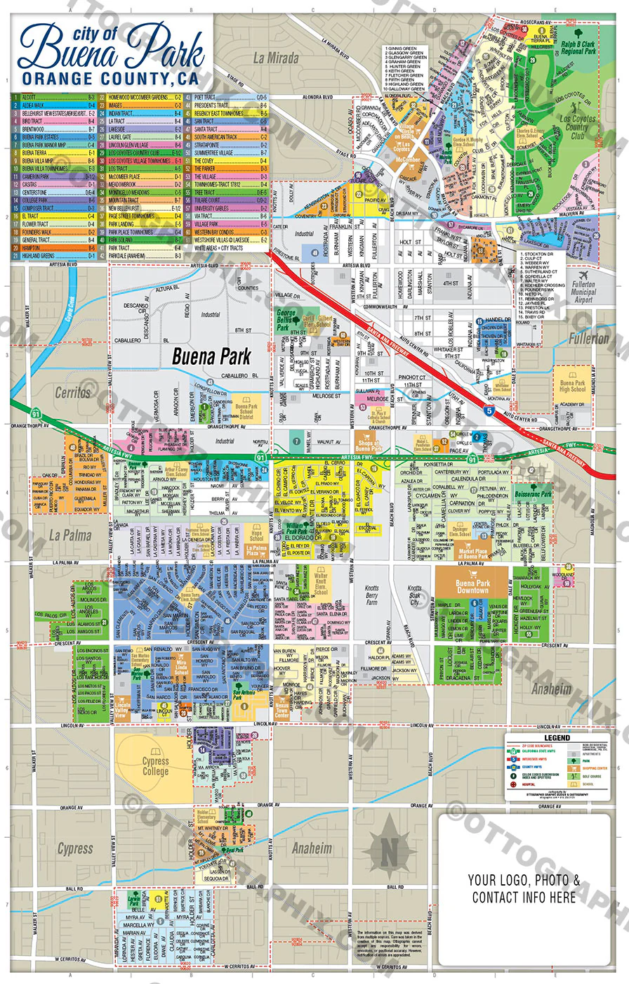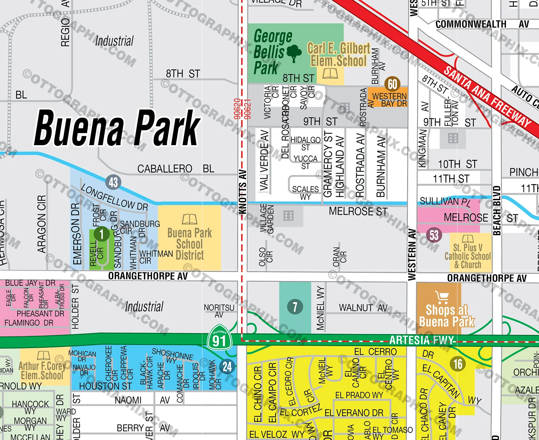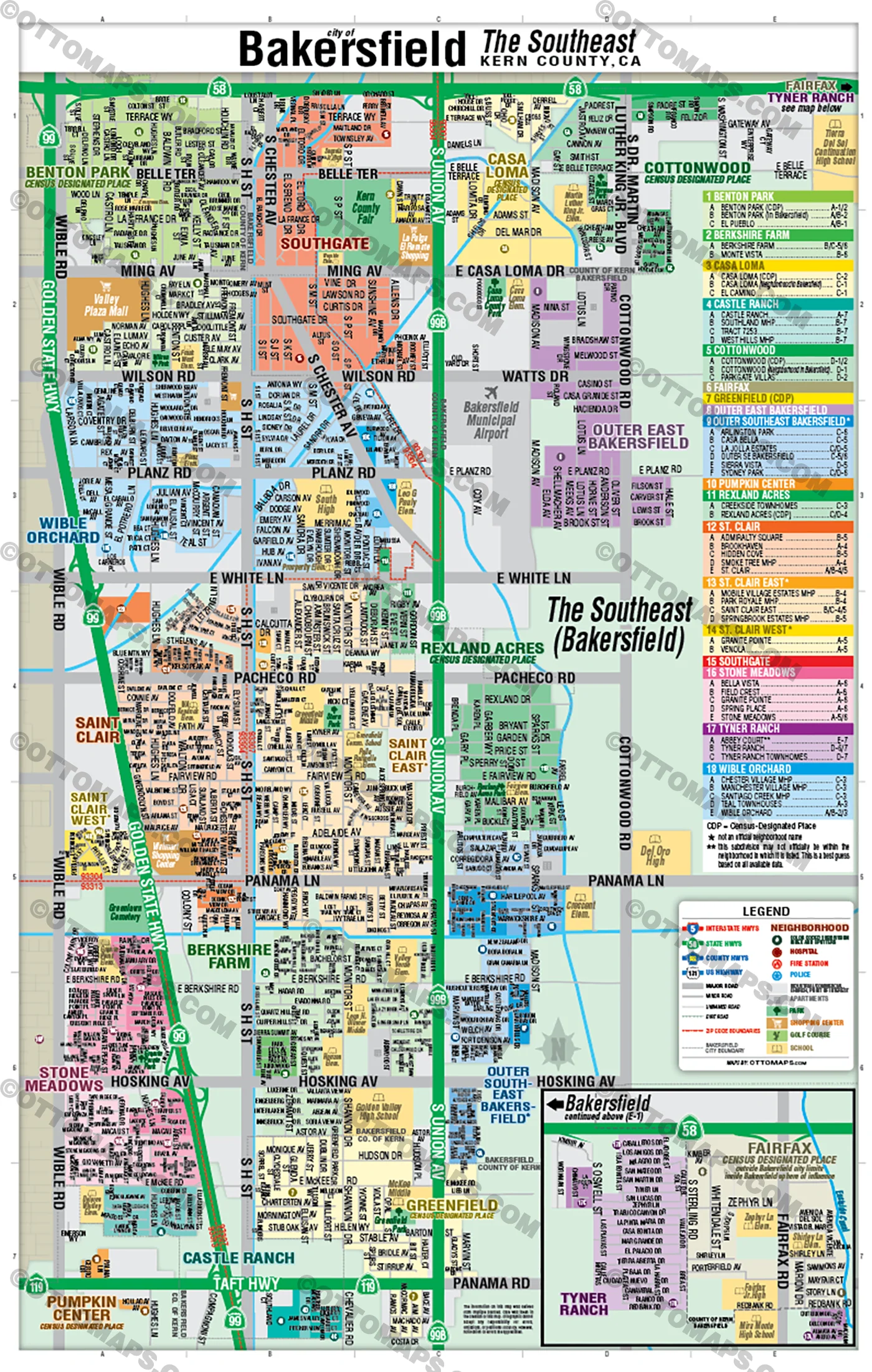
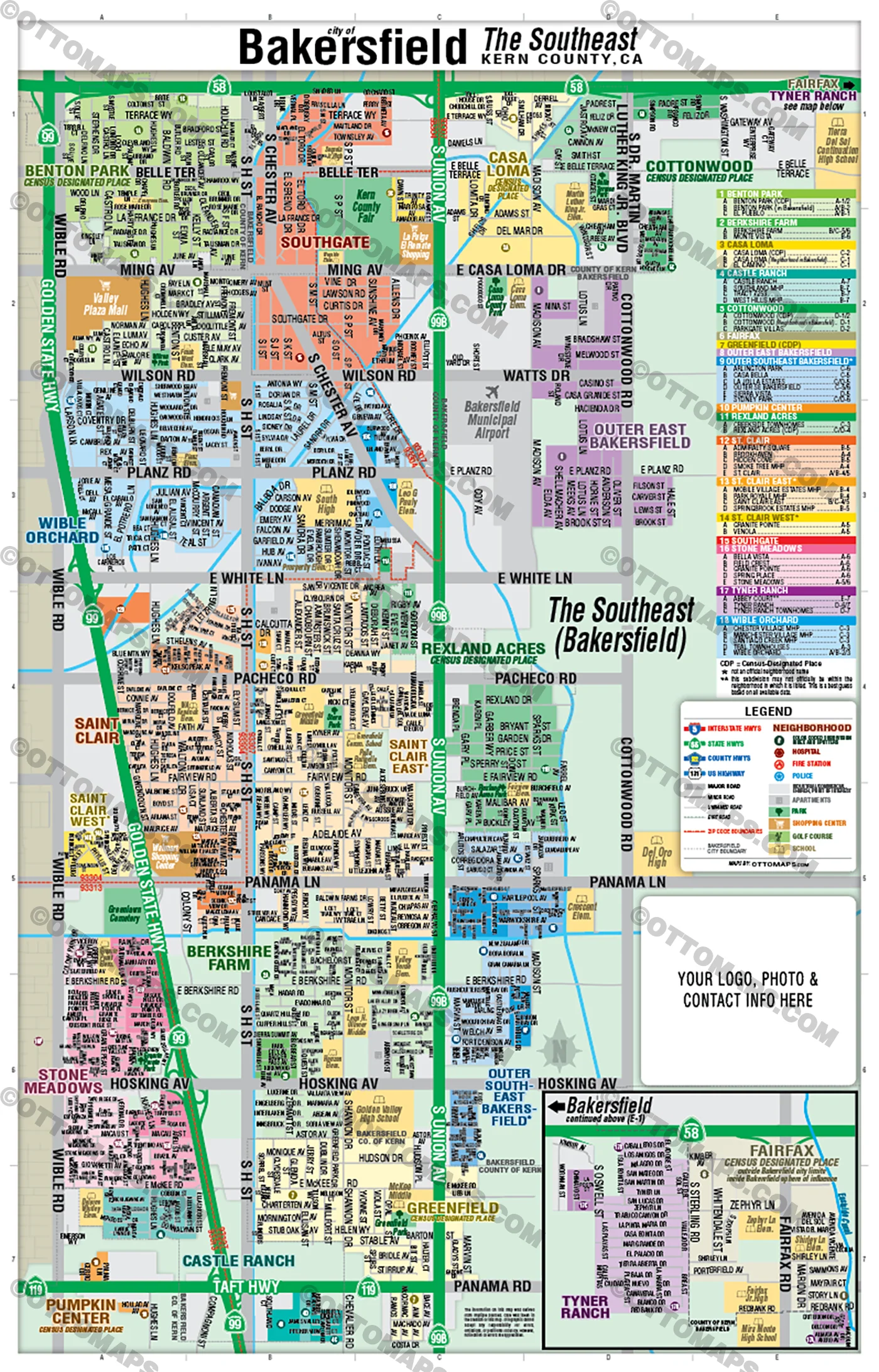
Bakersfield Map, The Southeast - Kern County, CA - FILES - PDF and AI Files, editable, vector, royalty free
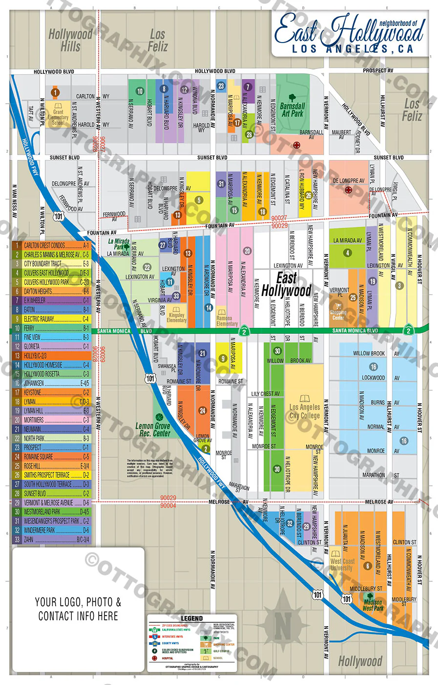
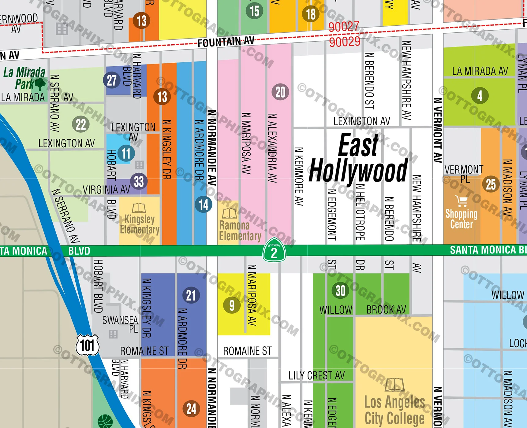
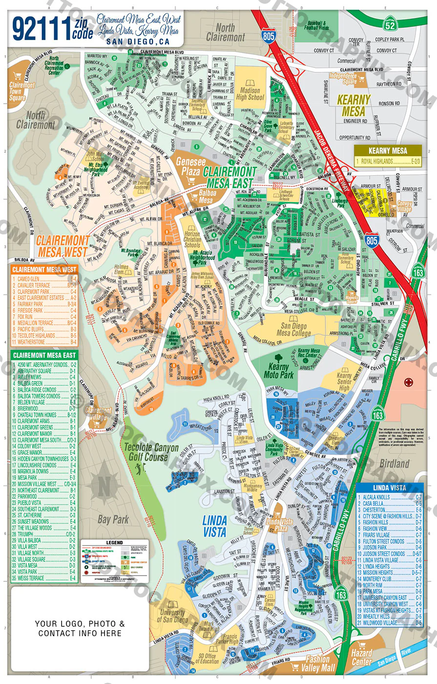
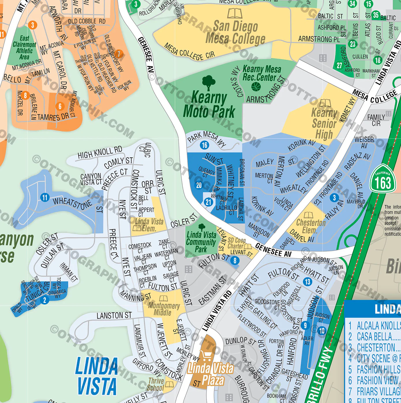
BAKERSFIELD SOUTHEAST MAP POSTER PRINTS
BAKERSFIELD SOUTHEAST MAP FILES - PDF and AI, editable, layered
PURCHASE INCLUDES:
- PDF Files - with Company Branding Box and without
- Adobe Illustrator Files and fonts (layered, editable)
- 11”x17” Vector File - enlarged or reduced to any size with out loss of quality
- Customization: Turn map layers on or off. Easily change Fonts and Colors
- Royalty Free / All Reproduction Rights Granted (not for resale)
- Prints not included, recommend GET PRINTS HERE
- NO SALES TAX!
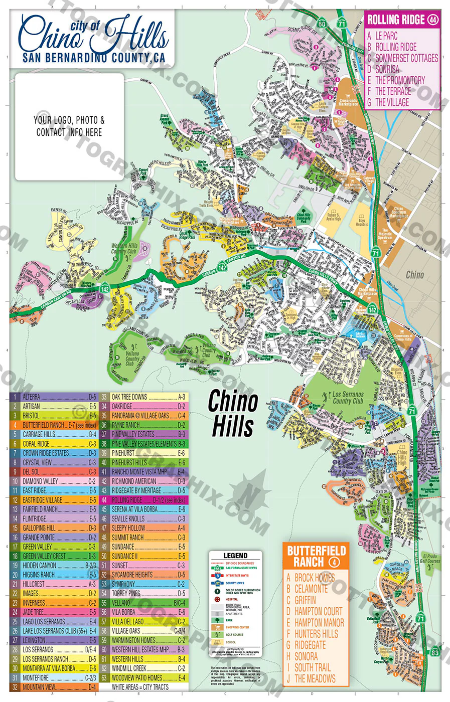
COMMUNITIES:
ABBEY COURT
ADMIRALTY SQUARE
ARLINGTON PARK
BELLA VISTA
BENTON PARK (CDP)
BENTON PARK (in Bakersfield)
BERKSHIRE FARM
BROOKHAVEN
CASA BELLA
CASA LOMA (CDP)
CASA LOMA (Neighborhood in Bakersfield)
CASTLE RANCH
CHESTER VILLAGE MHP
COTTONWOOD (CDP)
COTTONWOOD (Neighborhood in Bakersfield)
CREEKSIDE TOWNHOMES
EL CAMINO
EL PUEBLO
FAIRFAX (CDP)
FIELD CREST
GRANITE POINTE
GRANITE POINTE
GREENFIELD (CDP)
HIDDEN COVE
LA JOLLA ESTATES
MANCHESTER VILLAGE MHP
MOBILE VILLAGE ESTATES MHP
MONTE VISTA
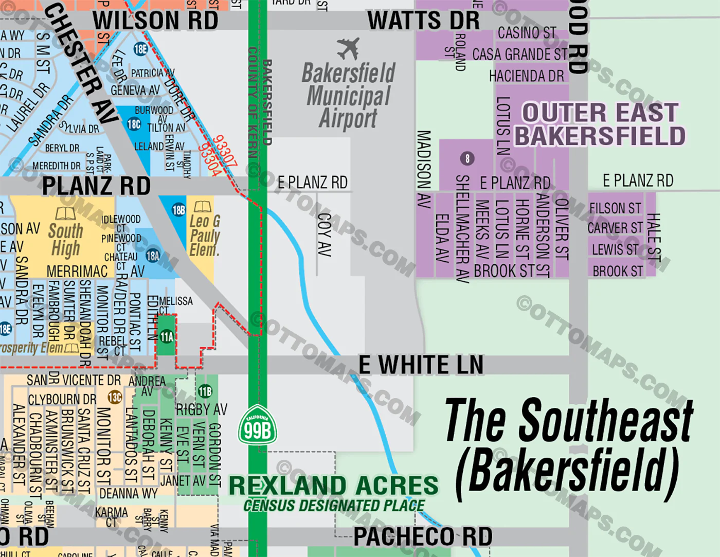
OUTER EAST BAKERSFIELD
OUTER SE BAKERSFIELD
PARK ROYALE MHP
PARKGATE VILLAS
PUMPKIN CENTER
REXLAND ACRES (CDP)
SAINT CLAIR EAST
SANTIAGO CREEK MHP
SIERRA VISTA
SMOKE TREE MHP
SOUTHGATE
SOUTHLAND MHP
SPRING PLACE
SPRINGBROOK ESTATES MHP
ST. CLAIR
STONE MEADOWS
SYDNEY PARK
TEAL TOWNHOUSES
TRACT 7253
TYNER RANCH
TYNER RANCH TOWNHOMES
VENOLA
WEST HILLS MHP
WIBLE ORCHARD
DETAILS:
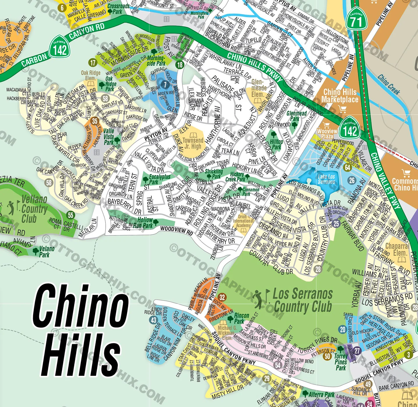
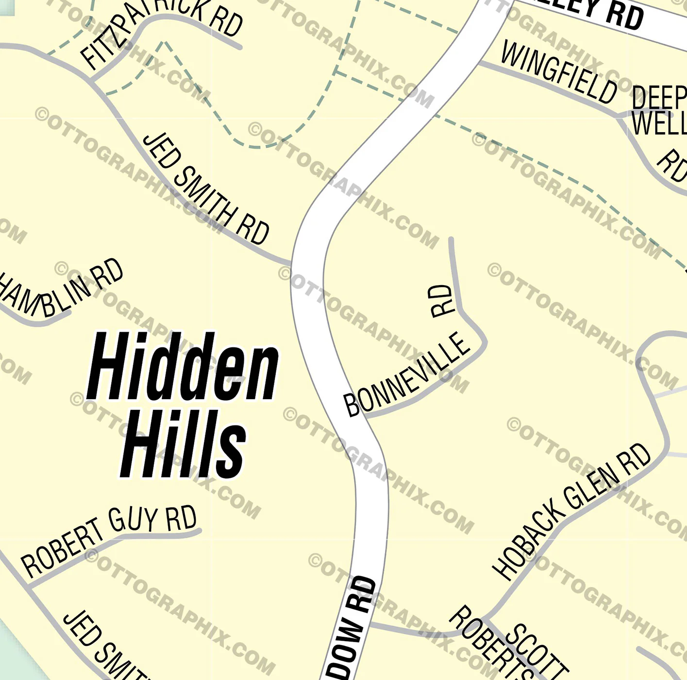
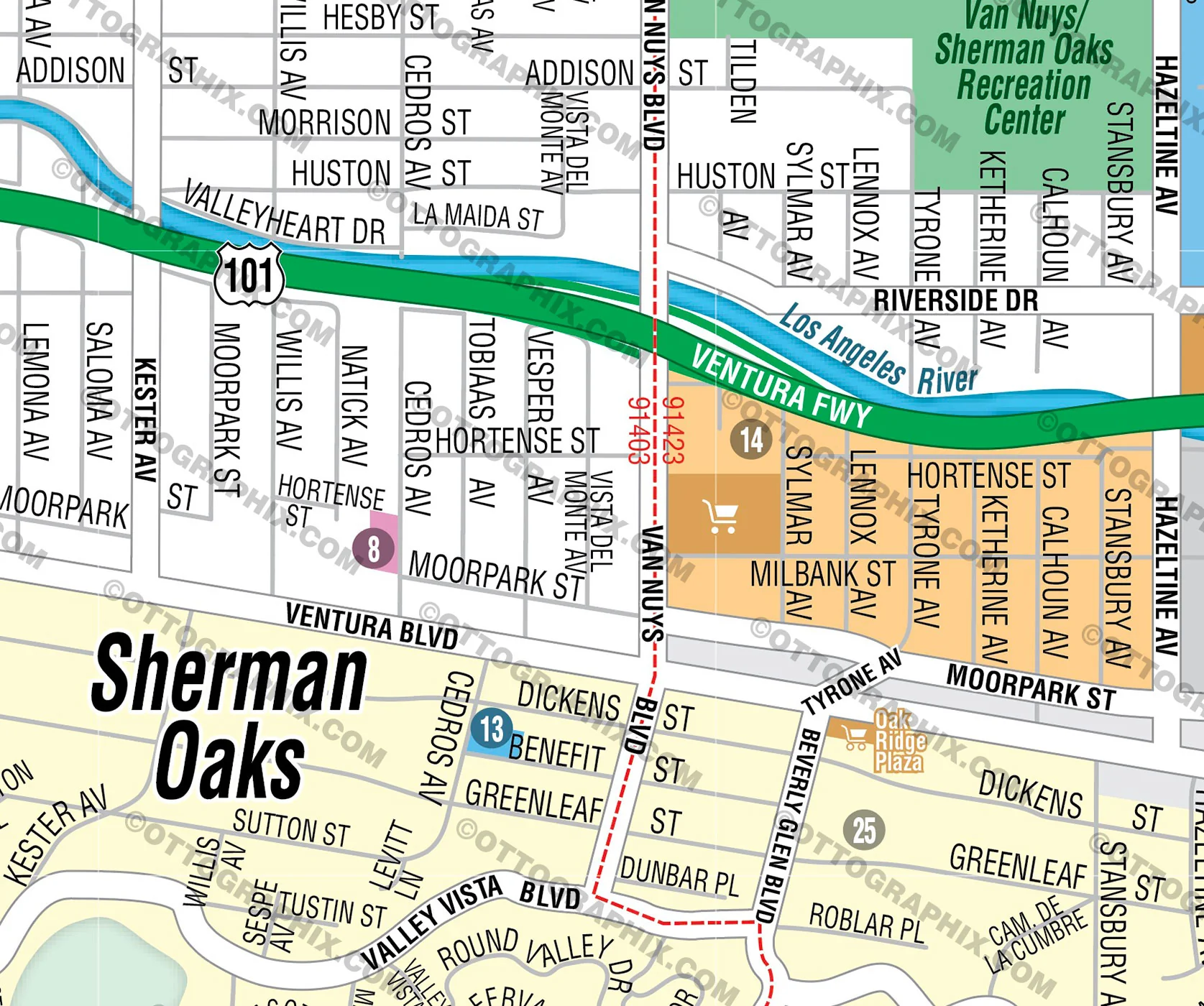
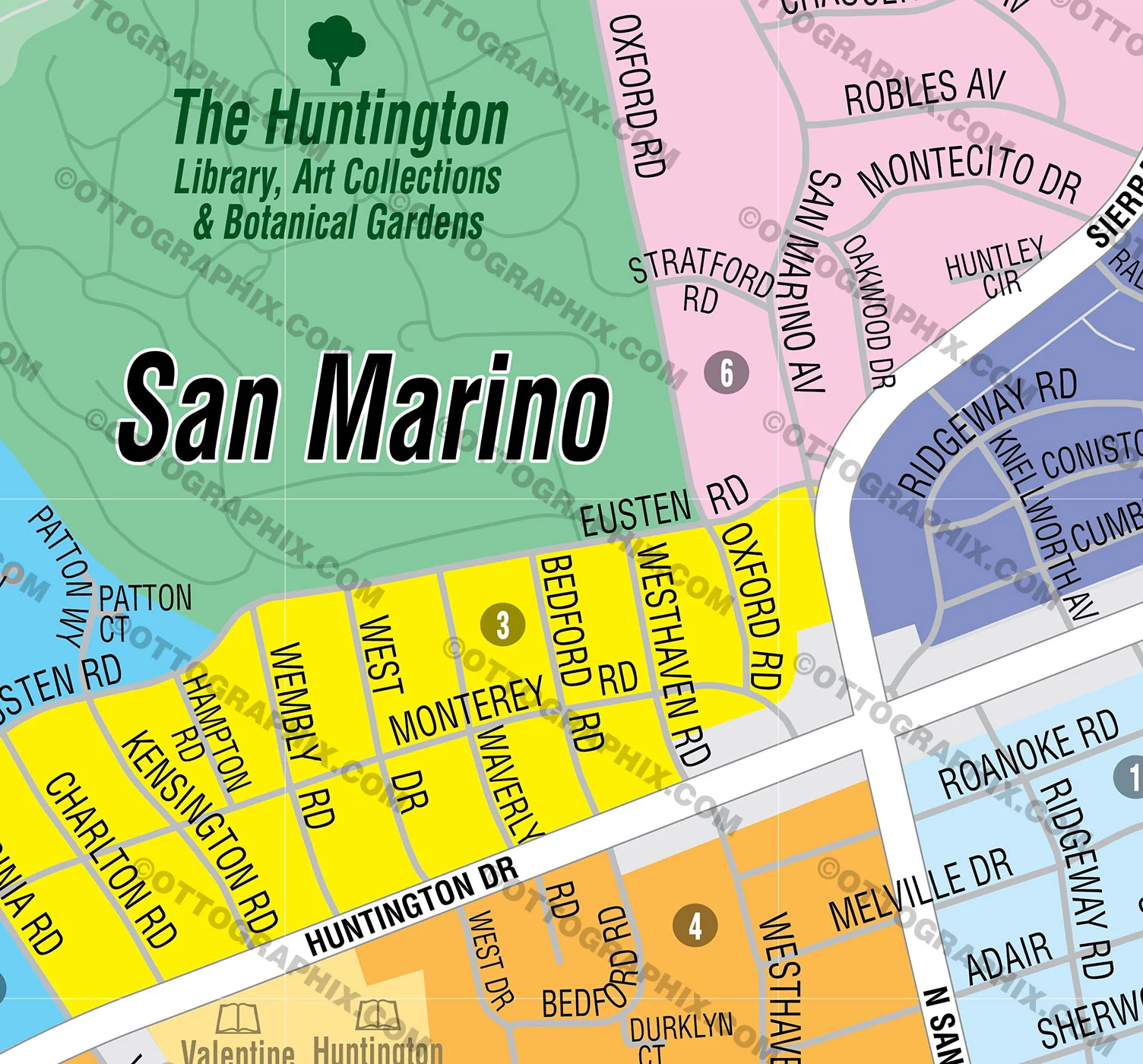
- Subdivision/Tract Boundaries and Index
- Full Street Detail
- Recreation Centers
- Parks
- Shopping Centers
- Golf Courses
- Schools
RIGHTS:
- Royalty Free
- Not for resale
- All reproduction rights granted
DISCLAIMER:
- The information on this map was derived from multiple sources. Care was taken in the creation of this map. Ottographix cannot accept any responsibility for errors, omissions, or positional accuracy. However, notification of errors are appreciated. If you find a mistake, Ottographix will fix it for no charge. Please contact us and we'll take care of it. https://www.ottographix.com/contact.html, [email protected]
- Maps are sold as-is. All necessary files are included for editing
- Additional customization is available from Ottographix at an additional cost. Please contact us for details and a free quote. http://www.ottographix.com/contact.html, [email protected]
Product Information
Product Information
Shipping & Returns
Shipping & Returns
Description
BAKERSFIELD SOUTHEAST MAP POSTER PRINTS
BAKERSFIELD SOUTHEAST MAP FILES - PDF and AI, editable, layered
PURCHASE INCLUDES:
- PDF Files - with Company Branding Box and without
- Adobe Illustrator Files and fonts (layered, editable)
- 11”x17” Vector File - enlarged or reduced to any size with out loss of quality
- Customization: Turn map layers on or off. Easily change Fonts and Colors
- Royalty Free / All Reproduction Rights Granted (not for resale)
- Prints not included, recommend GET PRINTS HERE
- NO SALES TAX!
COMMUNITIES:
ABBEY COURT
ADMIRALTY SQUARE
ARLINGTON PARK
BELLA VISTA
BENTON PARK (CDP)
BENTON PARK (in Bakersfield)
BERKSHIRE FARM
BROOKHAVEN
CASA BELLA
CASA LOMA (CDP)
CASA LOMA (Neighborhood in Bakersfield)
CASTLE RANCH
CHESTER VILLAGE MHP
COTTONWOOD (CDP)
COTTONWOOD (Neighborhood in Bakersfield)
CREEKSIDE TOWNHOMES
EL CAMINO
EL PUEBLO
FAIRFAX (CDP)
FIELD CREST
GRANITE POINTE
GRANITE POINTE
GREENFIELD (CDP)
HIDDEN COVE
LA JOLLA ESTATES
MANCHESTER VILLAGE MHP
MOBILE VILLAGE ESTATES MHP
MONTE VISTA
OUTER EAST BAKERSFIELD
OUTER SE BAKERSFIELD
PARK ROYALE MHP
PARKGATE VILLAS
PUMPKIN CENTER
REXLAND ACRES (CDP)
SAINT CLAIR EAST
SANTIAGO CREEK MHP
SIERRA VISTA
SMOKE TREE MHP
SOUTHGATE
SOUTHLAND MHP
SPRING PLACE
SPRINGBROOK ESTATES MHP
ST. CLAIR
STONE MEADOWS
SYDNEY PARK
TEAL TOWNHOUSES
TRACT 7253
TYNER RANCH
TYNER RANCH TOWNHOMES
VENOLA
WEST HILLS MHP
WIBLE ORCHARD
DETAILS:
- Subdivision/Tract Boundaries and Index
- Full Street Detail
- Recreation Centers
- Parks
- Shopping Centers
- Golf Courses
- Schools
RIGHTS:
- Royalty Free
- Not for resale
- All reproduction rights granted
DISCLAIMER:
- The information on this map was derived from multiple sources. Care was taken in the creation of this map. Ottographix cannot accept any responsibility for errors, omissions, or positional accuracy. However, notification of errors are appreciated. If you find a mistake, Ottographix will fix it for no charge. Please contact us and we'll take care of it. https://www.ottographix.com/contact.html, [email protected]
- Maps are sold as-is. All necessary files are included for editing
- Additional customization is available from Ottographix at an additional cost. Please contact us for details and a free quote. http://www.ottographix.com/contact.html, [email protected]