Coto De Caza Map, Orange County, CA - FILES - PDF and AI Files, editable, vector, royalty free
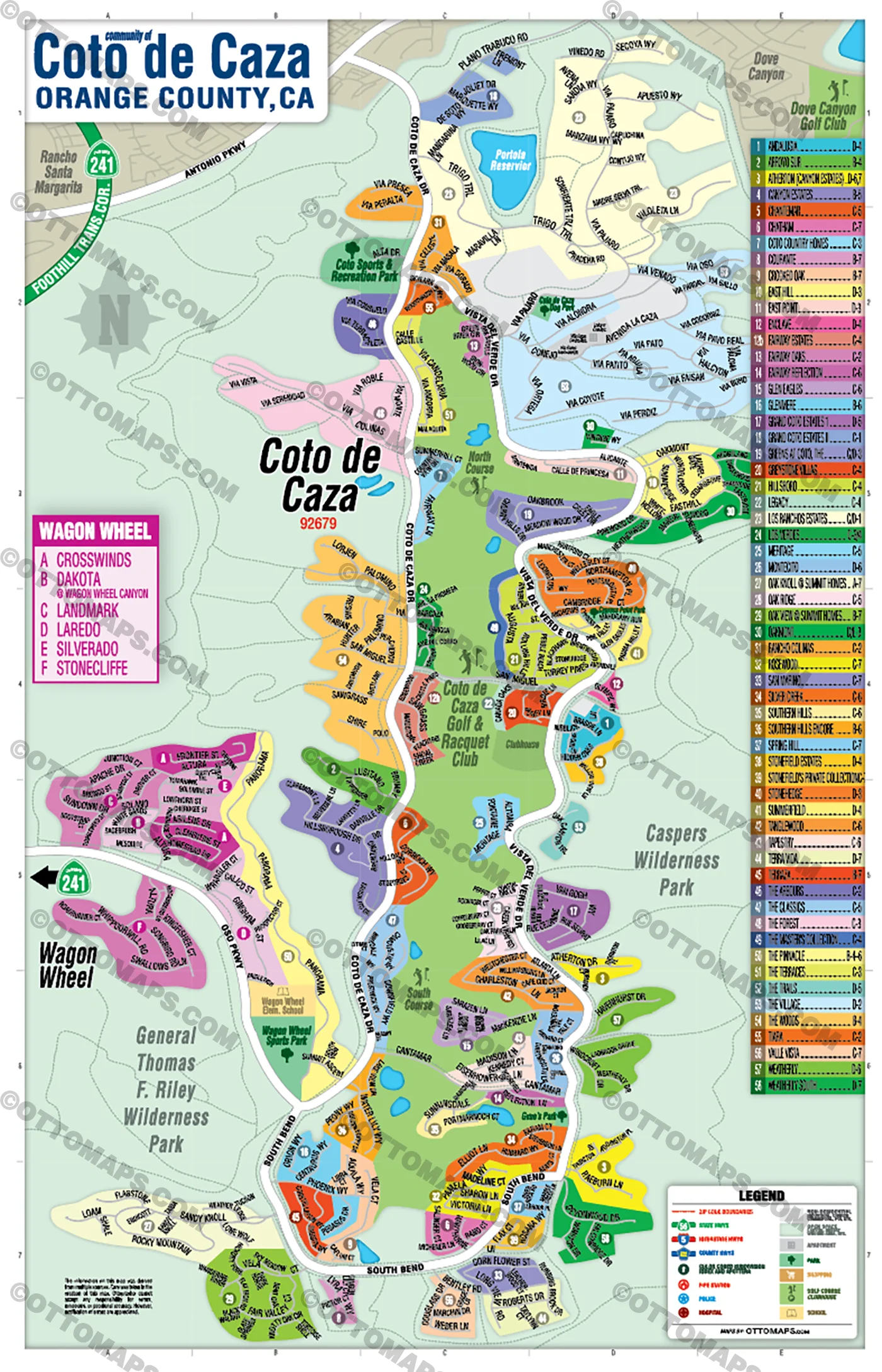
COTO DE CAZA MAP POSTER PRINT
COTO DE CAZA MAP FILES PDF and AI, editable, vector, layered, royalty free
PURCHASE INCLUDES:
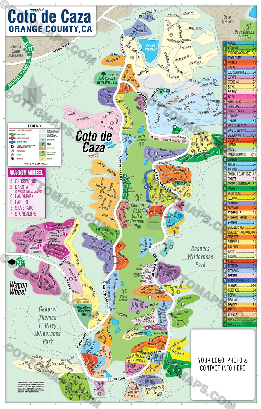
- PDF Files - with Company Branding Box and without
- Adobe Illustrator Files and fonts (layered, editable)
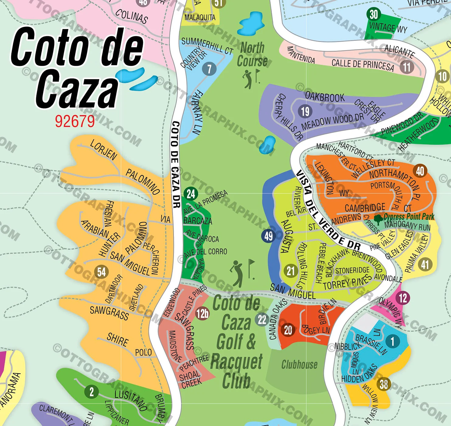
- 11”x17” Vector File - enlarged or reduced to any size with out loss of quality
- Customization: Turn map layers on or off. Easily change Fonts and Colors
- Royalty Free / All Reproduction Rights Granted (not for resale)
- Prints not included, recommend GET PRINTS HERE
- NO SALES TAX!
COMMUNITIES:
ANDALUSIA
ARROYO SUR
ATHERTON (CANYON ESTATES)
CANYON ESTATES
CHANTEMAR
CHATHAM
COTO COUNTRY HOMES
COURANTE
CROOKED OAK
EAST HILL
EAST POINT
ENCLAVE
FAIRWAY OAKS
FAIRWAY REFLECTION
GLEN EAGLES
GLENMERE
GRAND COTO ESTATES 1
GRAND COTO ESTATES II
GREENS AT COTO, THE
GREYSTONE VILLAS
HILLSBORO
LEGACY
LOS RANCHOS ESTATES
LOS VERDES
MERITAGE
MONTECITO
OAK KNOLL @ SUMMIT HOMES
OAK RIDGE
OAK VIEW @ SUMMIT HOMES
OAKMONT
RANCHO COLINAS
ROSEWOOD
SAN MARINO
SILVER CREEK
SOUTHERN HILLS
SOUTHERN HILLS ENCORE
SPRING HILL
STONEFIELD ESTATES
STONEFIELD’S PRIVATE COLLECTION
STONEHEDGE
SUMMERFIELD
TANGLEWOOD
TAPESTRY
TERRA VIDA
TERRAZA
THE ARBOURS
THE CLASSICS
THE FOREST
THE MASTER’S COLLECTION
THE PINNACLE
THE TERRACES
THE TRAILS
THE VILLAGE
THE WOODS
TIARA
VALLE VISTA
WEATHERLY
WEATHERLY SOUTH
DETAILS:
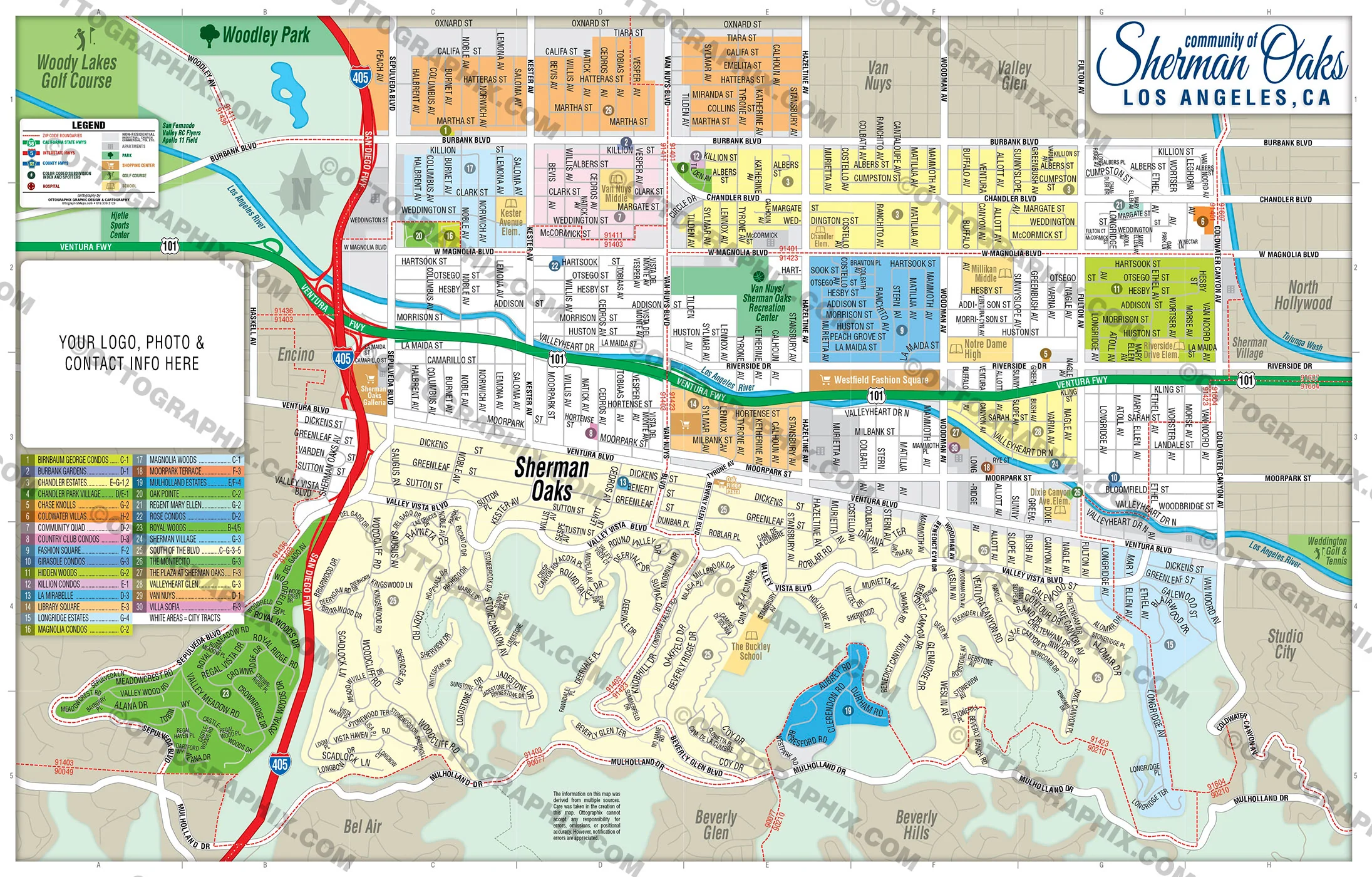
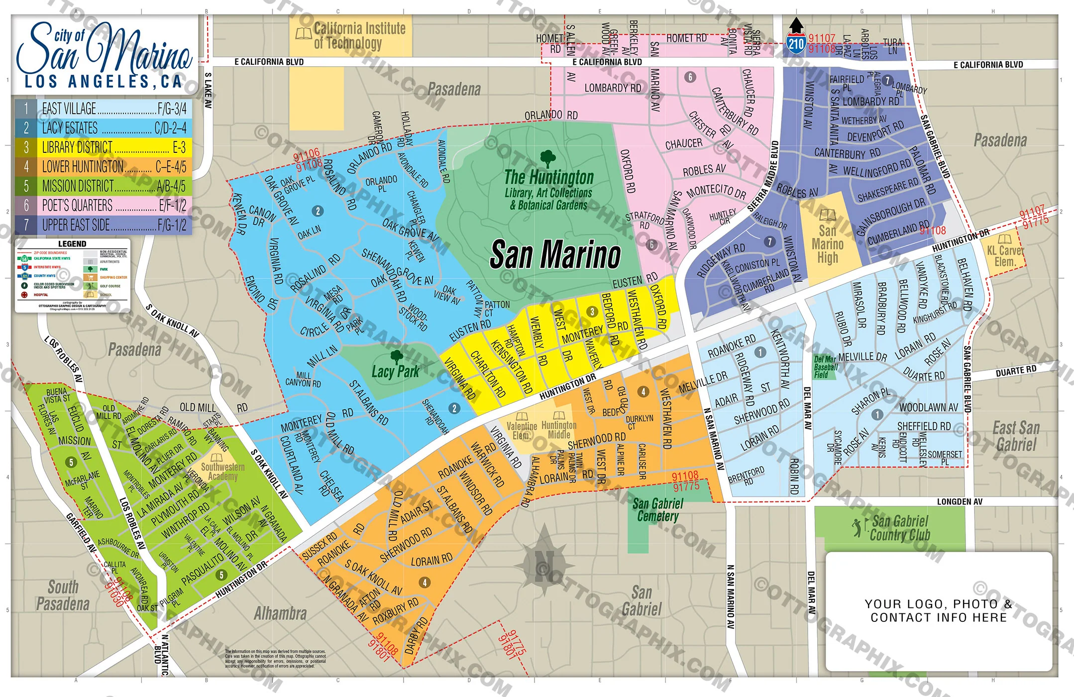
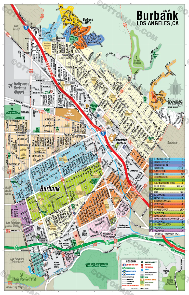
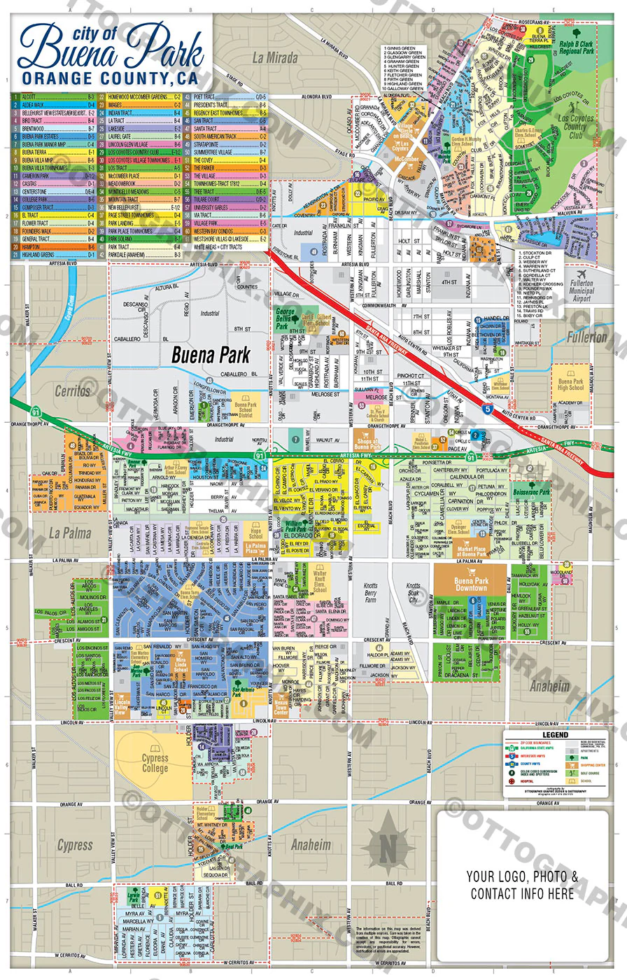
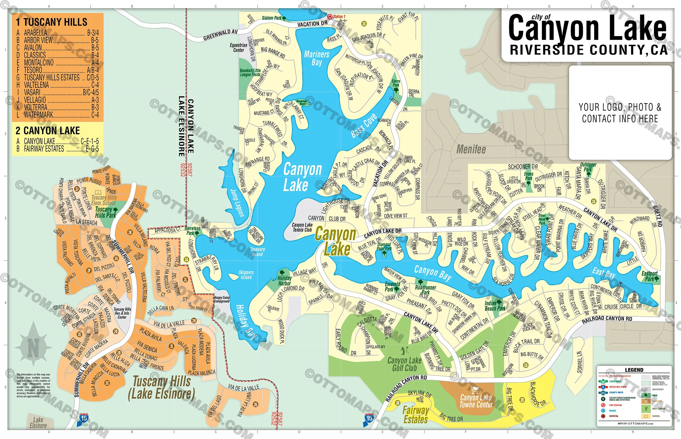
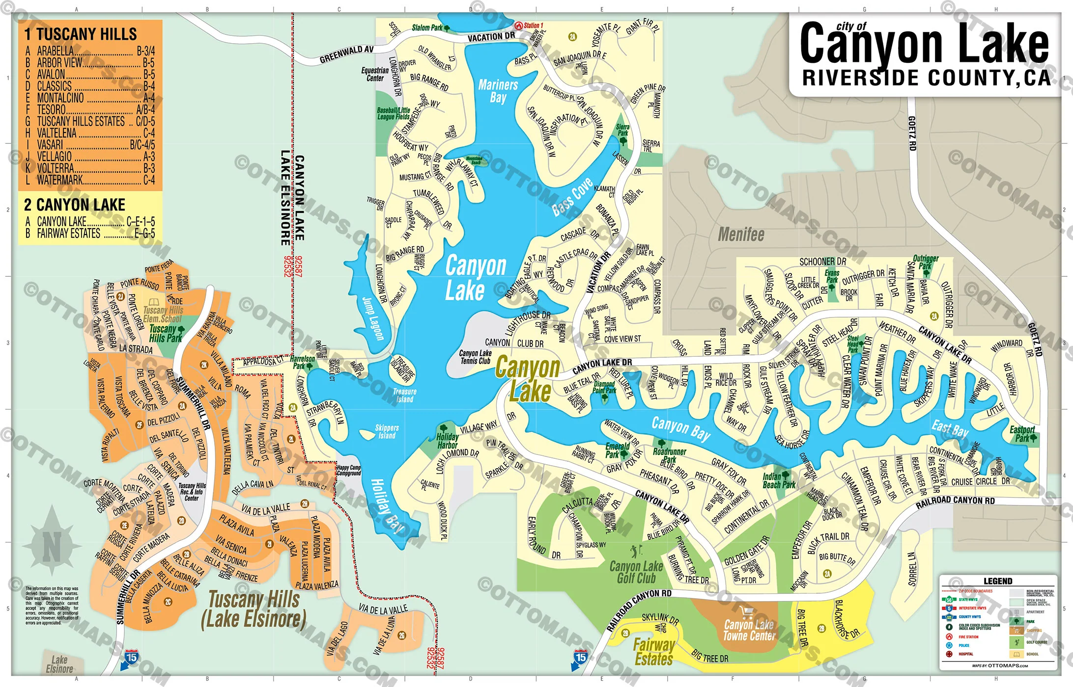
- Subdivision/Tract Boundaries and Index
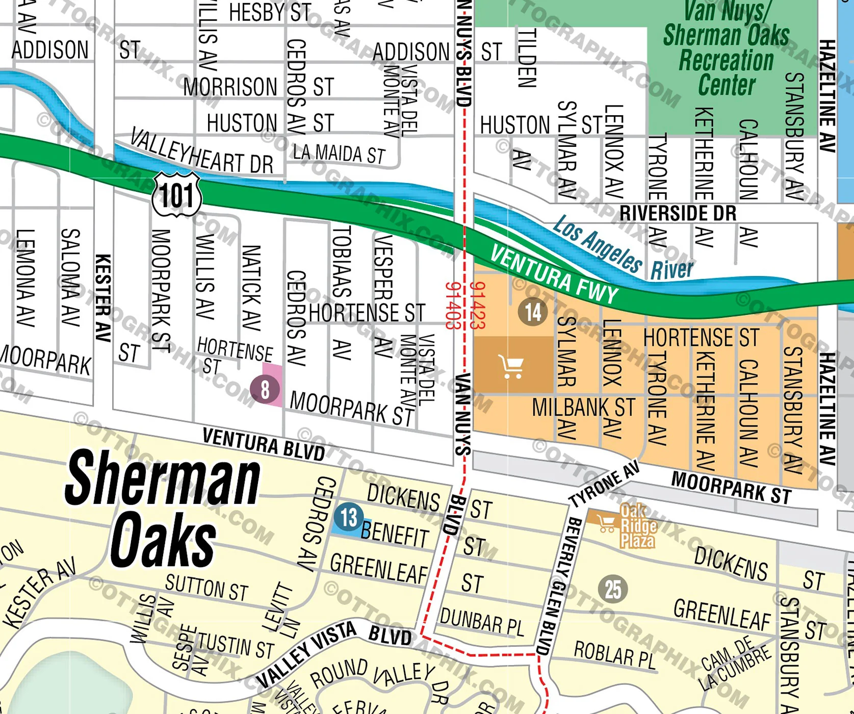
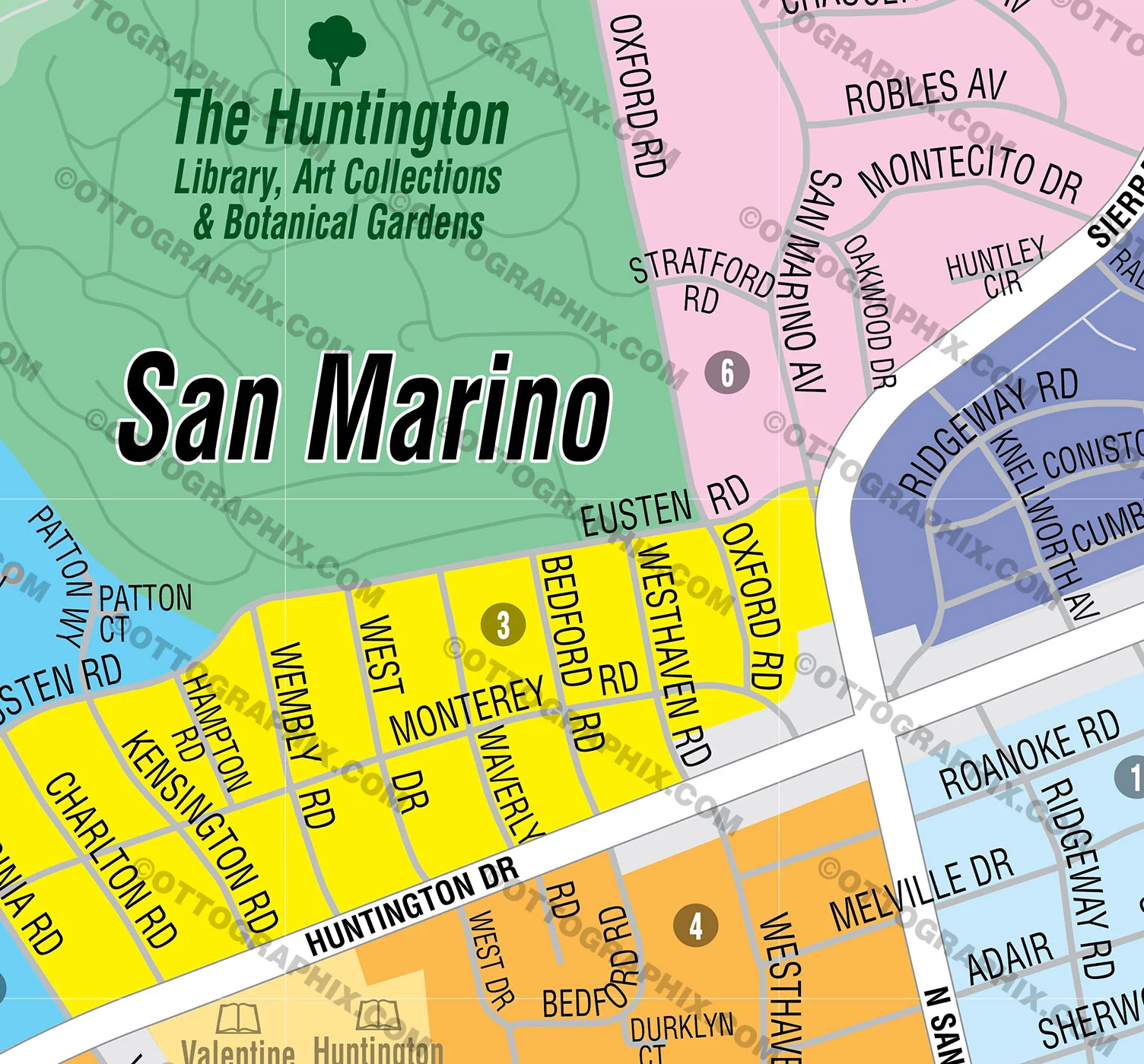
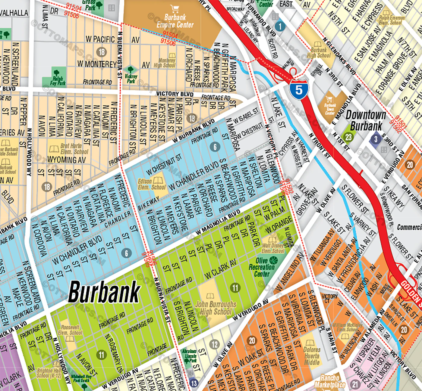
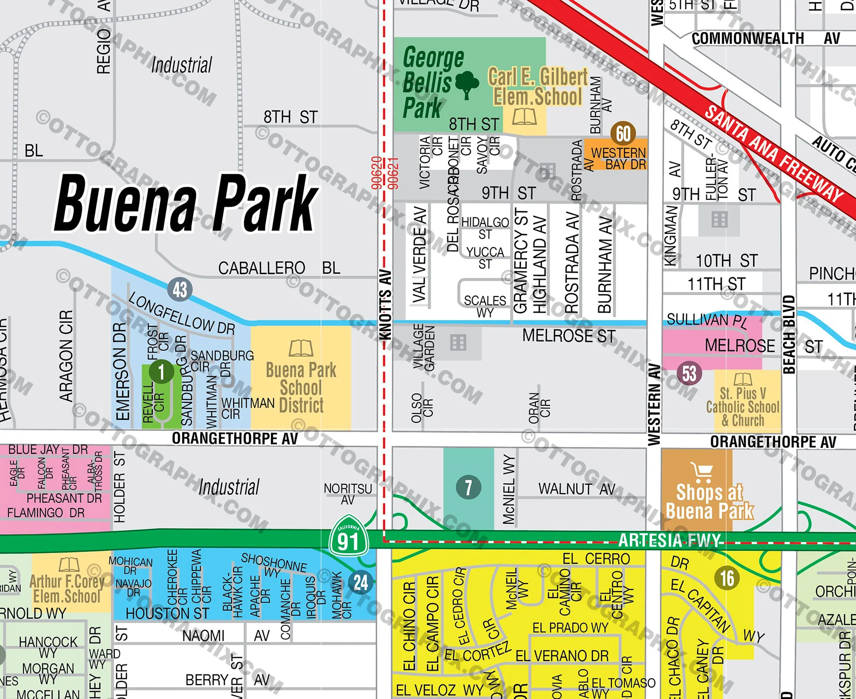
- Full Street Detail
- Recreation Centers
- Parks
- Shopping Centers
- Golf Courses
- Schools
RIGHTS:
- Royalty Free
- Not for resale
- All reproduction rights granted
DISCLAIMER:
- The information on this map was derived from multiple sources. Care was taken in the creation of this map. Ottographix cannot accept any responsibility for errors, omissions, or positional accuracy. However, notification of errors are appreciated. If you find a mistake, Ottographix will fix it for no charge. Please contact us and we'll take care of it. https://www.ottographix.com/contact.html, [email protected]
- Maps are sold as-is. All necessary files are included for editing
- Additional customization is available from Ottographix at an additional cost. Please contact us for details and a free quote. http://www.ottographix.com/contact.html, [email protected]
Original: $95.00
-65%$95.00
$33.25Product Information
Product Information
Shipping & Returns
Shipping & Returns
Description
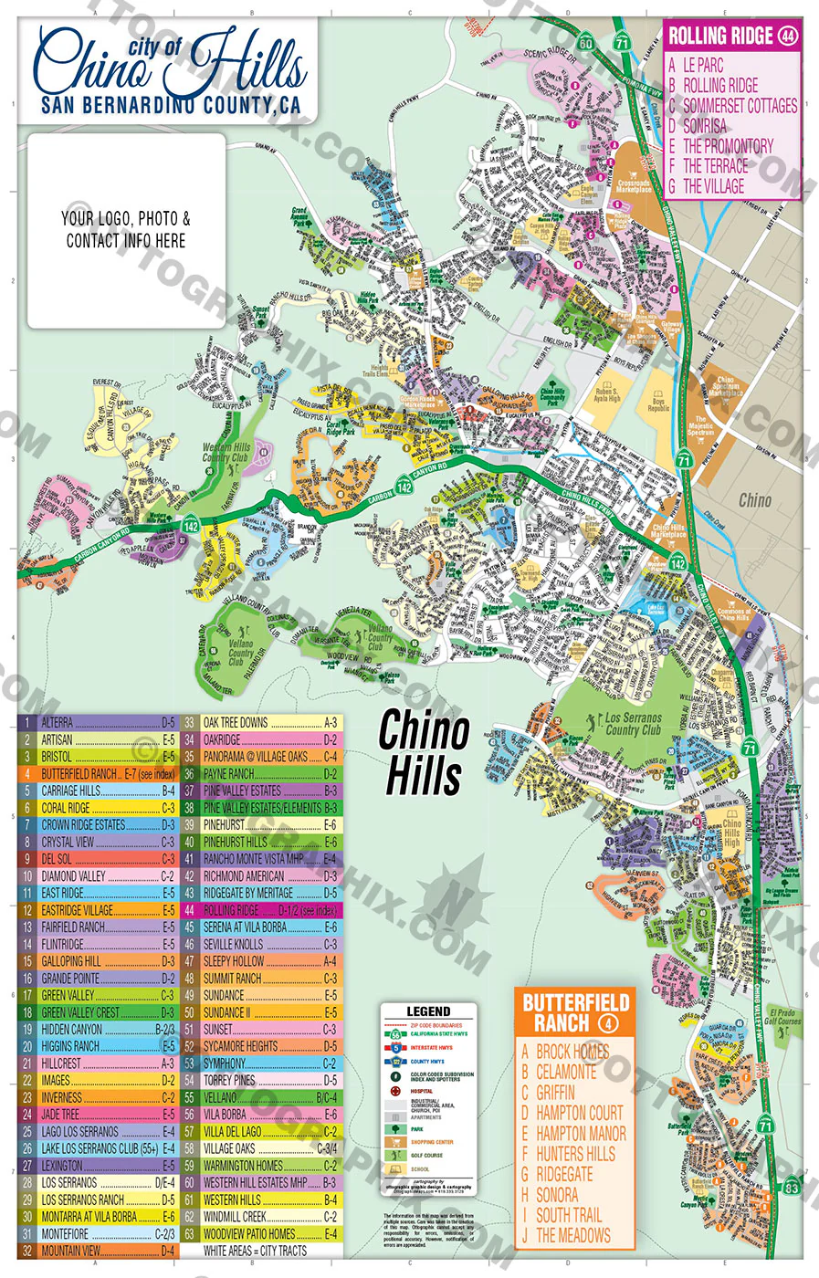
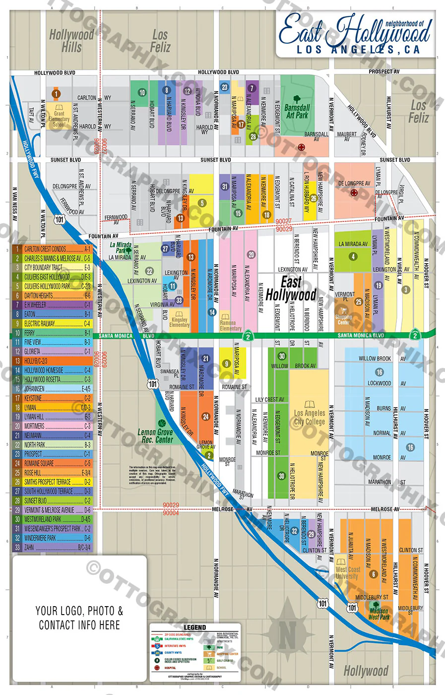
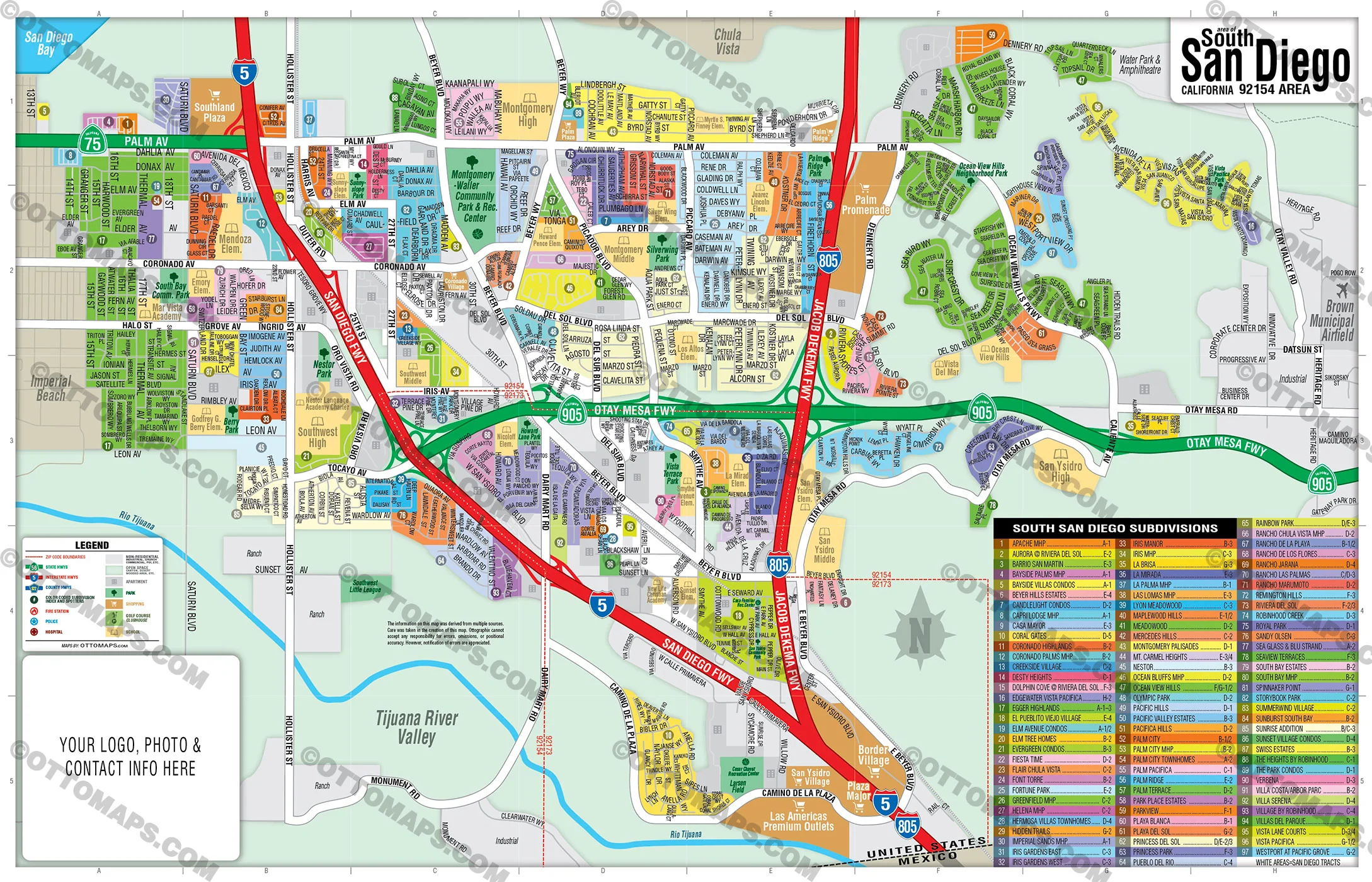
COTO DE CAZA MAP POSTER PRINT
COTO DE CAZA MAP FILES PDF and AI, editable, vector, layered, royalty free
PURCHASE INCLUDES:
- PDF Files - with Company Branding Box and without
- Adobe Illustrator Files and fonts (layered, editable)
- 11”x17” Vector File - enlarged or reduced to any size with out loss of quality
- Customization: Turn map layers on or off. Easily change Fonts and Colors
- Royalty Free / All Reproduction Rights Granted (not for resale)
- Prints not included, recommend GET PRINTS HERE
- NO SALES TAX!
COMMUNITIES:
ANDALUSIA
ARROYO SUR
ATHERTON (CANYON ESTATES)
CANYON ESTATES
CHANTEMAR
CHATHAM
COTO COUNTRY HOMES
COURANTE
CROOKED OAK
EAST HILL
EAST POINT
ENCLAVE
FAIRWAY OAKS
FAIRWAY REFLECTION
GLEN EAGLES
GLENMERE
GRAND COTO ESTATES 1
GRAND COTO ESTATES II
GREENS AT COTO, THE
GREYSTONE VILLAS
HILLSBORO
LEGACY
LOS RANCHOS ESTATES
LOS VERDES
MERITAGE
MONTECITO
OAK KNOLL @ SUMMIT HOMES
OAK RIDGE
OAK VIEW @ SUMMIT HOMES
OAKMONT
RANCHO COLINAS
ROSEWOOD
SAN MARINO
SILVER CREEK
SOUTHERN HILLS
SOUTHERN HILLS ENCORE
SPRING HILL
STONEFIELD ESTATES
STONEFIELD’S PRIVATE COLLECTION
STONEHEDGE
SUMMERFIELD
TANGLEWOOD
TAPESTRY
TERRA VIDA
TERRAZA
THE ARBOURS
THE CLASSICS
THE FOREST
THE MASTER’S COLLECTION
THE PINNACLE
THE TERRACES
THE TRAILS
THE VILLAGE
THE WOODS
TIARA
VALLE VISTA
WEATHERLY
WEATHERLY SOUTH
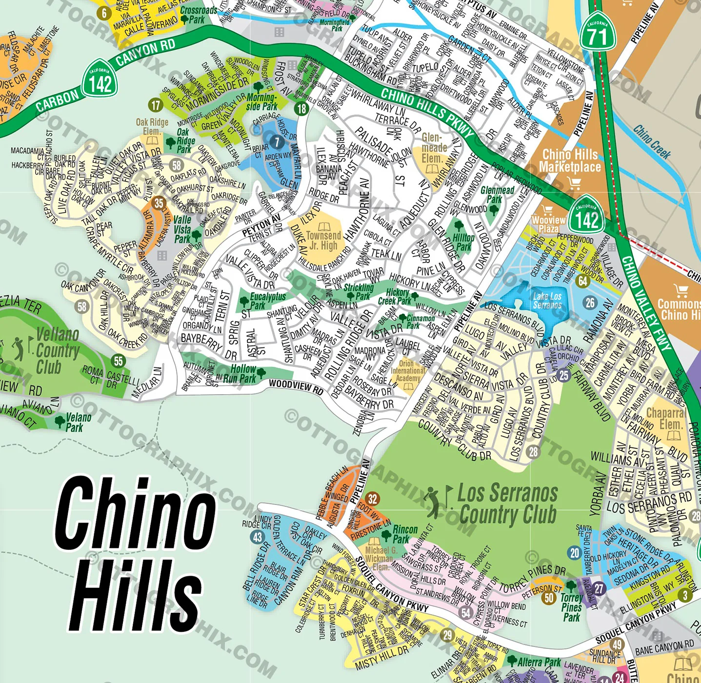
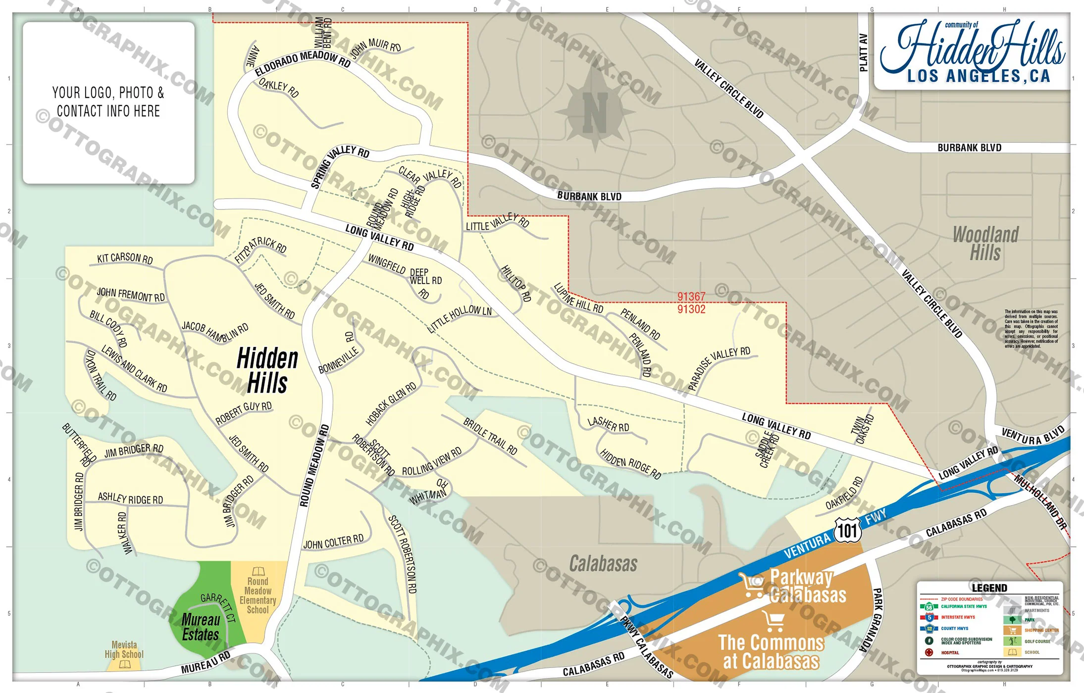
DETAILS:
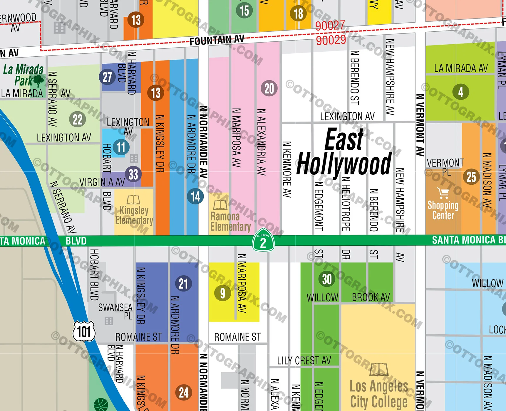
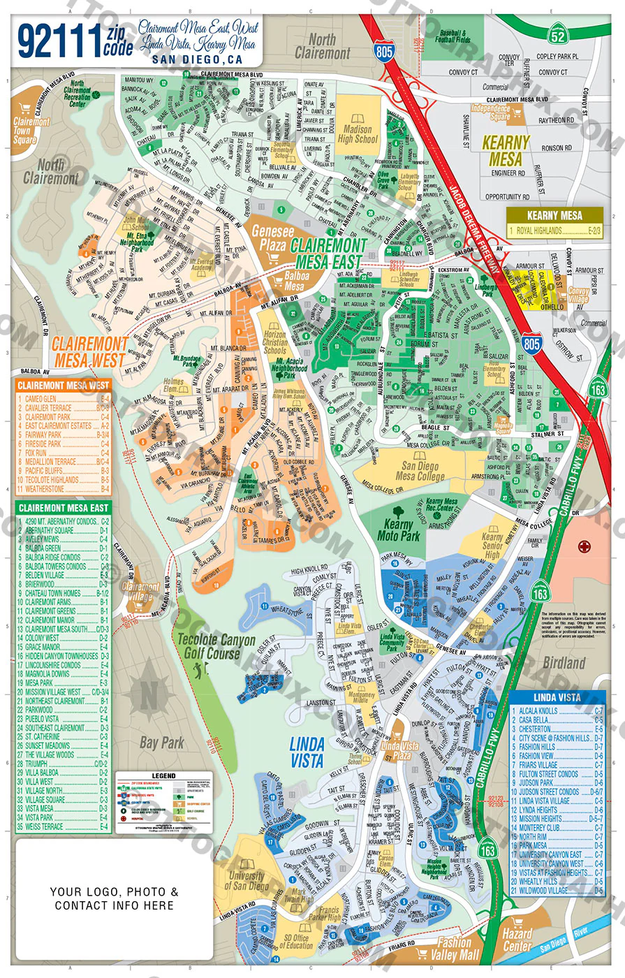
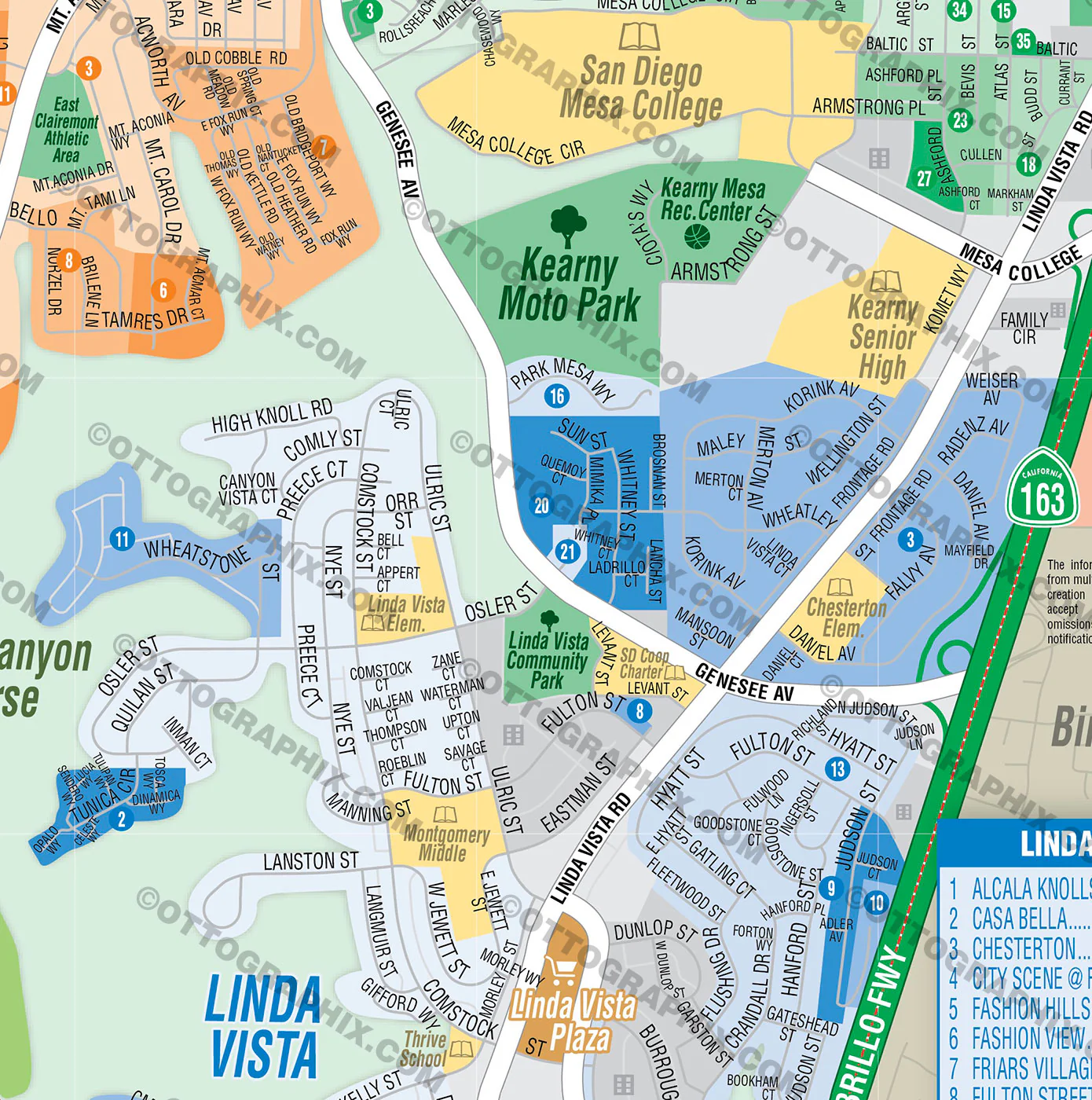
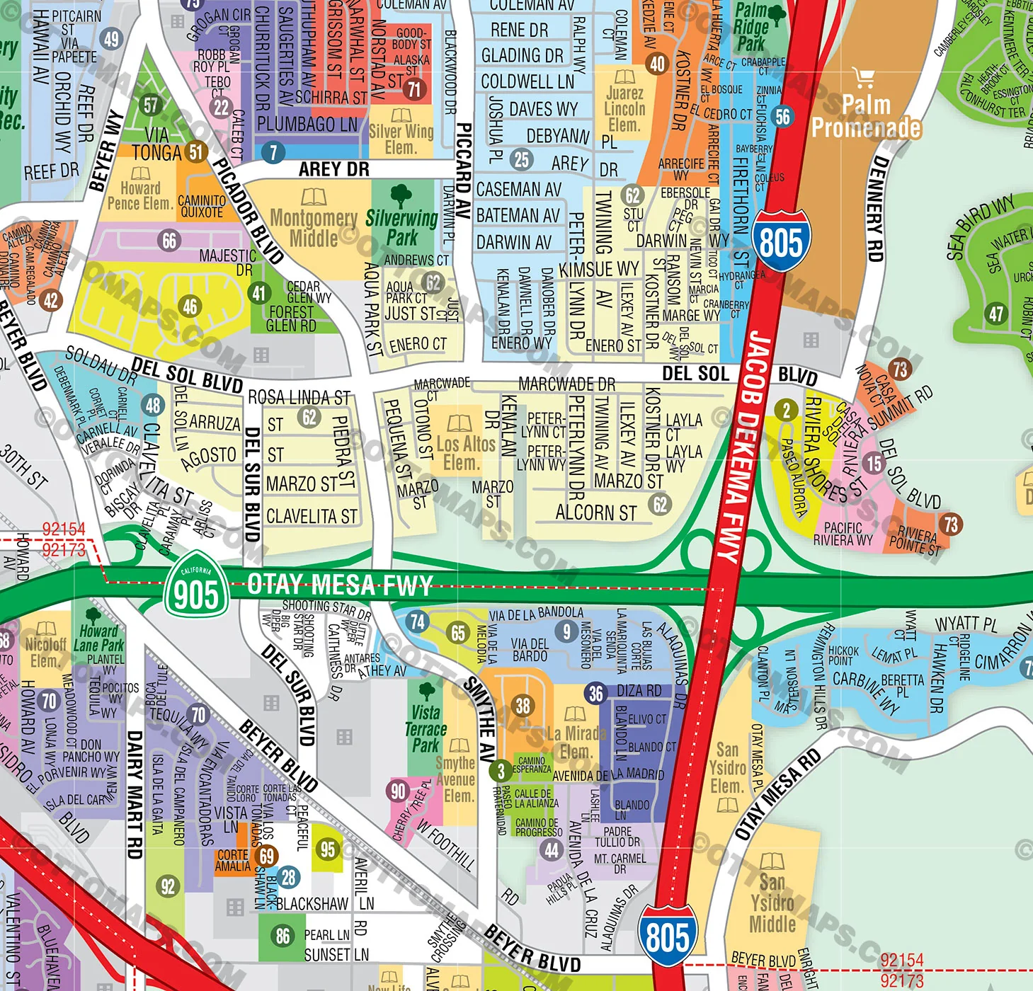
- Subdivision/Tract Boundaries and Index
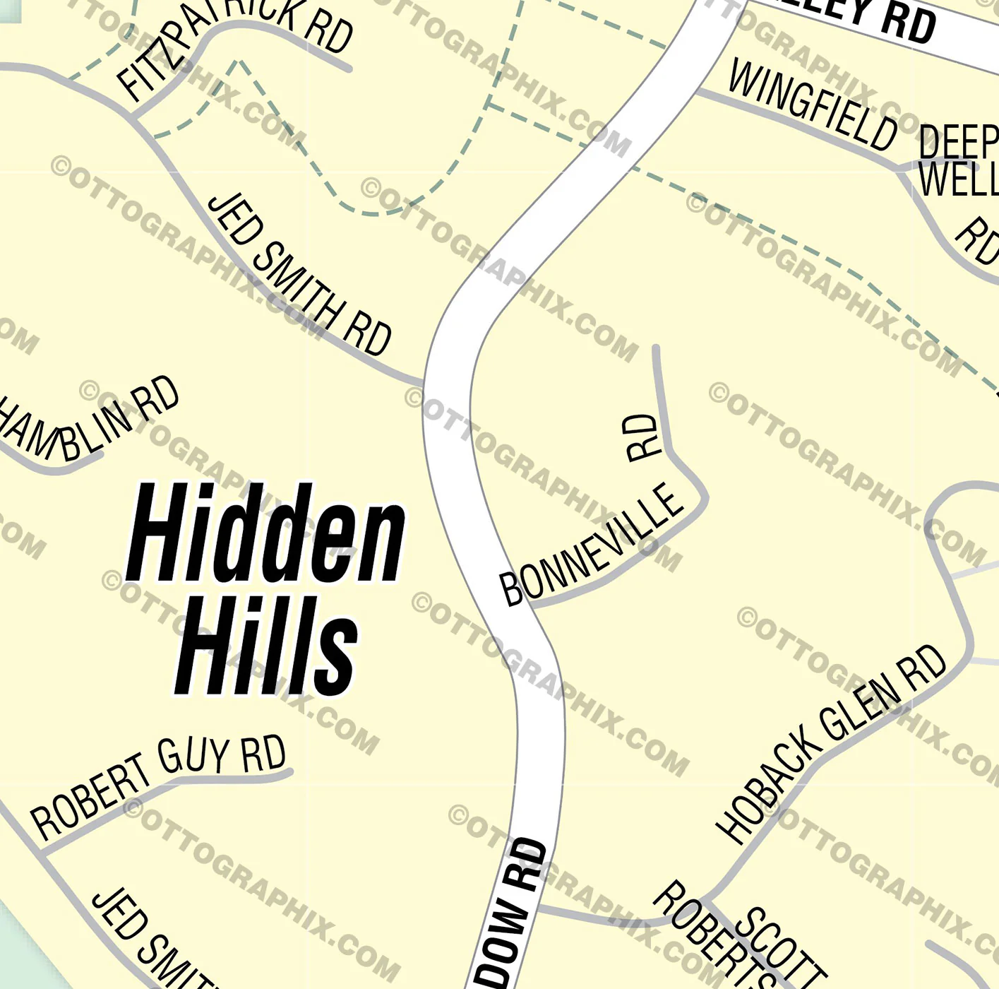
- Full Street Detail
- Recreation Centers
- Parks
- Shopping Centers
- Golf Courses
- Schools
RIGHTS:
- Royalty Free
- Not for resale
- All reproduction rights granted
DISCLAIMER:
- The information on this map was derived from multiple sources. Care was taken in the creation of this map. Ottographix cannot accept any responsibility for errors, omissions, or positional accuracy. However, notification of errors are appreciated. If you find a mistake, Ottographix will fix it for no charge. Please contact us and we'll take care of it. https://www.ottographix.com/contact.html, [email protected]
- Maps are sold as-is. All necessary files are included for editing
- Additional customization is available from Ottographix at an additional cost. Please contact us for details and a free quote. http://www.ottographix.com/contact.html, [email protected]