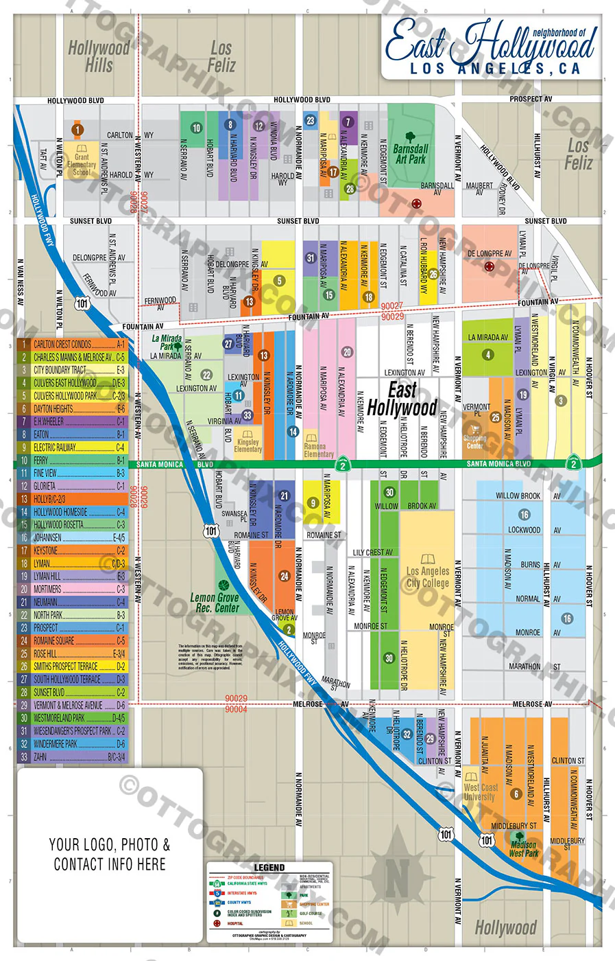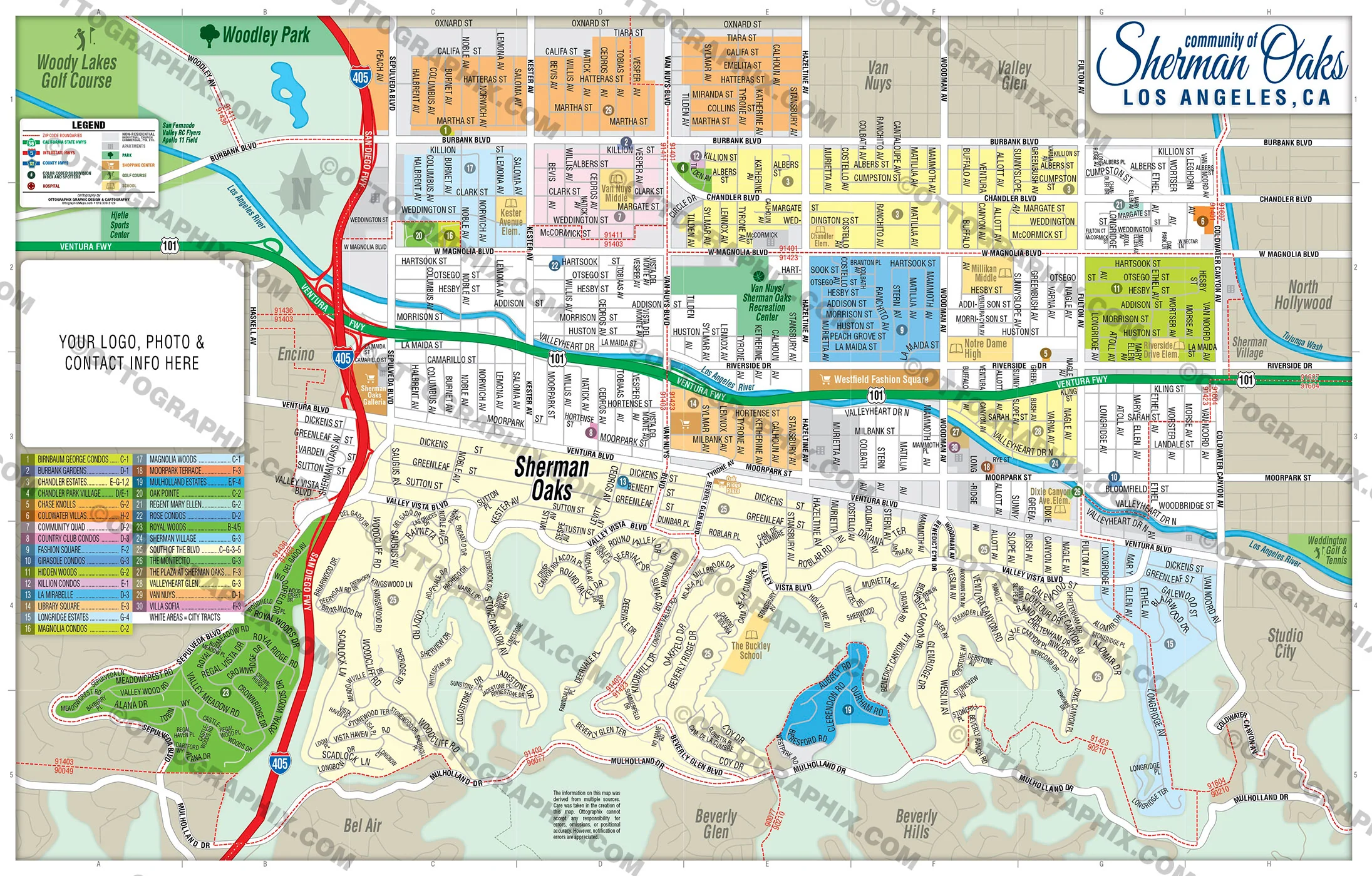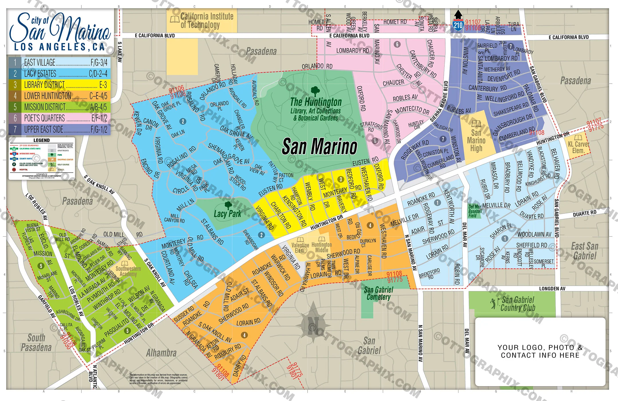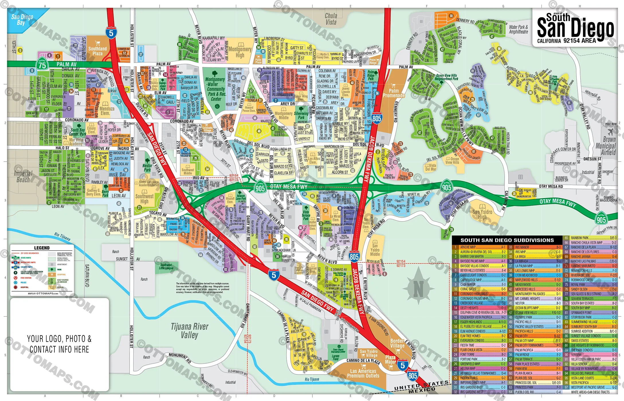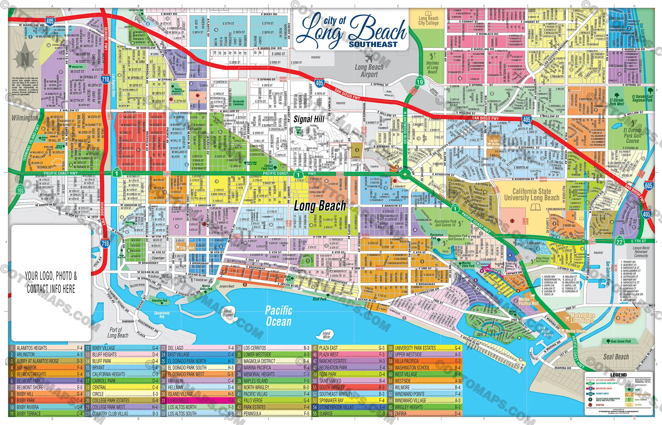
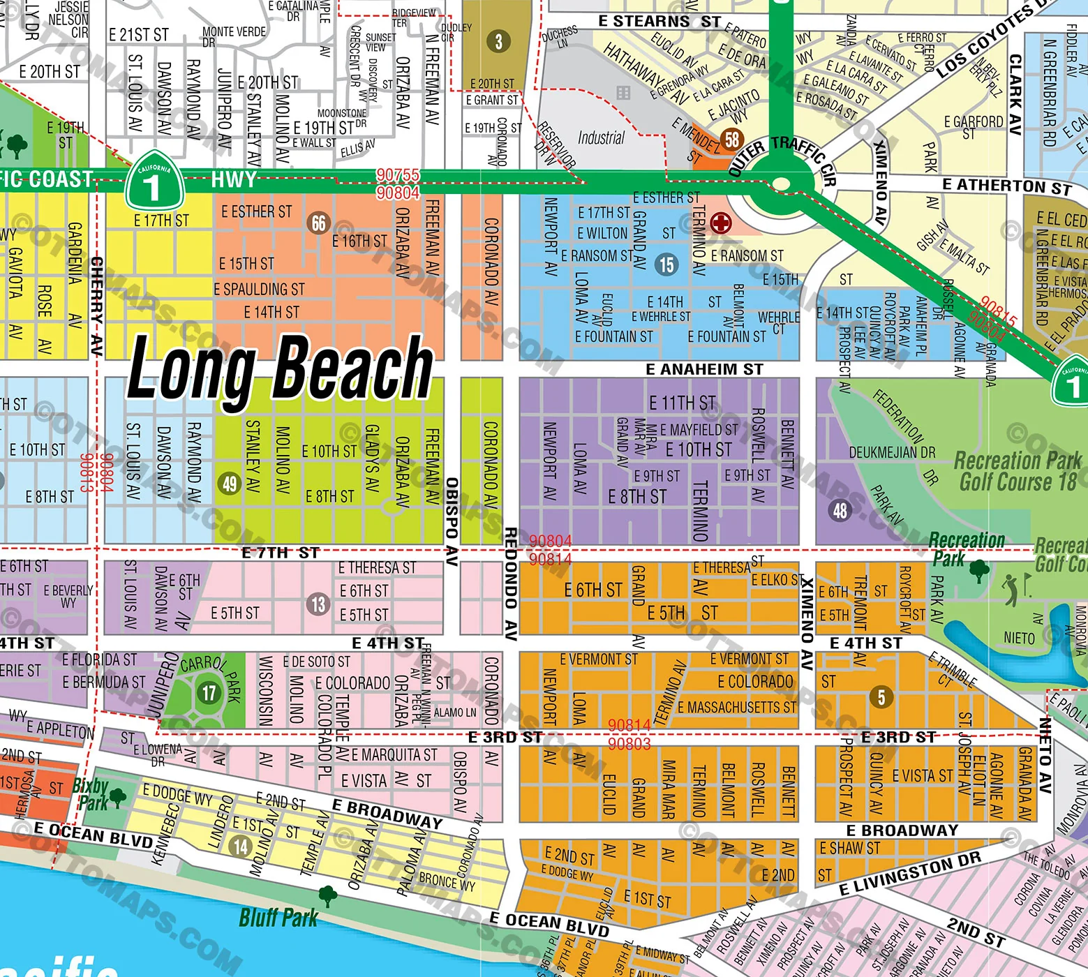
Long Beach Map - SouthEast - PDF, Editable, Royalty Free - FILES - PDF and AI, editable, vector, royalty free
PURCHASE INCLUDES:
Ready-To-Use PDF with blank box for company branding, and
Layered, editable Adobe Illustrator CC file with fonts
SIZE: 11w x 17h - Vector Maps: enlarge or reduce to any size without loss of quality
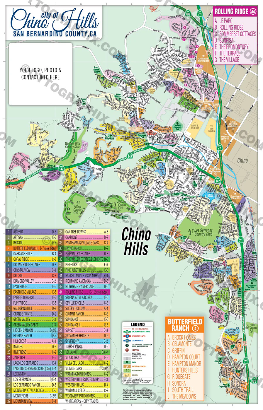
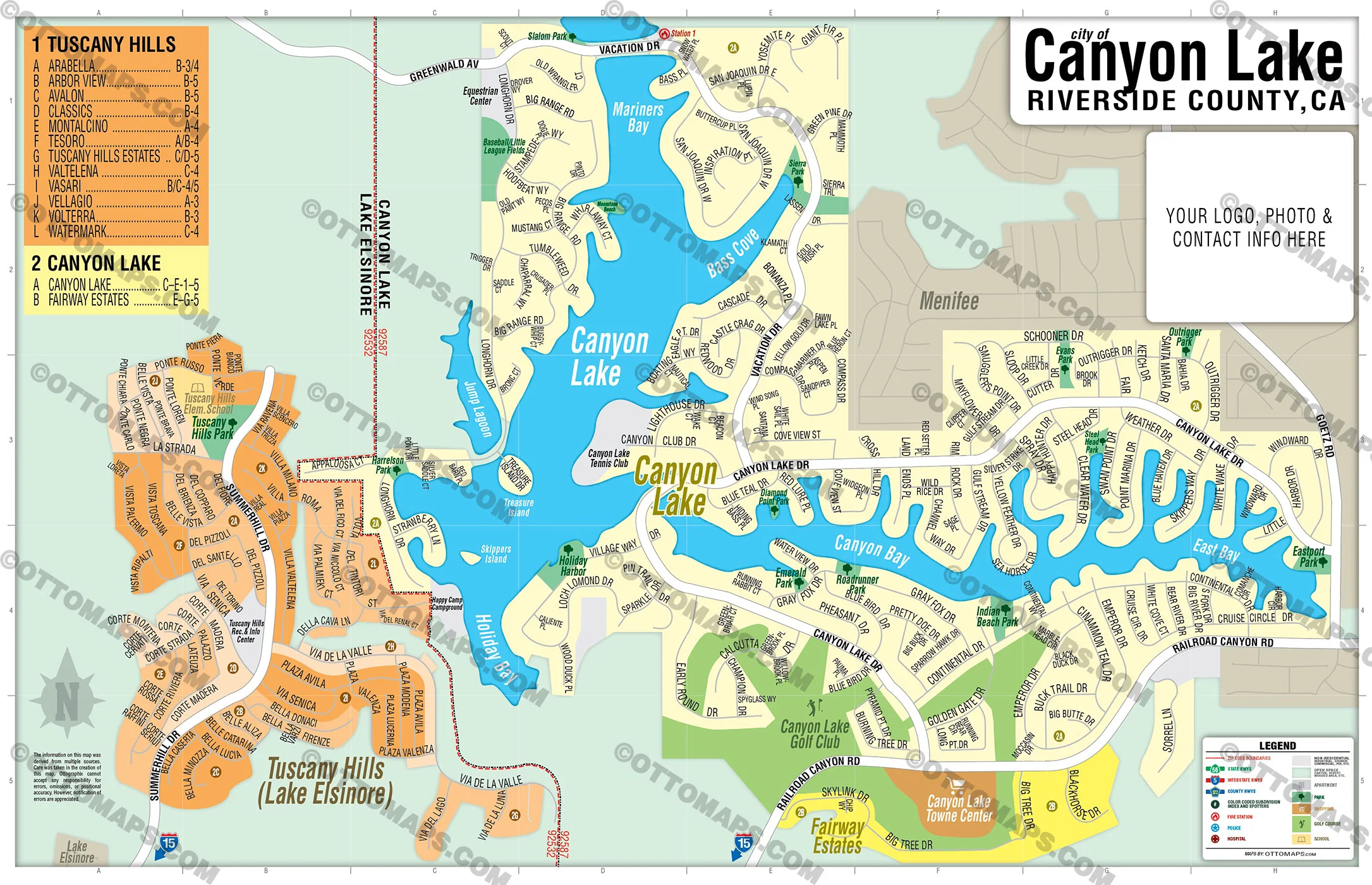
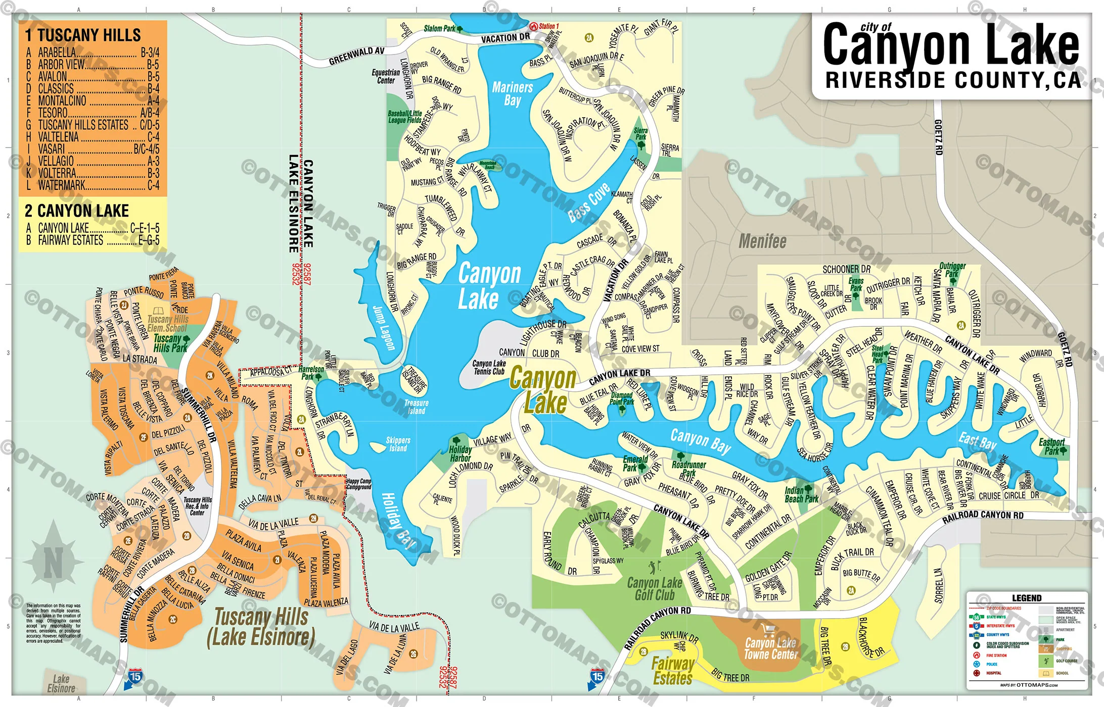
COMMUNITIES:
- ALAMITOS HEIGHTS
- ARLINGTON
- AUBRY AT ALAMITOS RIDGE
- BAY HARBOR
- BELMONT HEIGHTS
- BELMONT PARK
- BELMONT SHORE
- BIXBY HILL
- BIXBY PARK
- BIXBY RIVIERA
- BIXBY TERRACE
- BIXBY VILLAGE
- BLUFF HEIGHTS
- BLUFF PARK
- BRYANT
- CALIFORNIA HEIGHTS
- CARROLL PARK
- CENTRAL
- CIRCLE
- COLLEGE PARK ESTATES
- COLLEGE PARK WEST
- COUNTRY CLUB VILLAS
- DEL LAGO
- EAST VILLAGE
- EL DORADO PARK NORTH
- EL DORADO PARK SOUTH
- EL DORADO PARK WEST
- FRANKLIN
- HELLMAN
- ISLAND VILLAGE
- LA ROCHELLE
- LOS ALTOS NORTH
- LOS ALTOS SOUTH
- LOS CERRITOS
- LOWER WESTSIDE
- MAGNOLIA DISTRICT
- MARINA PACIFICA
- MEMORIAL HEIGHTS
- NAPLES ISLAND
- NORTH WRIGLEY
- PACIFIC VILLAS
- PALO VERDE
- PARK ESTATES
- PENINSULA
- PLAZA EAST
- PLAZA WEST
- RANCHO ESTATES
- RECREATION PARK
- ROSE PARK
- SAINT MARY'S
- SOUTH WRIGLEY
- SOUTHEAST WRIGLEY
- SPINNAKER BAY
- STONEYBROOK VILLAS
- SUNRISE
- UNIVERSITY PARK ESTATES
UPPER WESTSIDE
VILLA PACIFICA
WASHINGTON SCHOOL
WEST VILLAGE
WESTSIDE
WILMORE
WINDWARD POINTE
WINDWARD VILLAGE
WRIGLEY HEIGHTS
ZAFIRIA
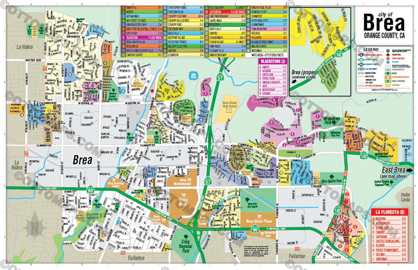
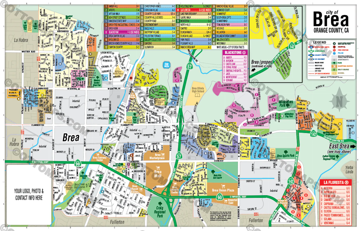
CONTAINS:
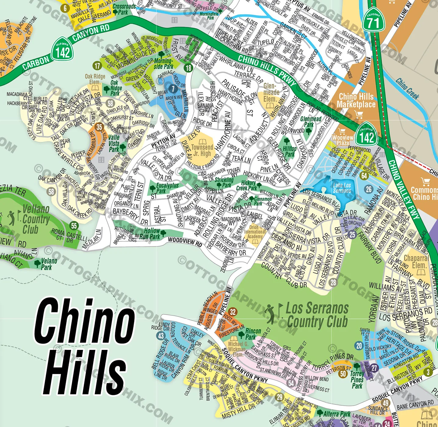
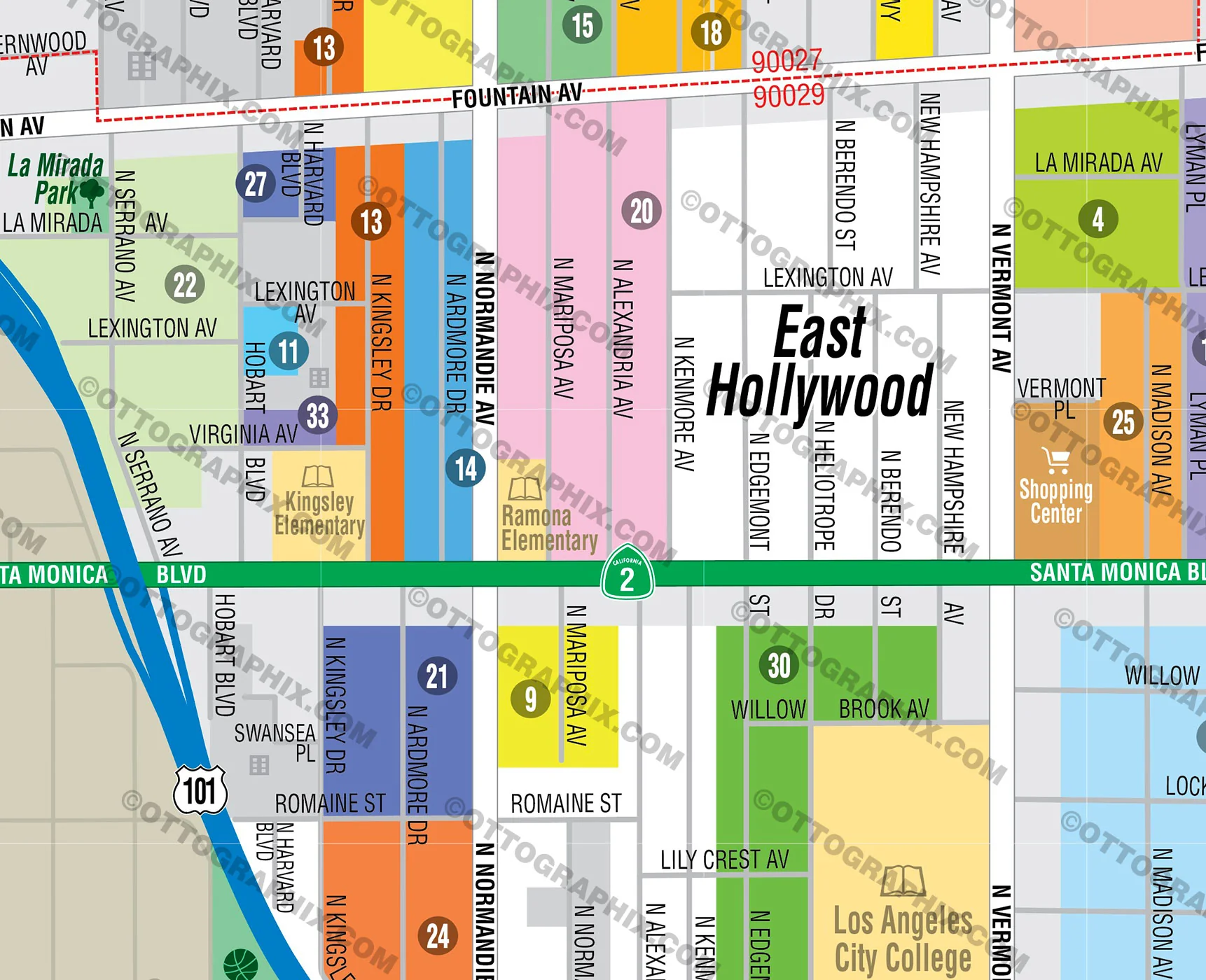
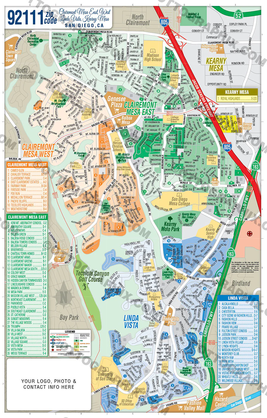
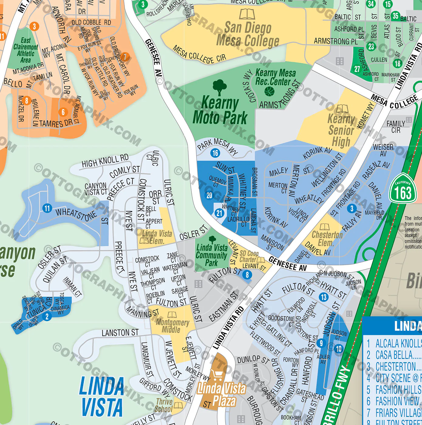
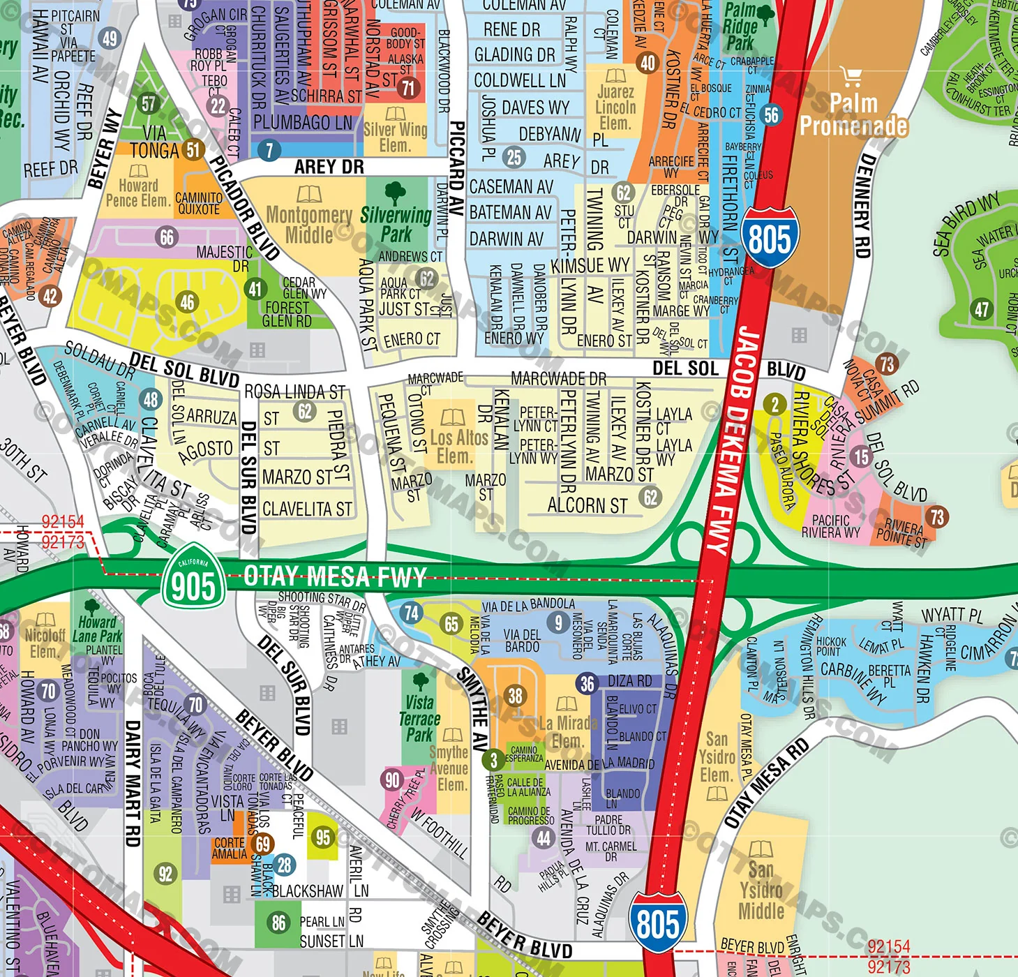
- Subdivision/Tract Boundaries and Index
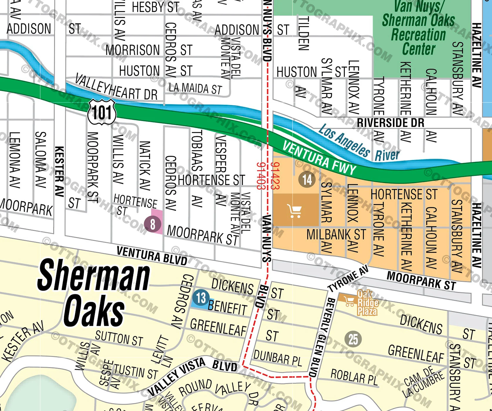
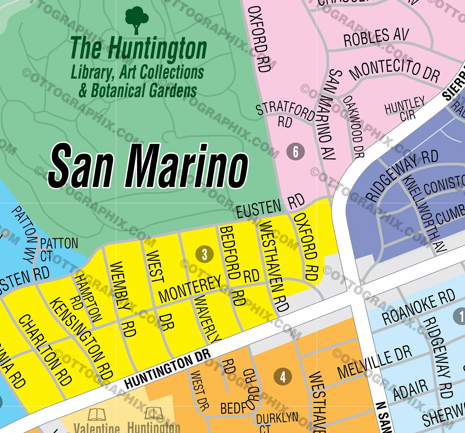
- Full Street Detail
- Recreation Centers
- Parks
- Shopping Centers
- Golf Courses
- Schools
RIGHTS:
- Royalty Free
- Not for resale
- All reproduction rights granted
CUSTOMIZATION:
- Clearly labeled layers. Turn any map feature on and off.
- Maps are sold as-is. All necessary files are included for editing
- Additional customization is available from Ottographix at an additional cost. Please contact us for deatils and a free quote! http://www.ottographix.com/contact.html, 619.339.3129, [email protected]
DISCLAIMER:
The information on this map was derived from multiple sources. Care was taken in the creation of this map. Ottographix cannot accept any responsibility for errors, omissions, or positional accuracy. However, notification of errors are appreciated. If you find a mistake, Ottographix will fix it for no charge. Please contact us and we'll take care of it. http://www.ottographix.com/contact.html, 619.339.3129, [email protected]
Original: $95.00
-65%$95.00
$33.25Product Information
Product Information
Shipping & Returns
Shipping & Returns
Description
PURCHASE INCLUDES:
Ready-To-Use PDF with blank box for company branding, and
Layered, editable Adobe Illustrator CC file with fonts
SIZE: 11w x 17h - Vector Maps: enlarge or reduce to any size without loss of quality
COMMUNITIES:
- ALAMITOS HEIGHTS
- ARLINGTON
- AUBRY AT ALAMITOS RIDGE
- BAY HARBOR
- BELMONT HEIGHTS
- BELMONT PARK
- BELMONT SHORE
- BIXBY HILL
- BIXBY PARK
- BIXBY RIVIERA
- BIXBY TERRACE
- BIXBY VILLAGE
- BLUFF HEIGHTS
- BLUFF PARK
- BRYANT
- CALIFORNIA HEIGHTS
- CARROLL PARK
- CENTRAL
- CIRCLE
- COLLEGE PARK ESTATES
- COLLEGE PARK WEST
- COUNTRY CLUB VILLAS
- DEL LAGO
- EAST VILLAGE
- EL DORADO PARK NORTH
- EL DORADO PARK SOUTH
- EL DORADO PARK WEST
- FRANKLIN
- HELLMAN
- ISLAND VILLAGE
- LA ROCHELLE
- LOS ALTOS NORTH
- LOS ALTOS SOUTH
- LOS CERRITOS
- LOWER WESTSIDE
- MAGNOLIA DISTRICT
- MARINA PACIFICA
- MEMORIAL HEIGHTS
- NAPLES ISLAND
- NORTH WRIGLEY
- PACIFIC VILLAS
- PALO VERDE
- PARK ESTATES
- PENINSULA
- PLAZA EAST
- PLAZA WEST
- RANCHO ESTATES
- RECREATION PARK
- ROSE PARK
- SAINT MARY'S
- SOUTH WRIGLEY
- SOUTHEAST WRIGLEY
- SPINNAKER BAY
- STONEYBROOK VILLAS
- SUNRISE
- UNIVERSITY PARK ESTATES
UPPER WESTSIDE
VILLA PACIFICA
WASHINGTON SCHOOL
WEST VILLAGE
WESTSIDE
WILMORE
WINDWARD POINTE
WINDWARD VILLAGE
WRIGLEY HEIGHTS
ZAFIRIA
CONTAINS:
- Subdivision/Tract Boundaries and Index
- Full Street Detail
- Recreation Centers
- Parks
- Shopping Centers
- Golf Courses
- Schools
RIGHTS:
- Royalty Free
- Not for resale
- All reproduction rights granted
CUSTOMIZATION:
- Clearly labeled layers. Turn any map feature on and off.
- Maps are sold as-is. All necessary files are included for editing
- Additional customization is available from Ottographix at an additional cost. Please contact us for deatils and a free quote! http://www.ottographix.com/contact.html, 619.339.3129, [email protected]
DISCLAIMER:
The information on this map was derived from multiple sources. Care was taken in the creation of this map. Ottographix cannot accept any responsibility for errors, omissions, or positional accuracy. However, notification of errors are appreciated. If you find a mistake, Ottographix will fix it for no charge. Please contact us and we'll take care of it. http://www.ottographix.com/contact.html, 619.339.3129, [email protected]