✨ New Arrivals Just Dropped!Explore
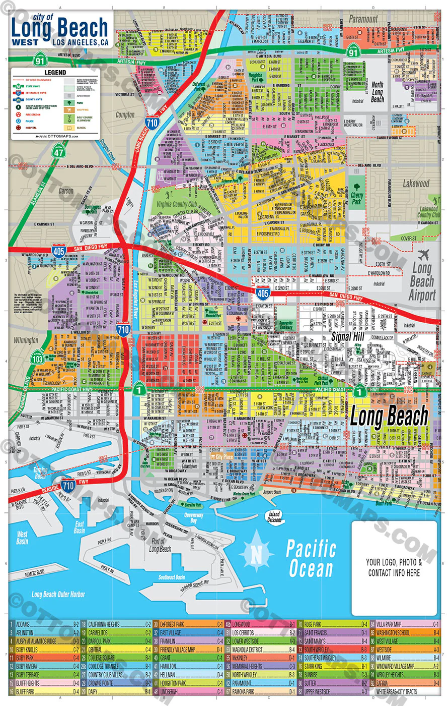
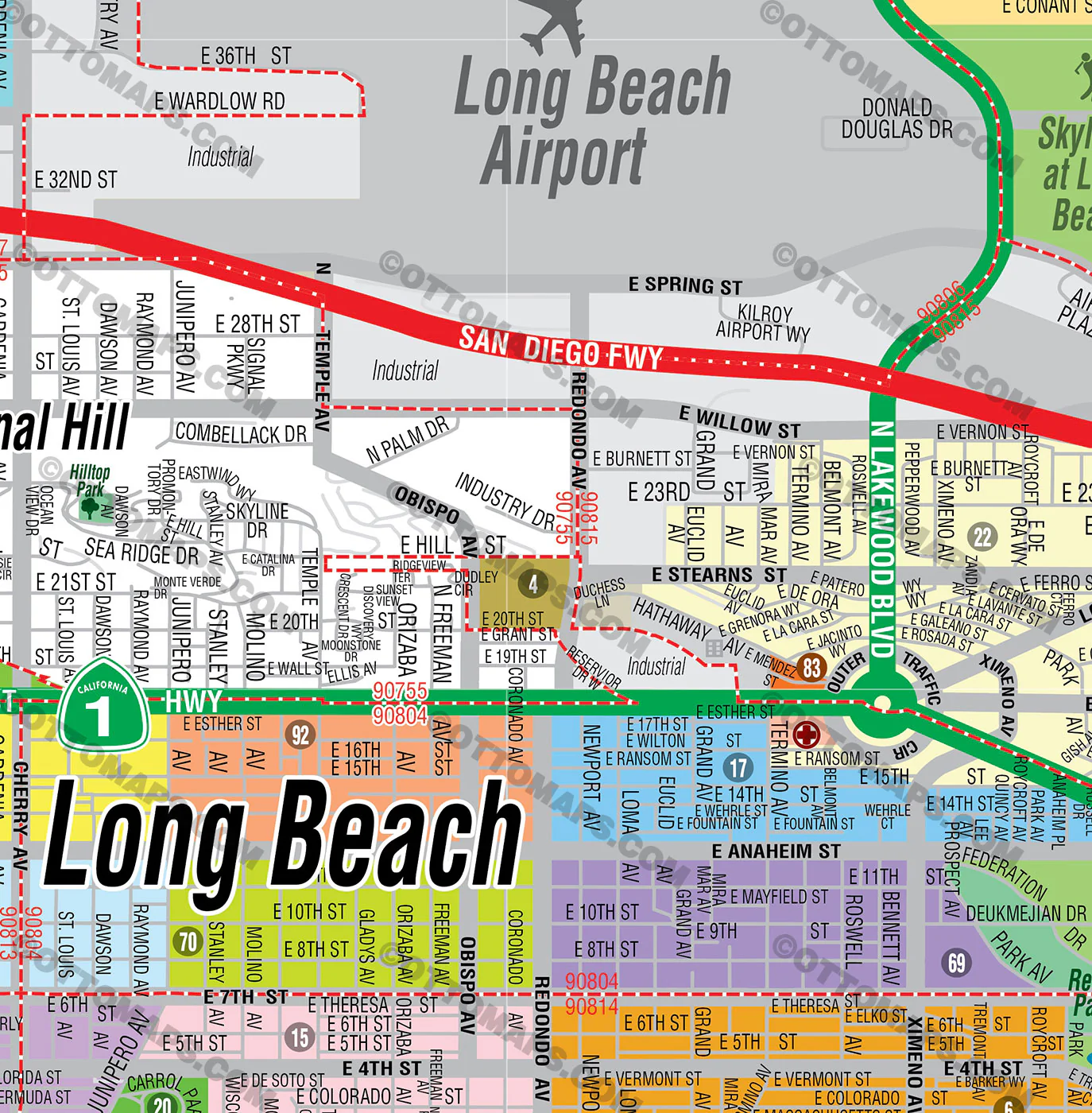
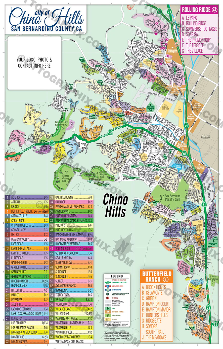
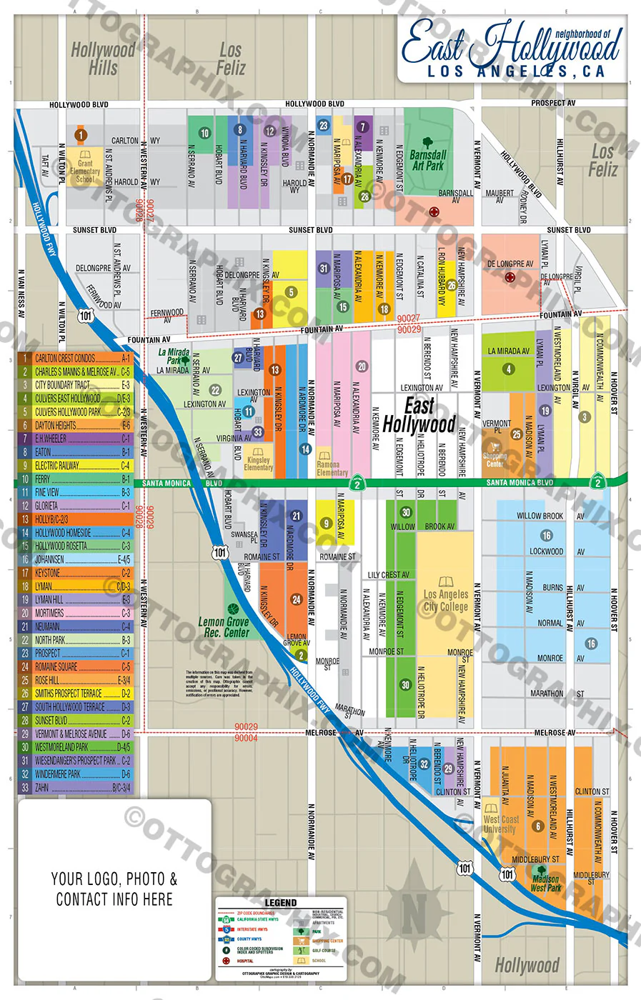
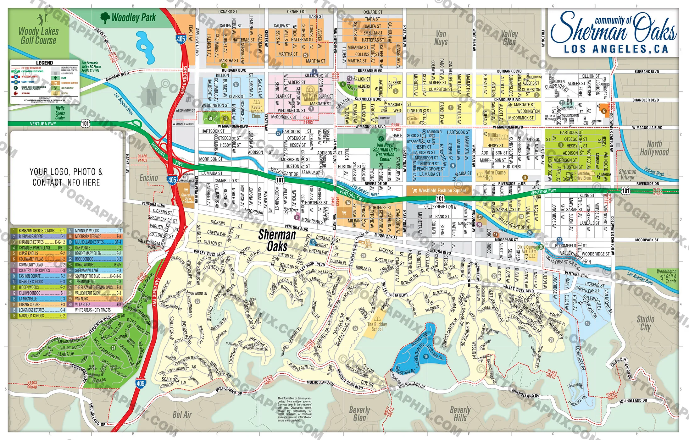
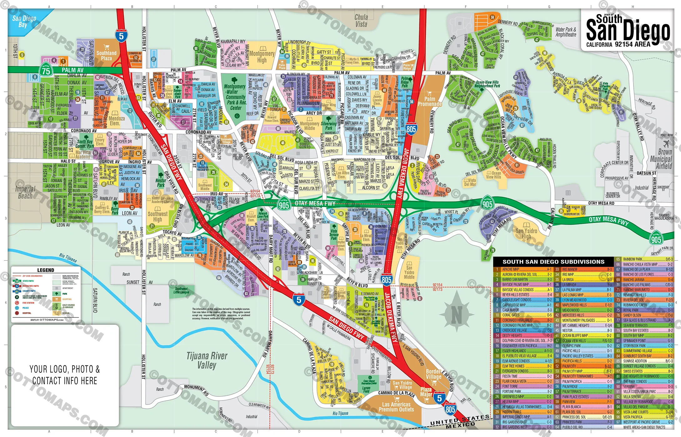
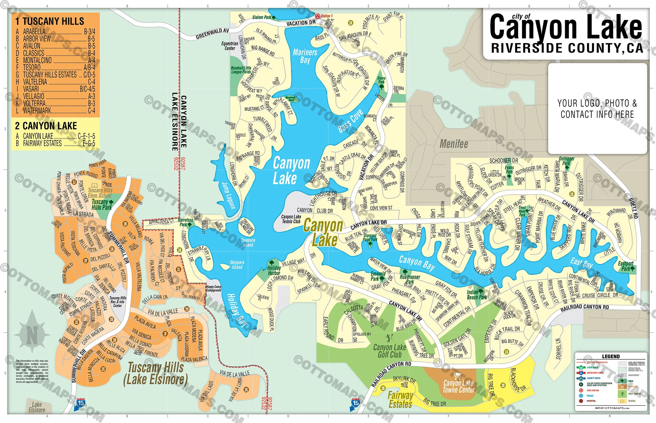
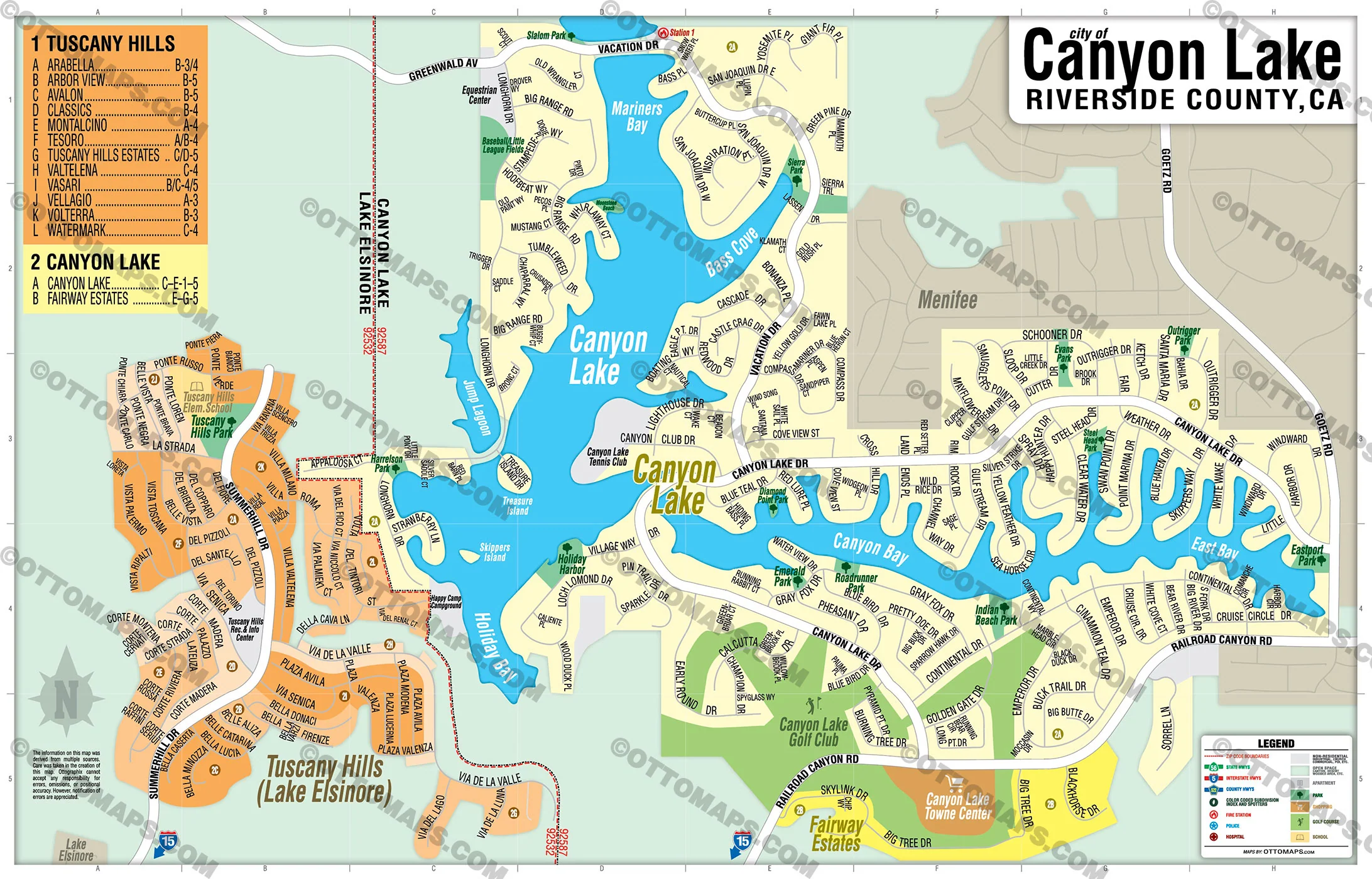
Long Beach Map WEST, Los Angeles County, CA - FILES - PDF and AI, editable, vector, royalty free
PURCHASE INCLUDES:
- PDF Files - with Company Branding Box and without
- Adobe Illustrator Files and fonts (layered, editable)
- 11”x17” Vector File - enlarged or reduced to any size with out loss of quality
- Customization: Turn map layers on or off. Easily change Fonts and Colors
- Royalty Free / All Reproduction Rights Granted (not for resale)
- Prints not included, recommend Kinkos
- NO SALES TAX!
COMMUNITIES:
- ADDAMS
- ARLINGTON
- AUBRY AT ALAMITOS RIDGE
- BIXBY KNOLLS
- BIXBY PARK
- BIXBY RIVIERA
- BIXBY TERRACE
- BLUFF HEIGHTS
- BLUFF PARK
- CALIFORNIA HEIGHTS
- CARMELITOS
- CARROLL PARK
- CENTRAL
- COLLEGE SQUARE
- COOLIDGE TRIANGLE
- COUNTRY CLUB VILLAS
- CROWNE POINTE
- DAIRY
- DeFOREST PARK
- EAST VILLAGE
- FRANKLIN
- FRIENDLY VILLAGE MHP
- GRANT
- HAMILTON
- HELLMAN
- HOUGHTON PARK
- LINDBERGH
- LONGWOOD
- LOS CERRITOS
- LOWER WESTSIDE
- MAGNOLIA DISTRICT
- McKINLEY
- MEMORIAL HEIGHTS
- NORTH WRIGLEY
- PARAMOUNT
- RAMONA PARK
- ROSE PARK
- SAINT FRANCIS
- SAINT MARY'S
- SOUTH WRIGLEY
- SOUTHEAST WRIGLEY
- STARR KING
- SUNRISE
- SUTTER
- UPPER WESTSIDE
- VILLA PARK MHP
- WASHINGTON SCHOOL
- WEST VILLAGE
- WESTSIDE
- WILMORE
- WINDWARD VILLAGE MHP
- WRIGLEY HEIGHTS
- ZAFIRIA
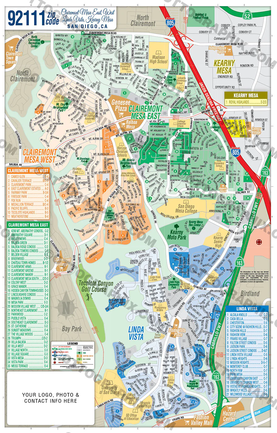
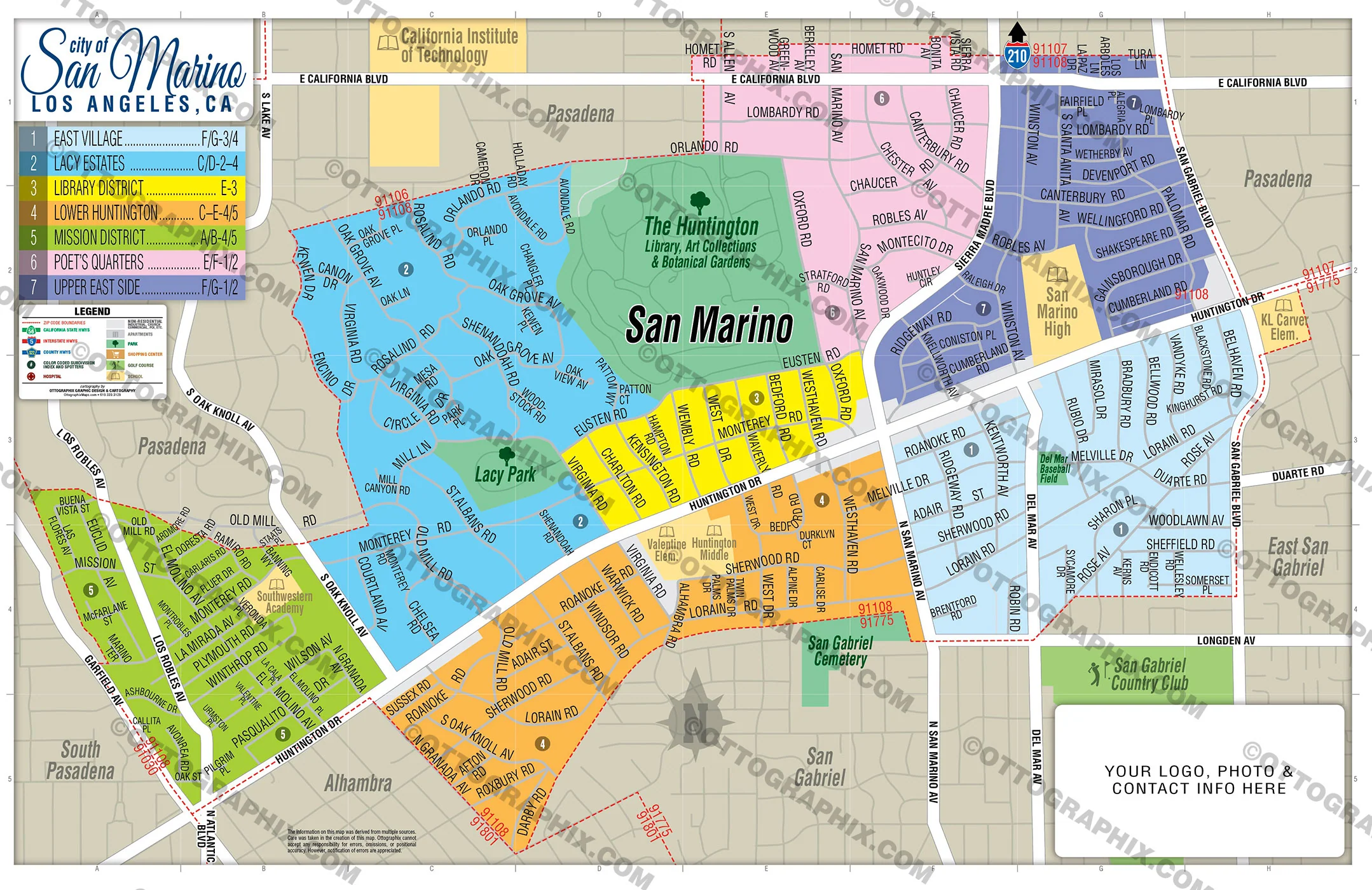
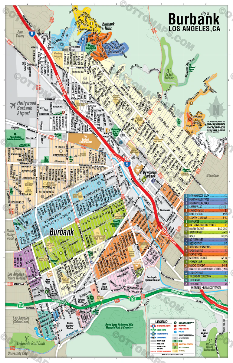
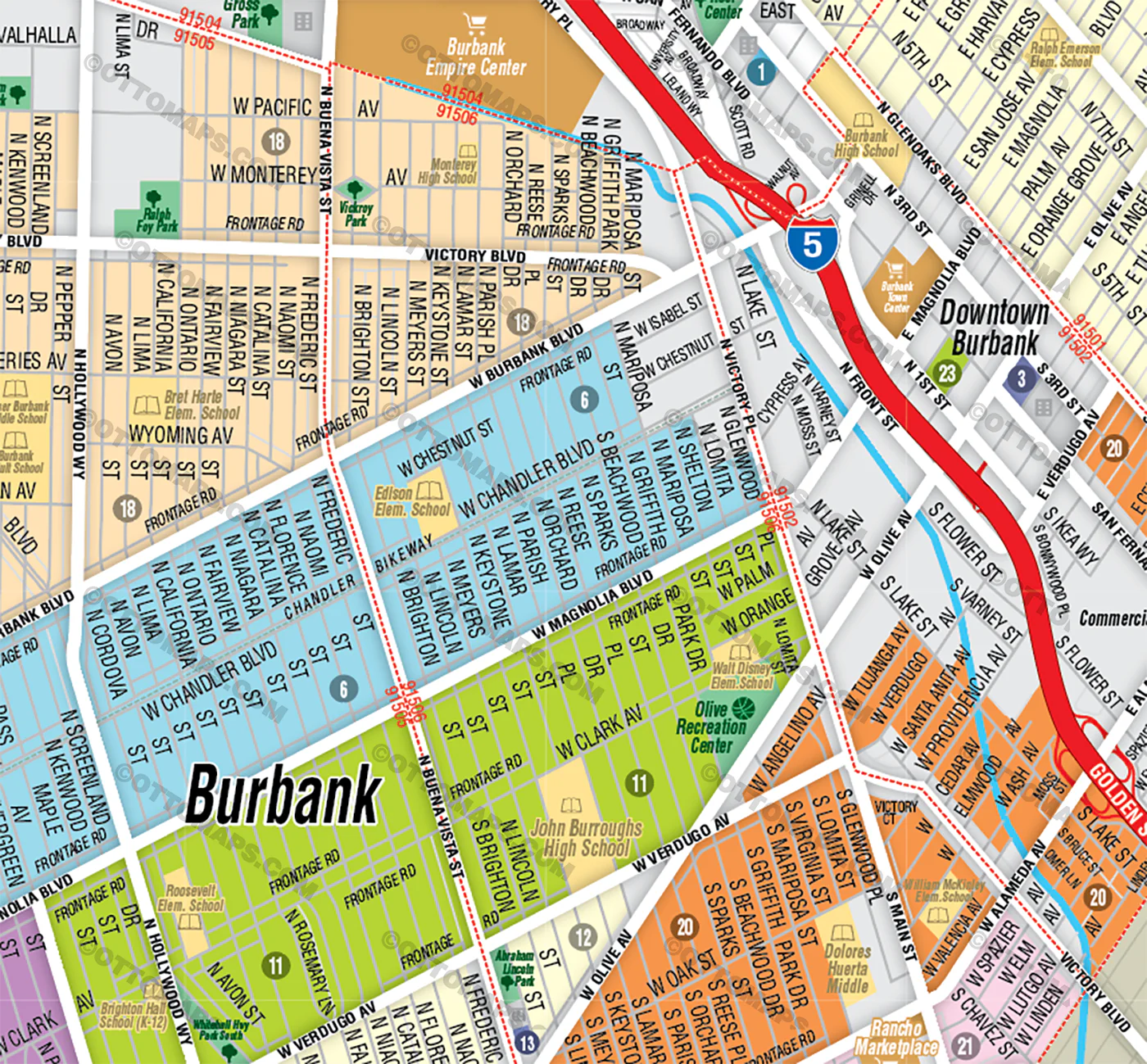
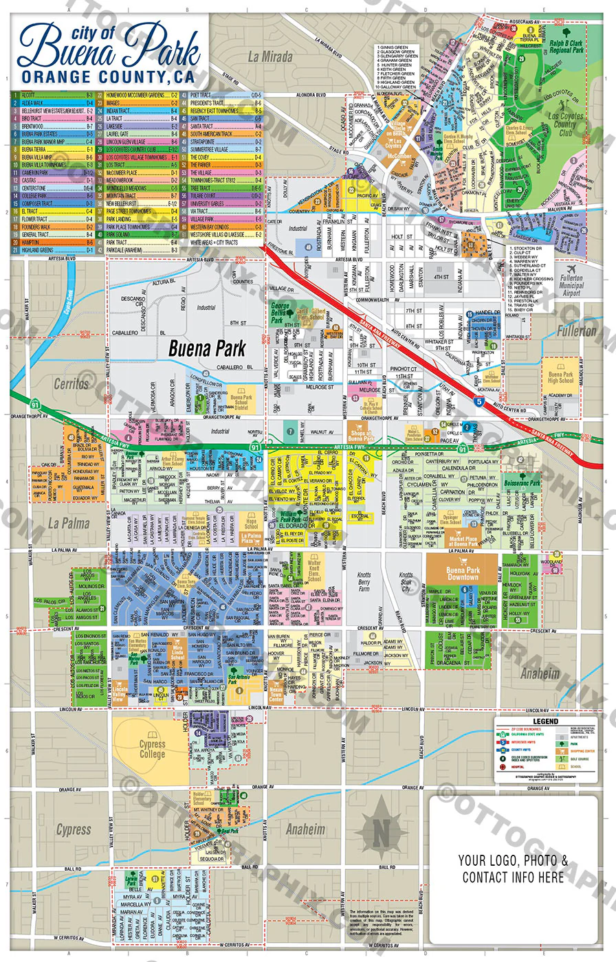
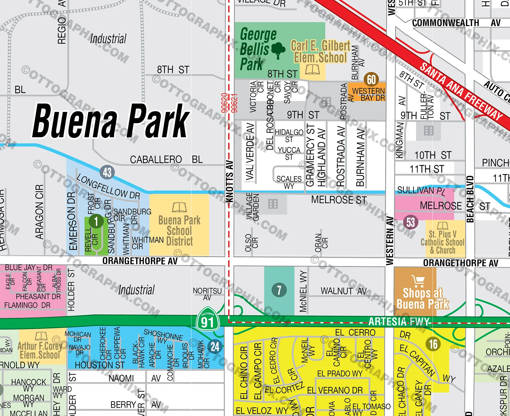
DETAILS:
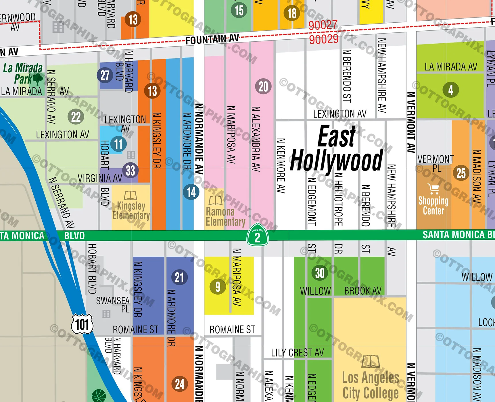
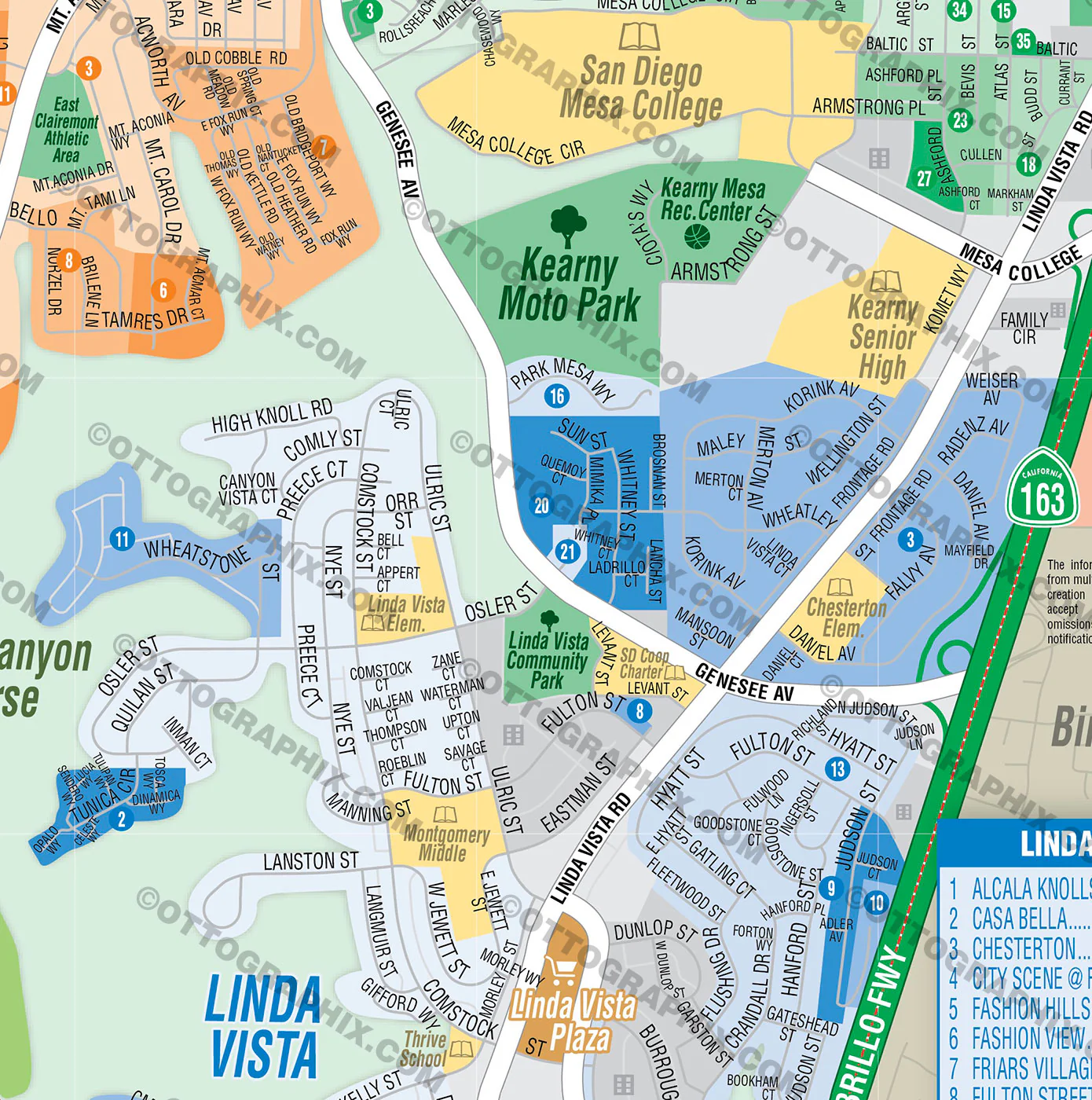
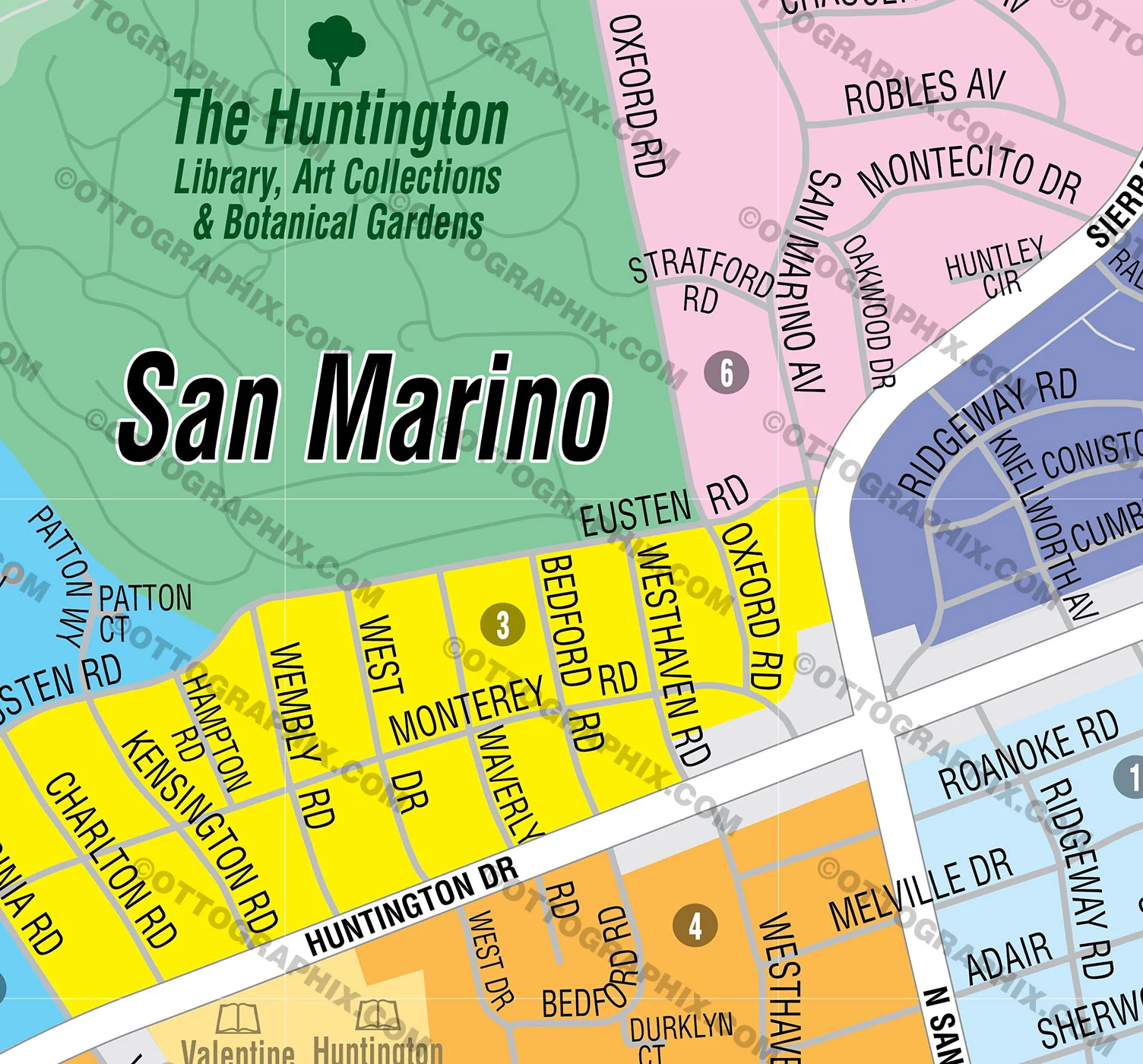
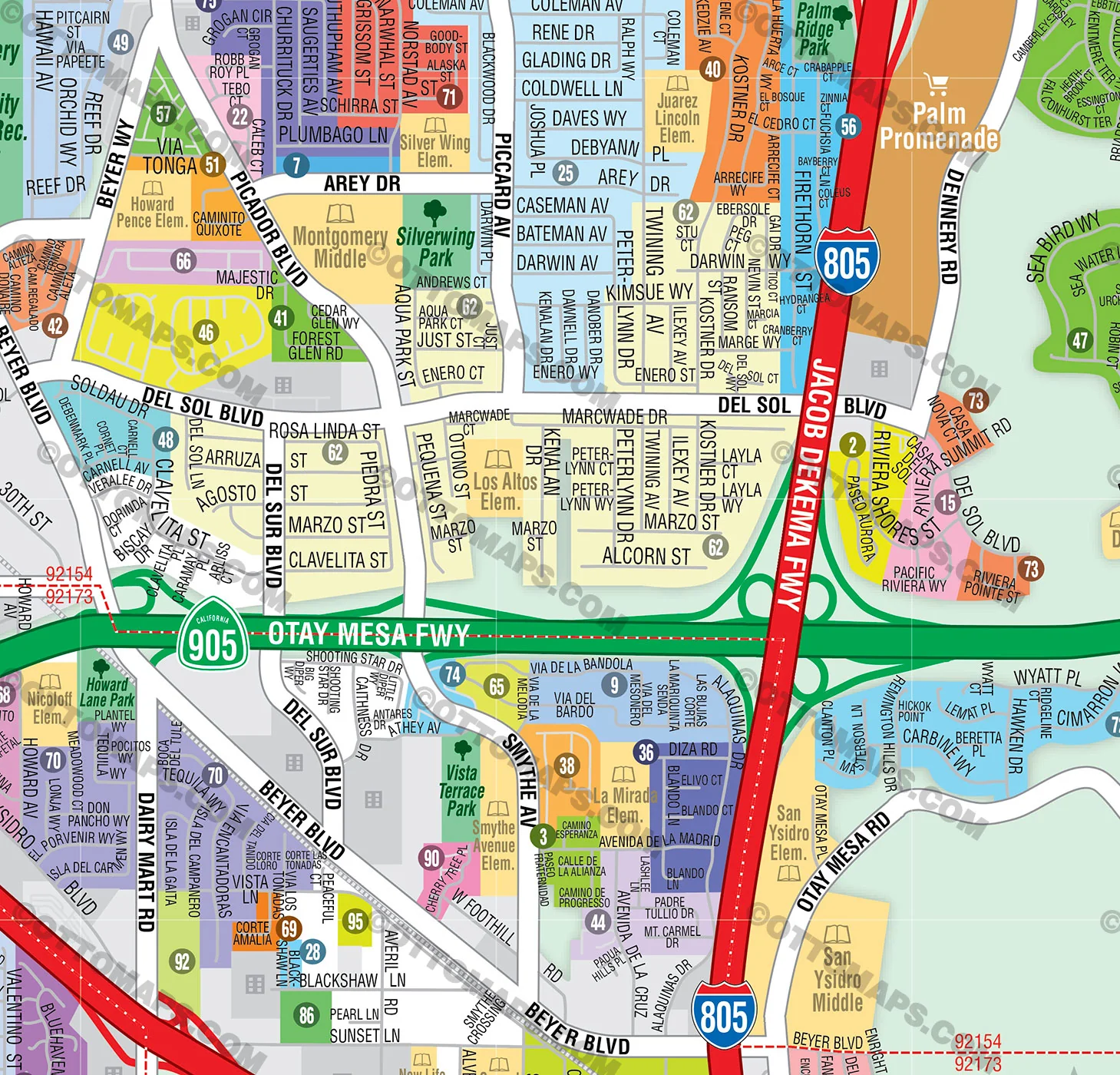
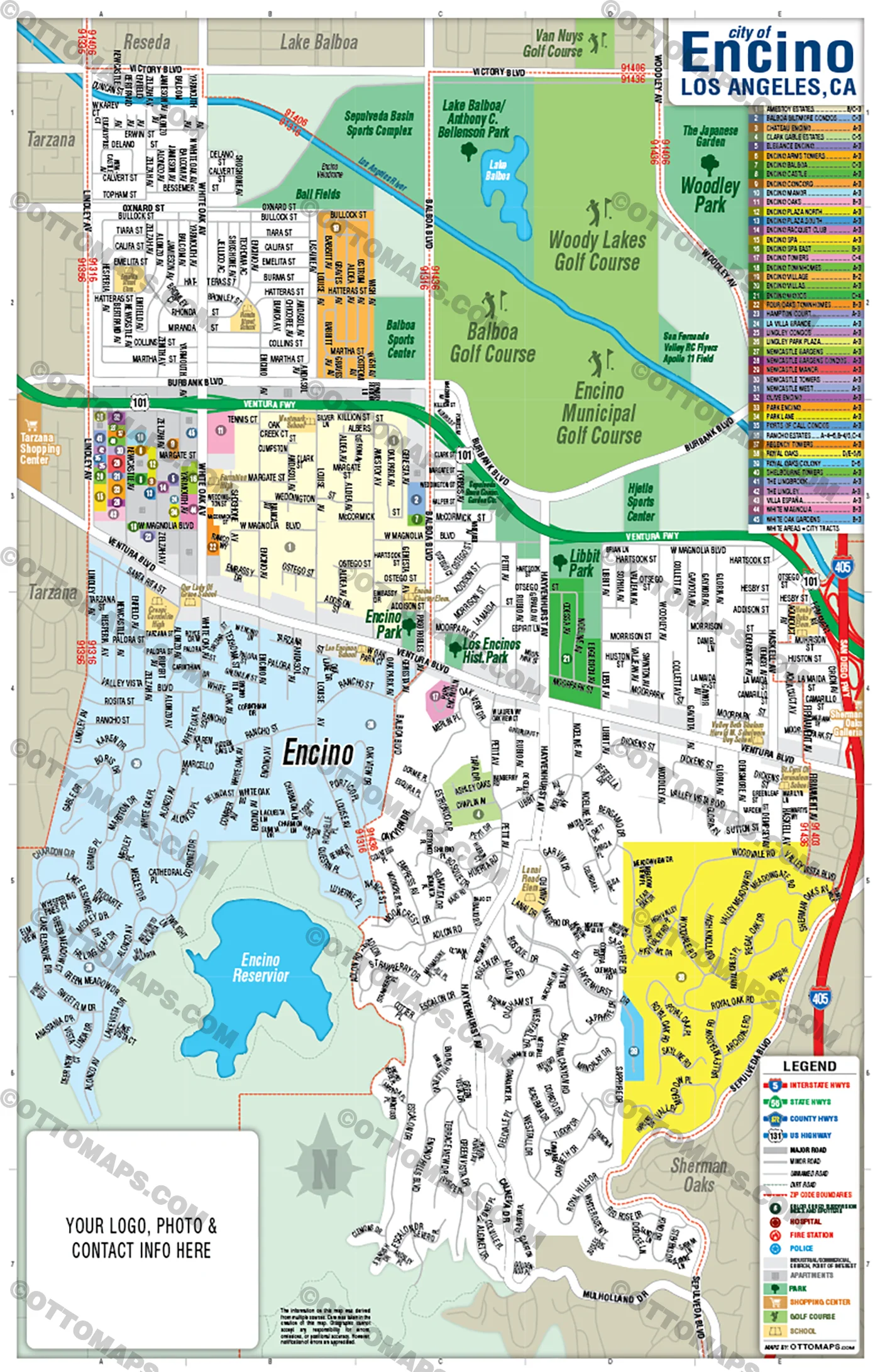
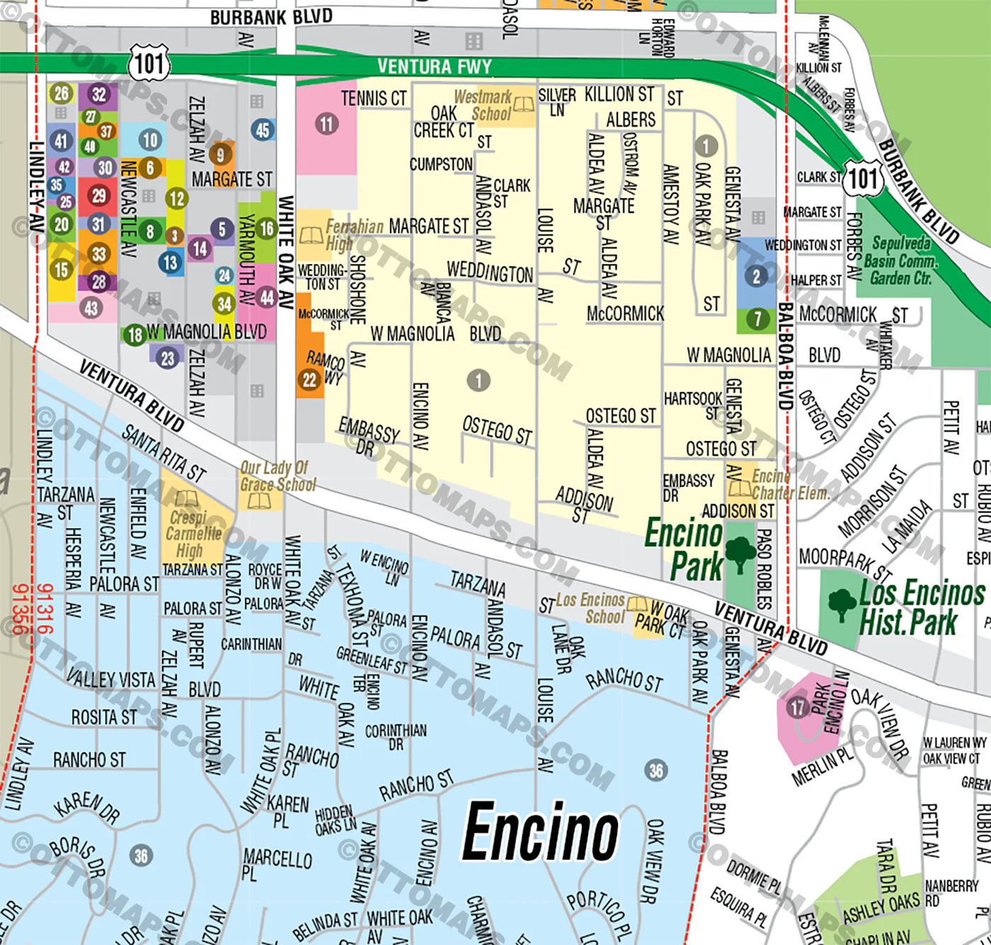
- Subdivision/Tract Boundaries and Index
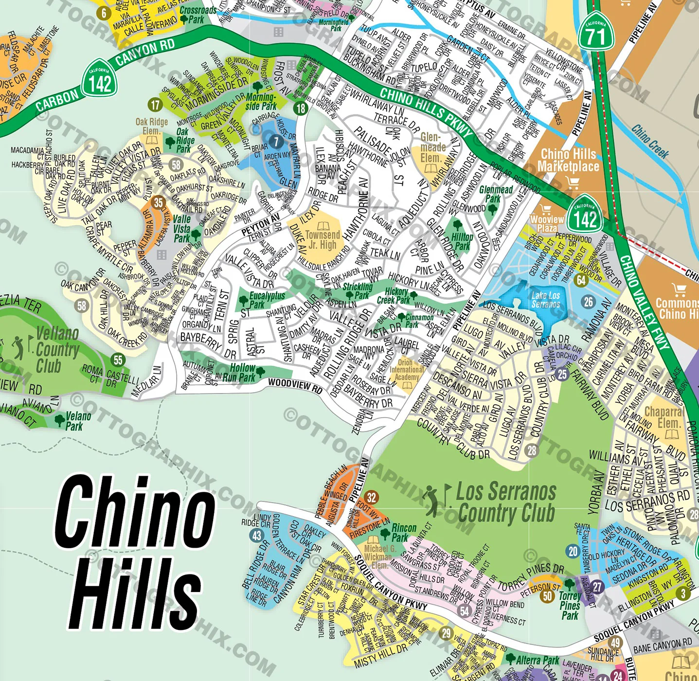
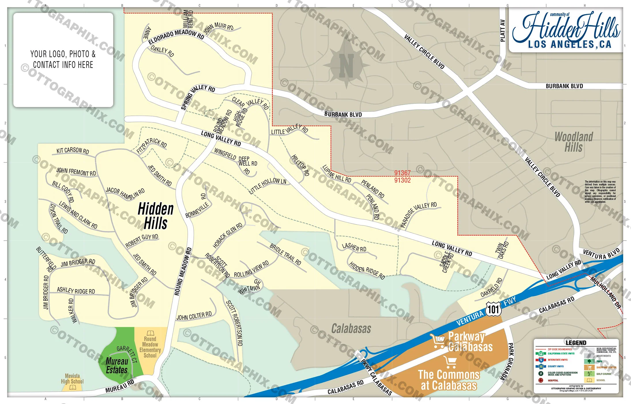
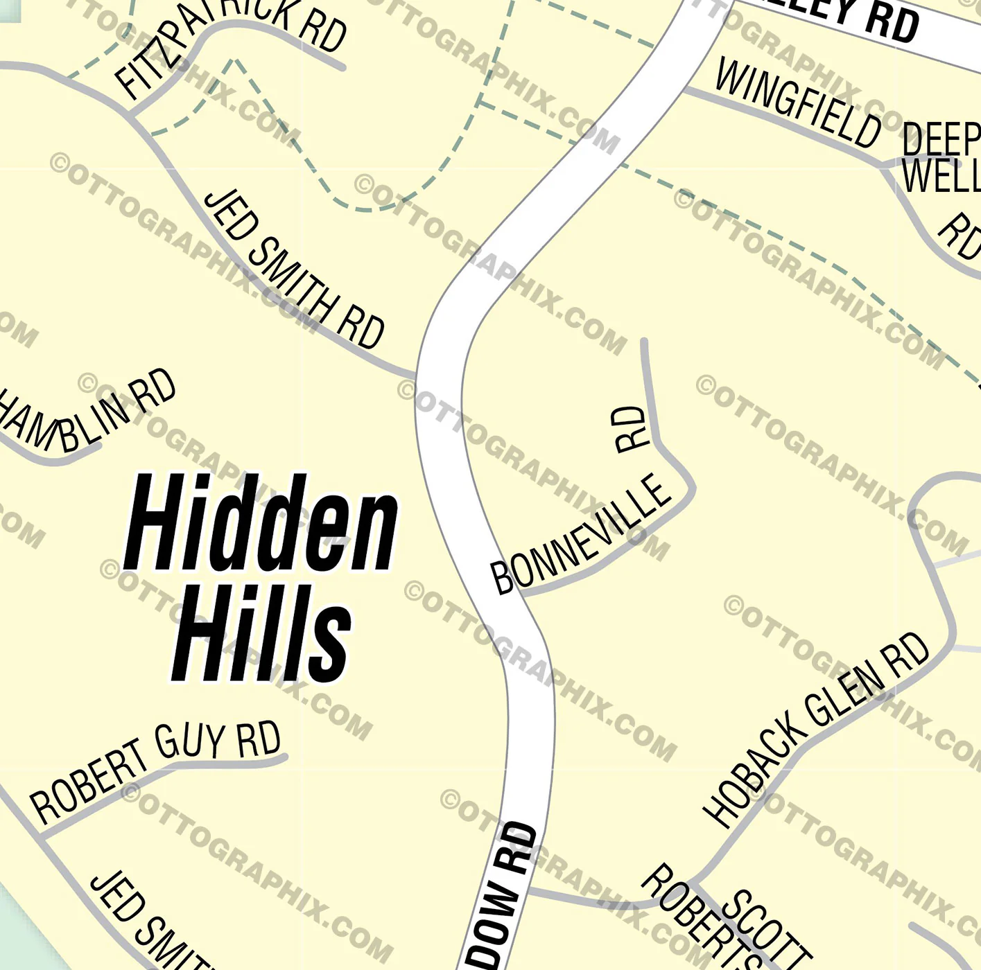
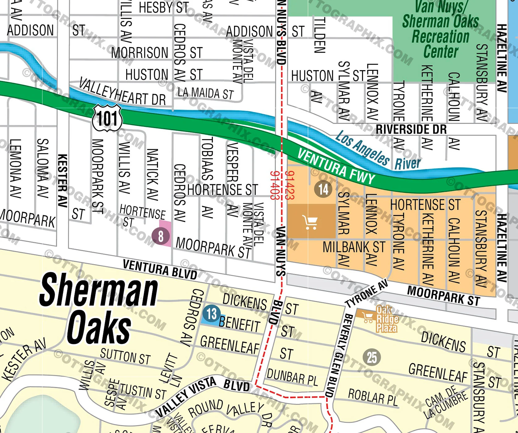
- Full Street Detail
- Recreation Centers
- Parks
- Shopping Centers
- Golf Courses
- Schools
-
- RIGHTS:
- Royalty Free
- Not for resale
- All reproduction rights granted
DISCLAIMER:
- The information on this map was derived from multiple sources. Care was taken in the creation of this map. Ottographix cannot accept any responsibility for errors, omissions, or positional accuracy. However, notification of errors are appreciated. If you find a mistake, Ottographix will fix it for no charge. Please contact us and we'll take care of it. https://www.ottographix.com/contact.html, 619.339.3129, [email protected]
- Maps are sold as-is. All necessary files are included for editing
- Additional customization is available from Ottographix at an additional cost. Please contact us for details and a free quote. http://www.ottographix.com/contact.html, 619.339.3129, [email protected]
$113.75
Original: $325.00
-65%Long Beach Map WEST, Los Angeles County, CA - FILES - PDF and AI, editable, vector, royalty free—
$325.00
$113.75Product Information
Product Information
Shipping & Returns
Shipping & Returns
Description
PURCHASE INCLUDES:
- PDF Files - with Company Branding Box and without
- Adobe Illustrator Files and fonts (layered, editable)
- 11”x17” Vector File - enlarged or reduced to any size with out loss of quality
- Customization: Turn map layers on or off. Easily change Fonts and Colors
- Royalty Free / All Reproduction Rights Granted (not for resale)
- Prints not included, recommend Kinkos
- NO SALES TAX!
COMMUNITIES:
- ADDAMS
- ARLINGTON
- AUBRY AT ALAMITOS RIDGE
- BIXBY KNOLLS
- BIXBY PARK
- BIXBY RIVIERA
- BIXBY TERRACE
- BLUFF HEIGHTS
- BLUFF PARK
- CALIFORNIA HEIGHTS
- CARMELITOS
- CARROLL PARK
- CENTRAL
- COLLEGE SQUARE
- COOLIDGE TRIANGLE
- COUNTRY CLUB VILLAS
- CROWNE POINTE
- DAIRY
- DeFOREST PARK
- EAST VILLAGE
- FRANKLIN
- FRIENDLY VILLAGE MHP
- GRANT
- HAMILTON
- HELLMAN
- HOUGHTON PARK
- LINDBERGH
- LONGWOOD
- LOS CERRITOS
- LOWER WESTSIDE
- MAGNOLIA DISTRICT
- McKINLEY
- MEMORIAL HEIGHTS
- NORTH WRIGLEY
- PARAMOUNT
- RAMONA PARK
- ROSE PARK
- SAINT FRANCIS
- SAINT MARY'S
- SOUTH WRIGLEY
- SOUTHEAST WRIGLEY
- STARR KING
- SUNRISE
- SUTTER
- UPPER WESTSIDE
- VILLA PARK MHP
- WASHINGTON SCHOOL
- WEST VILLAGE
- WESTSIDE
- WILMORE
- WINDWARD VILLAGE MHP
- WRIGLEY HEIGHTS
- ZAFIRIA
DETAILS:
- Subdivision/Tract Boundaries and Index
- Full Street Detail
- Recreation Centers
- Parks
- Shopping Centers
- Golf Courses
- Schools
-
- RIGHTS:
- Royalty Free
- Not for resale
- All reproduction rights granted
DISCLAIMER:
- The information on this map was derived from multiple sources. Care was taken in the creation of this map. Ottographix cannot accept any responsibility for errors, omissions, or positional accuracy. However, notification of errors are appreciated. If you find a mistake, Ottographix will fix it for no charge. Please contact us and we'll take care of it. https://www.ottographix.com/contact.html, 619.339.3129, [email protected]
- Maps are sold as-is. All necessary files are included for editing
- Additional customization is available from Ottographix at an additional cost. Please contact us for details and a free quote. http://www.ottographix.com/contact.html, 619.339.3129, [email protected]