✨ New Arrivals Just Dropped!Explore
Santa Paula Map, Ventura County, CA - FILES - PDF and AI, editable, vector, royalty free
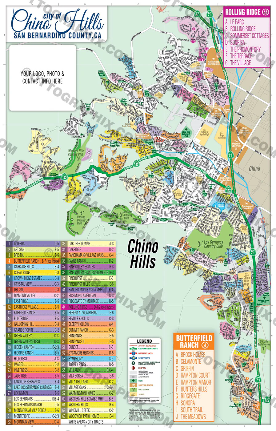
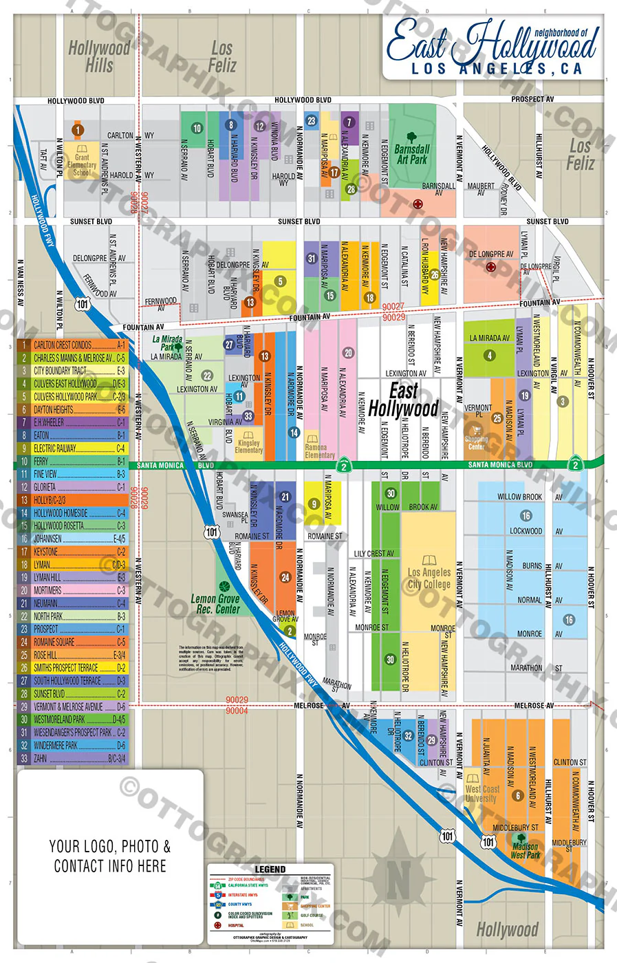
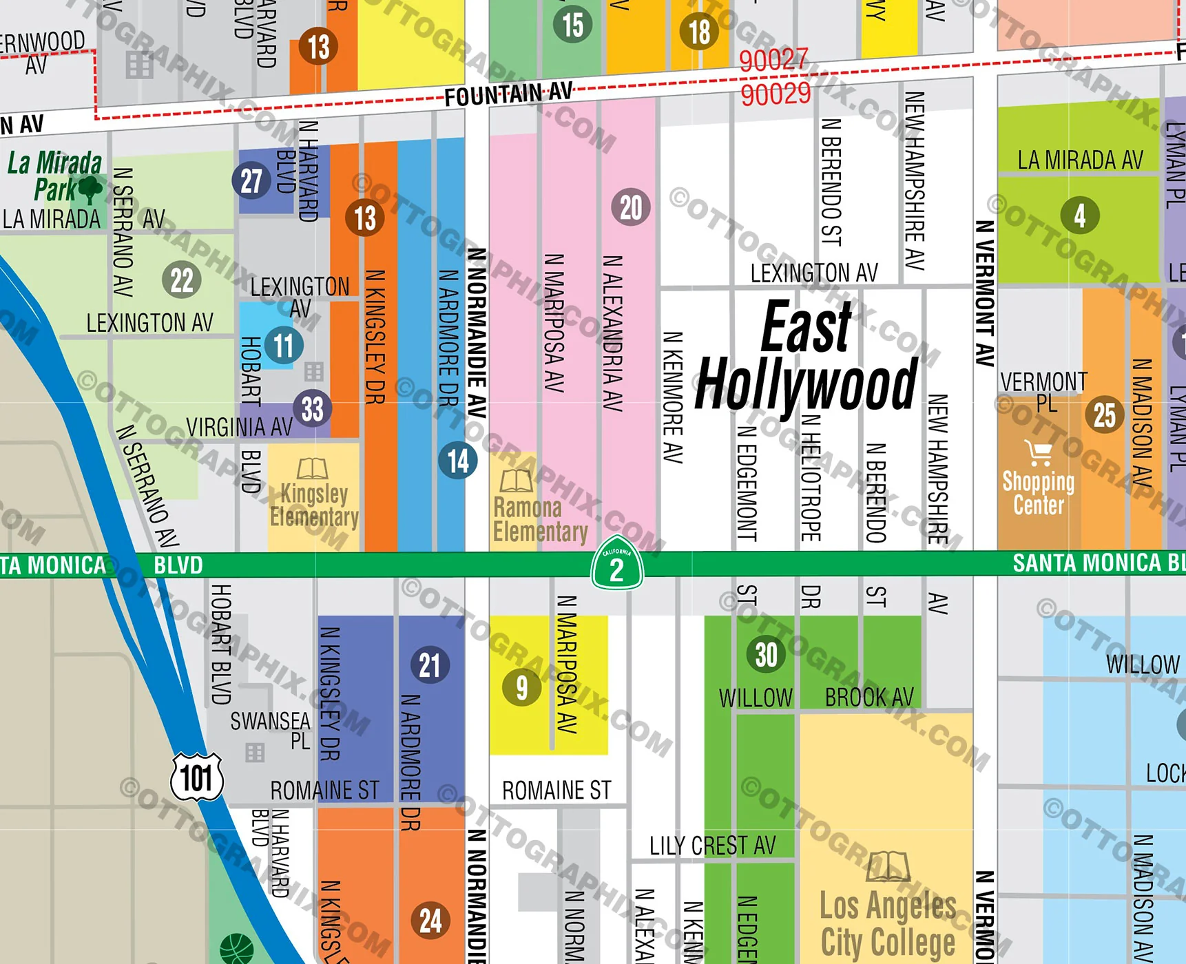
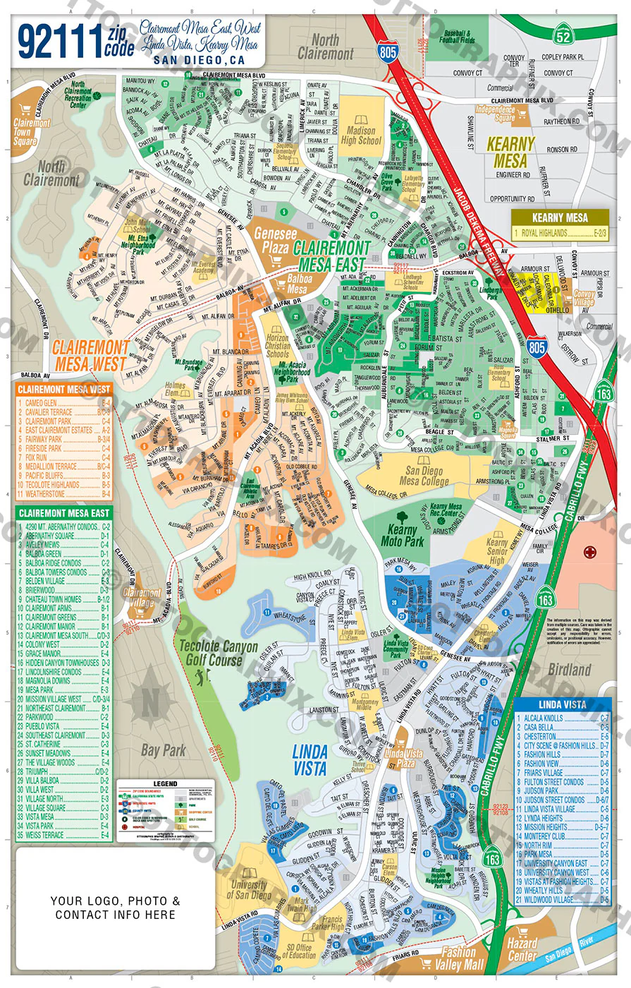
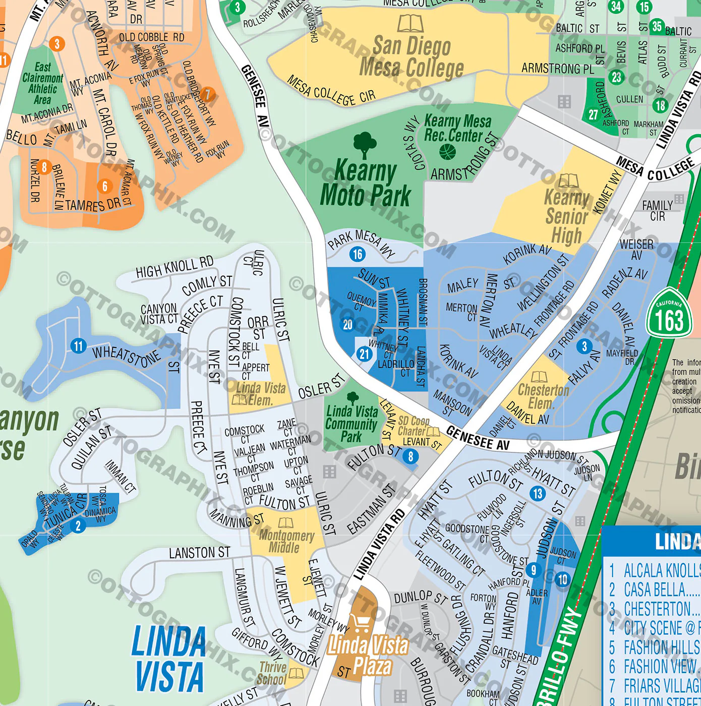
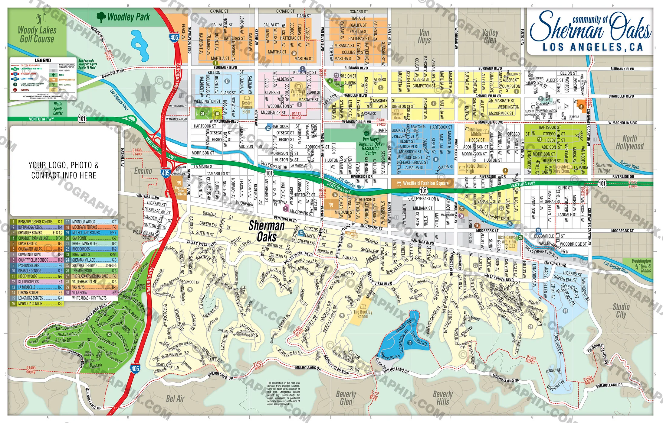
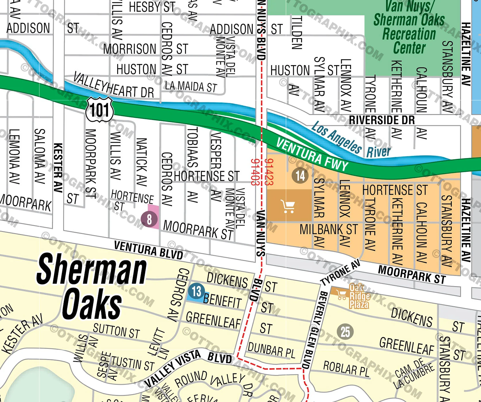
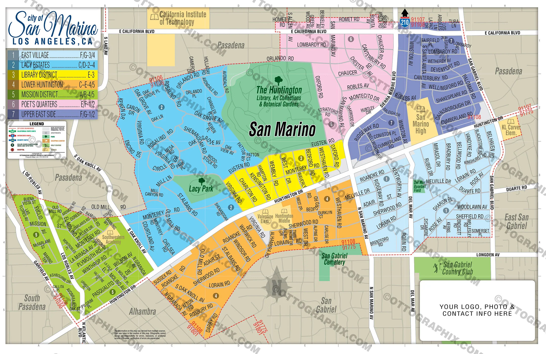
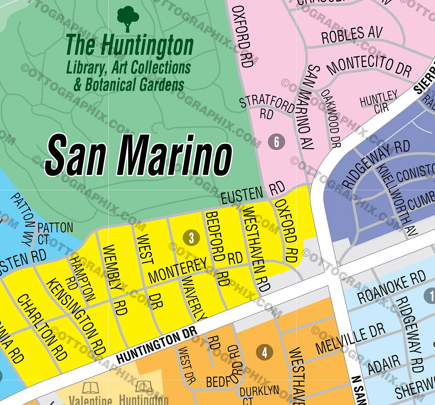
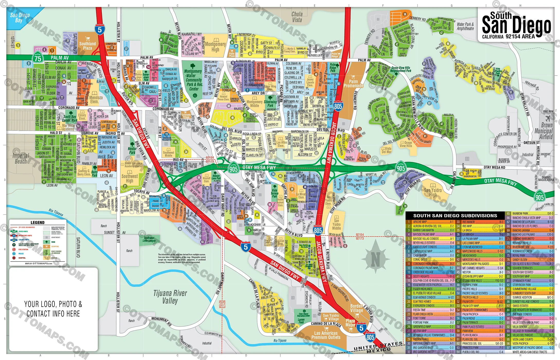
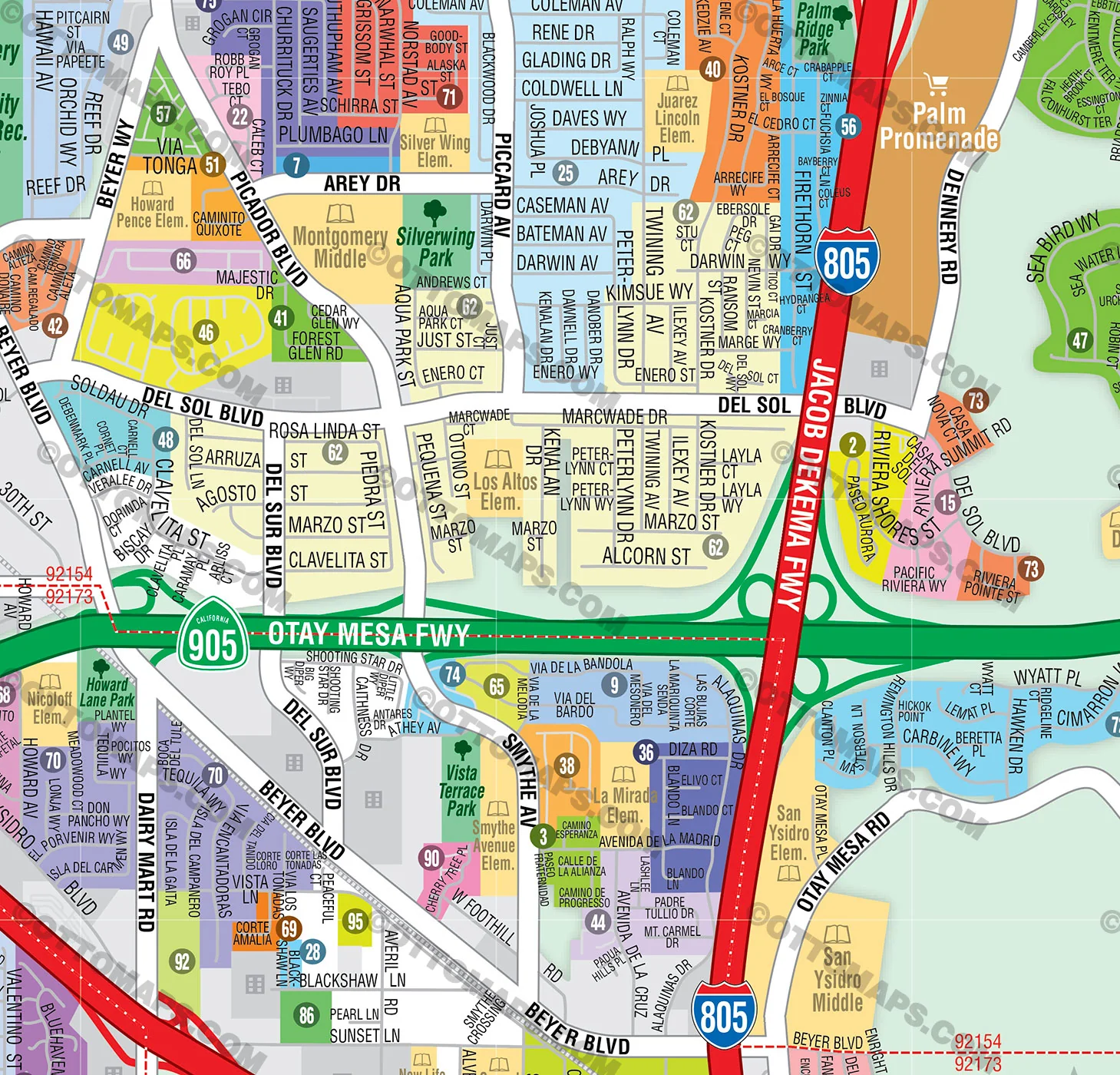
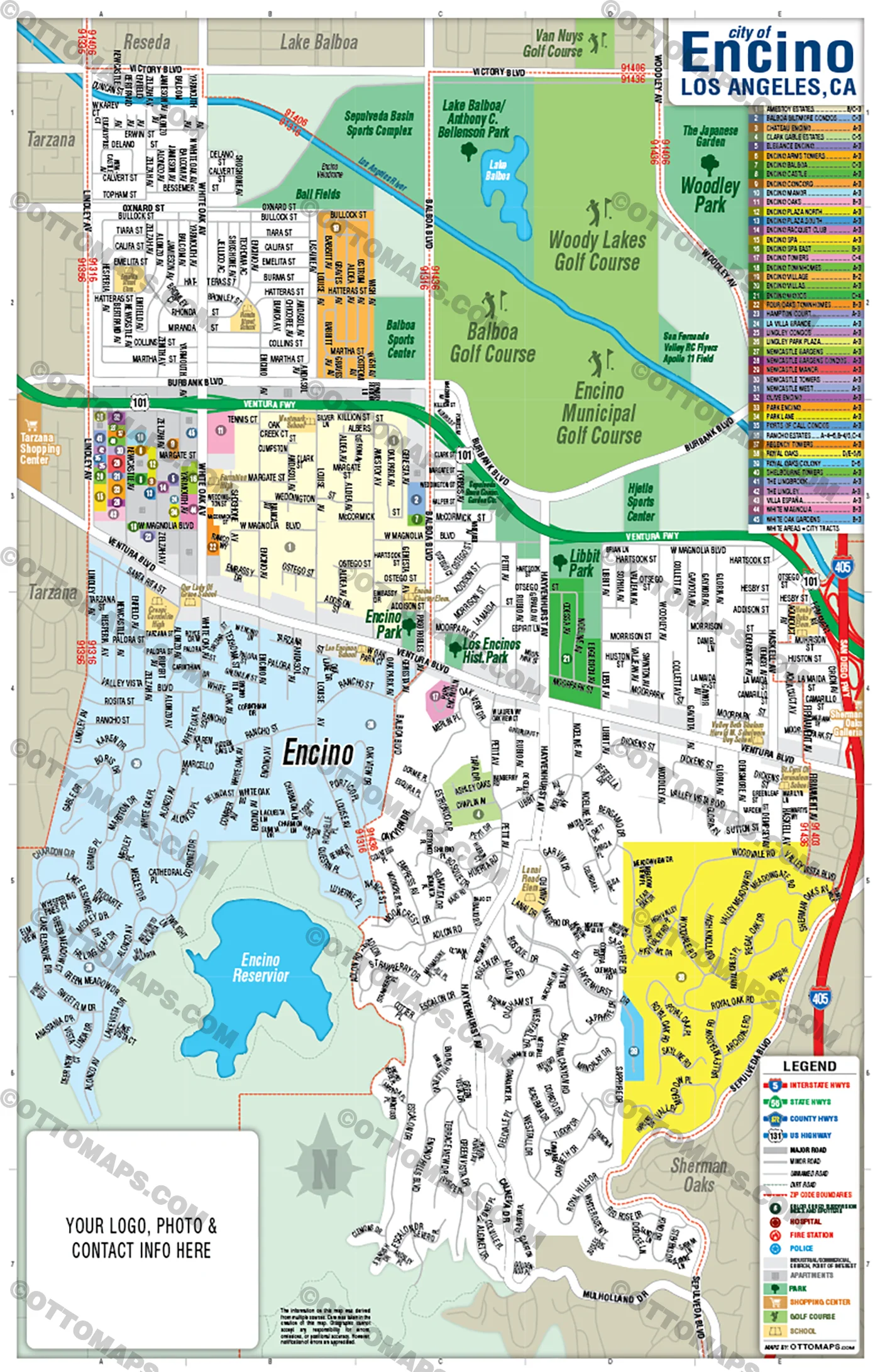
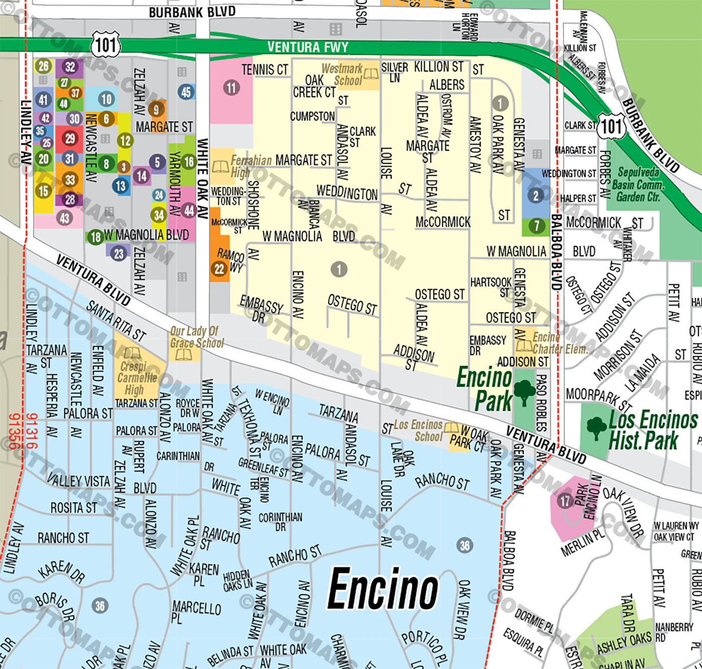
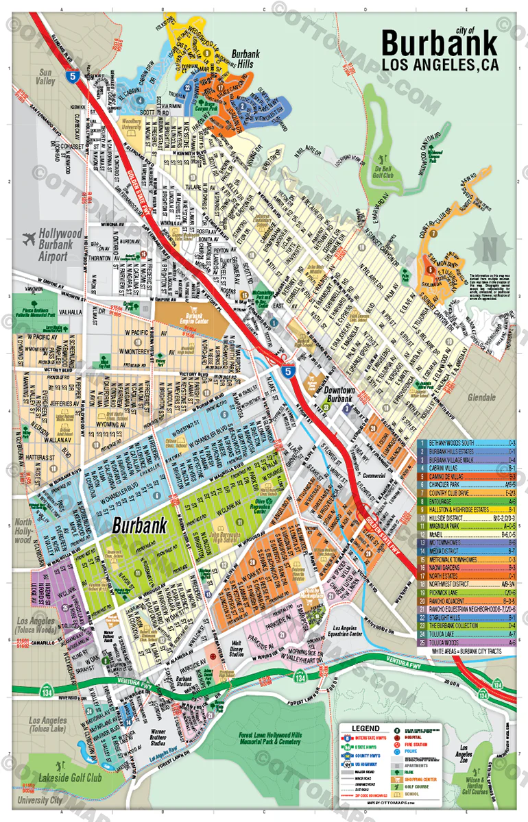
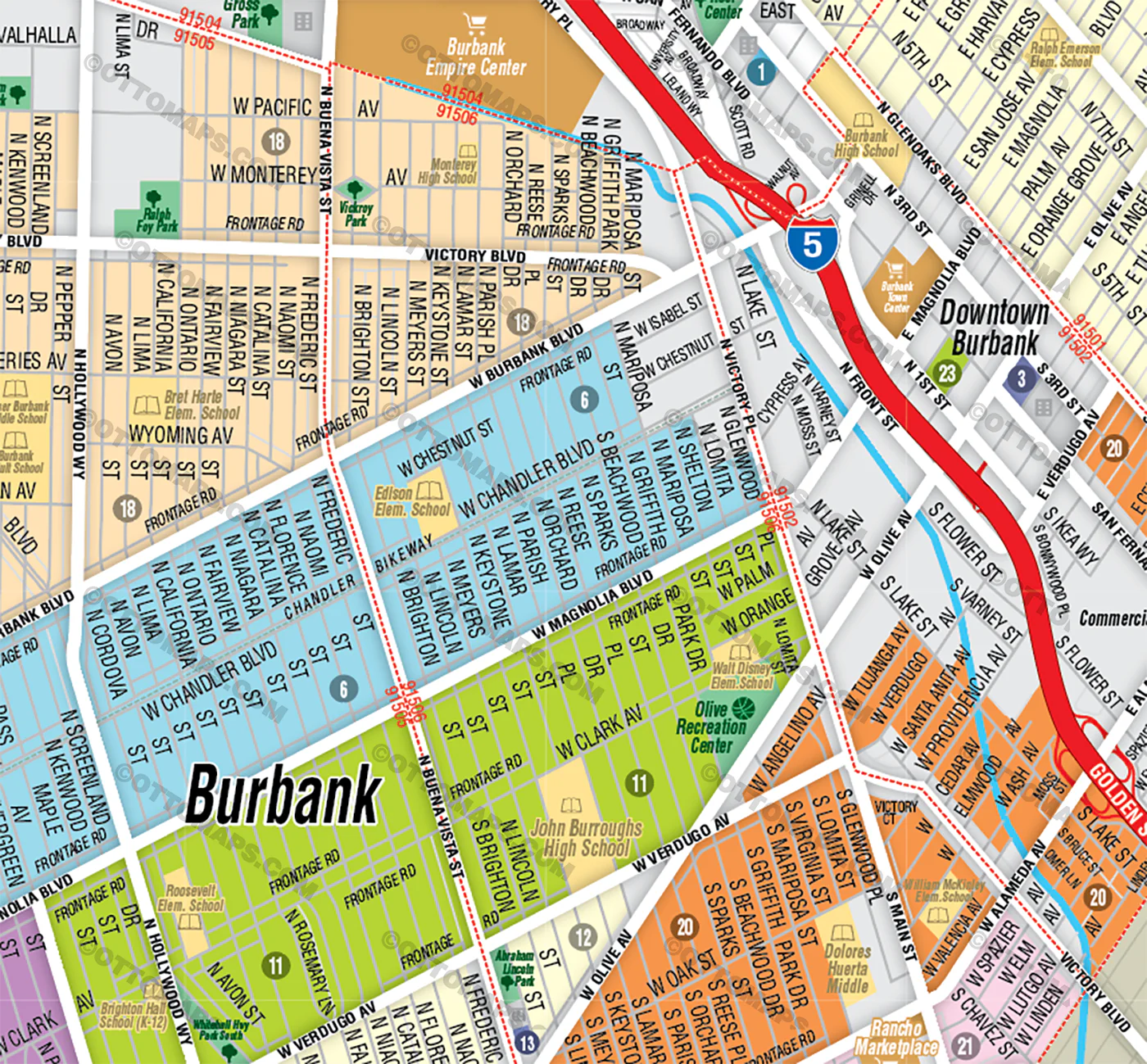
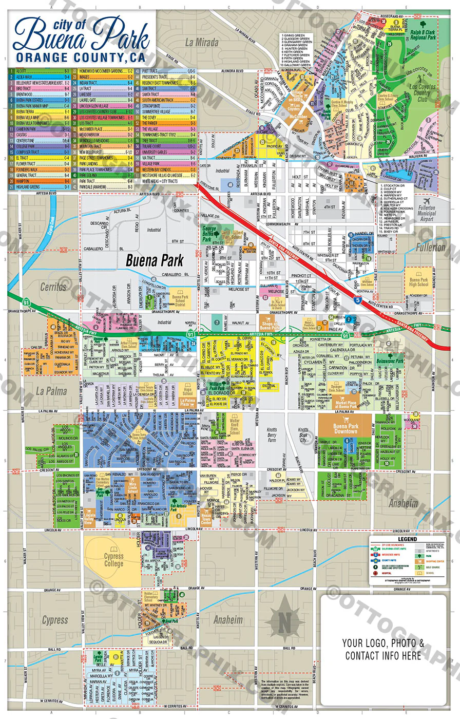
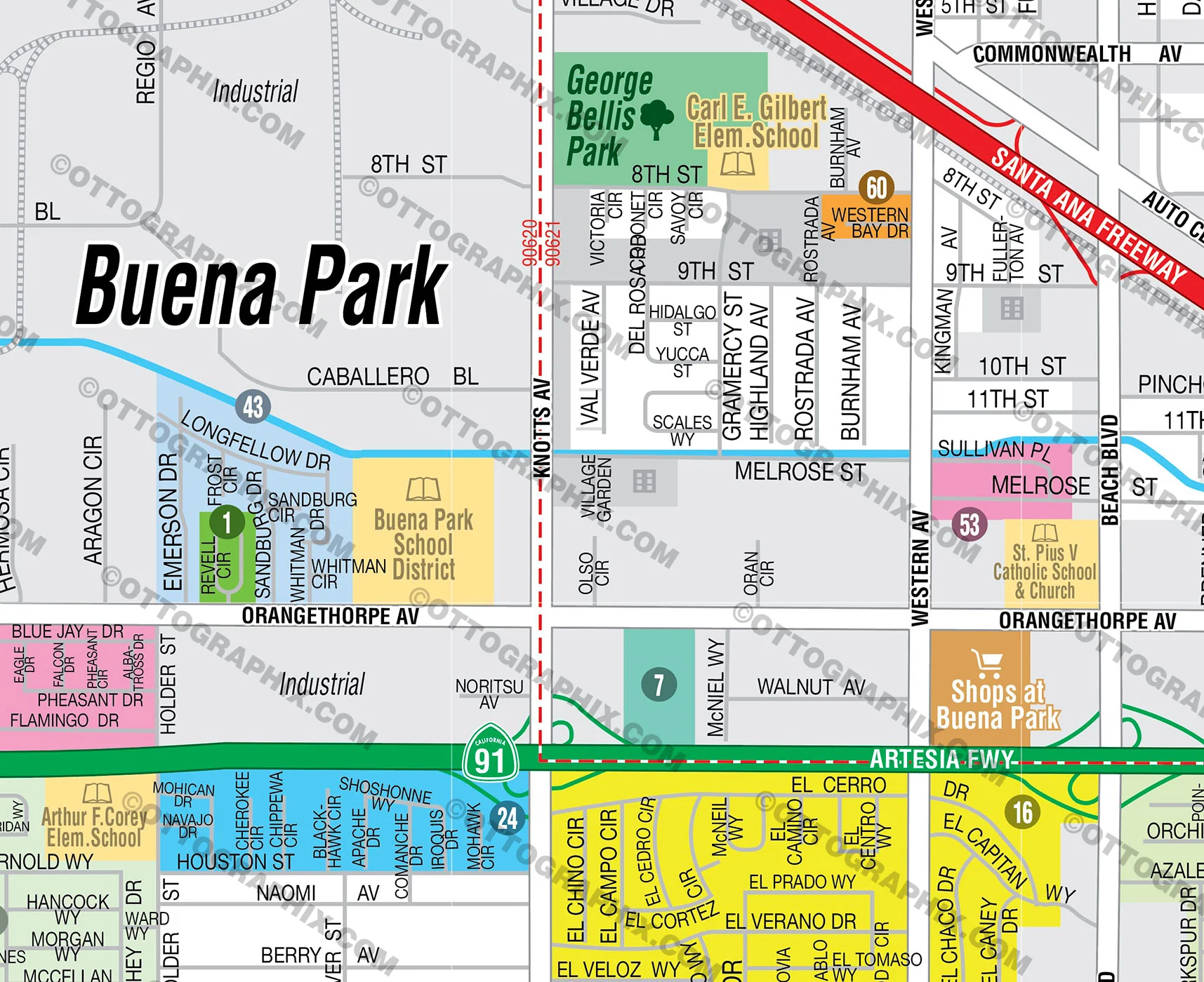
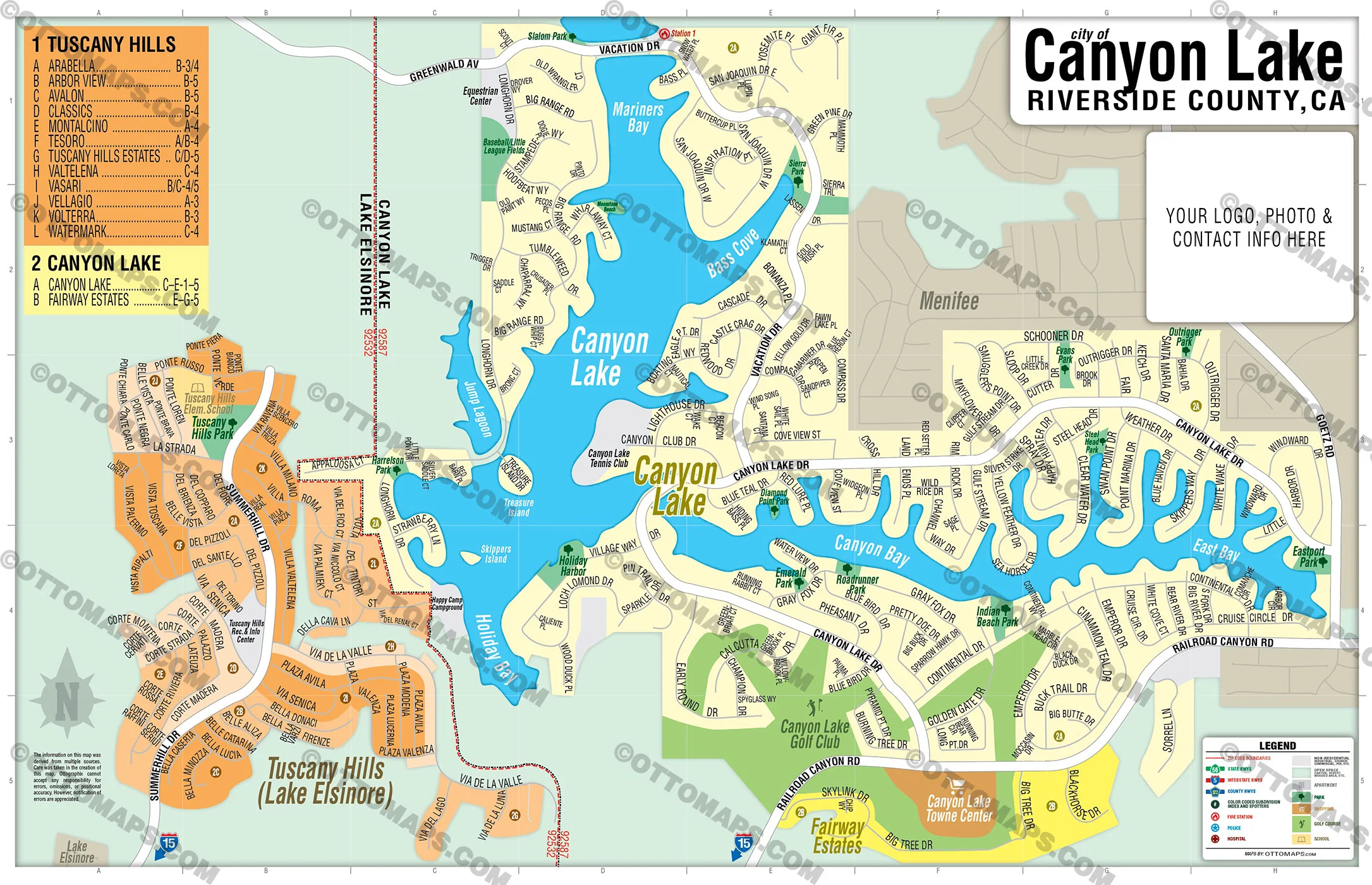
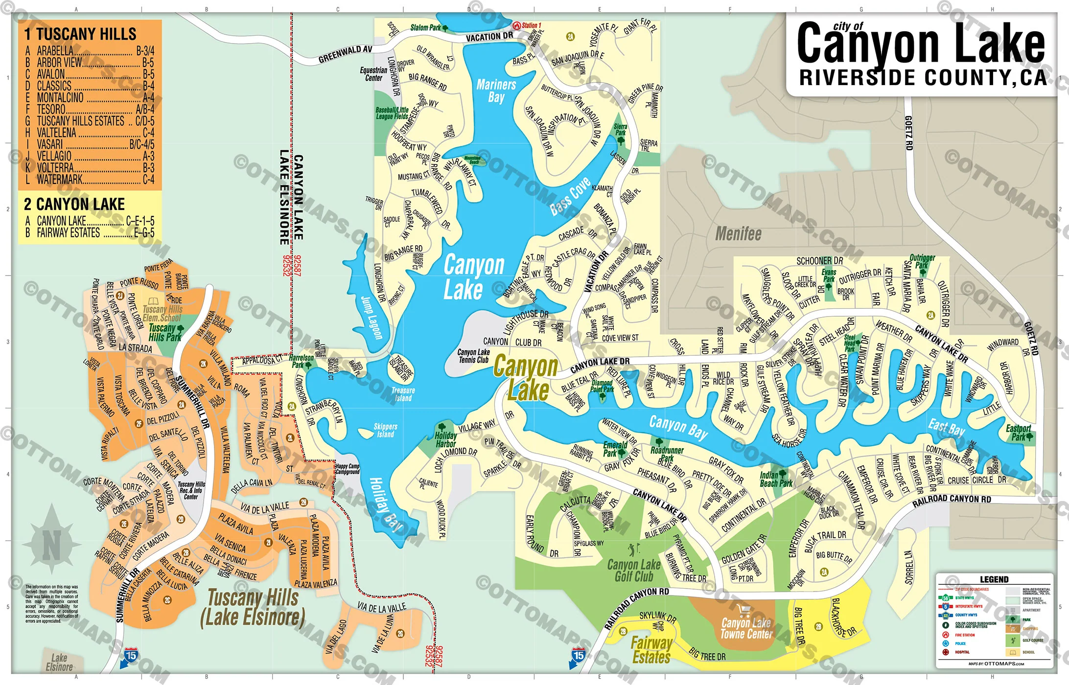
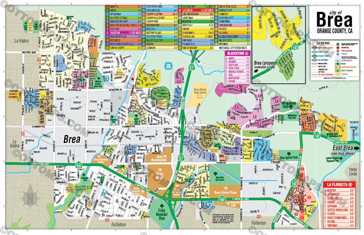
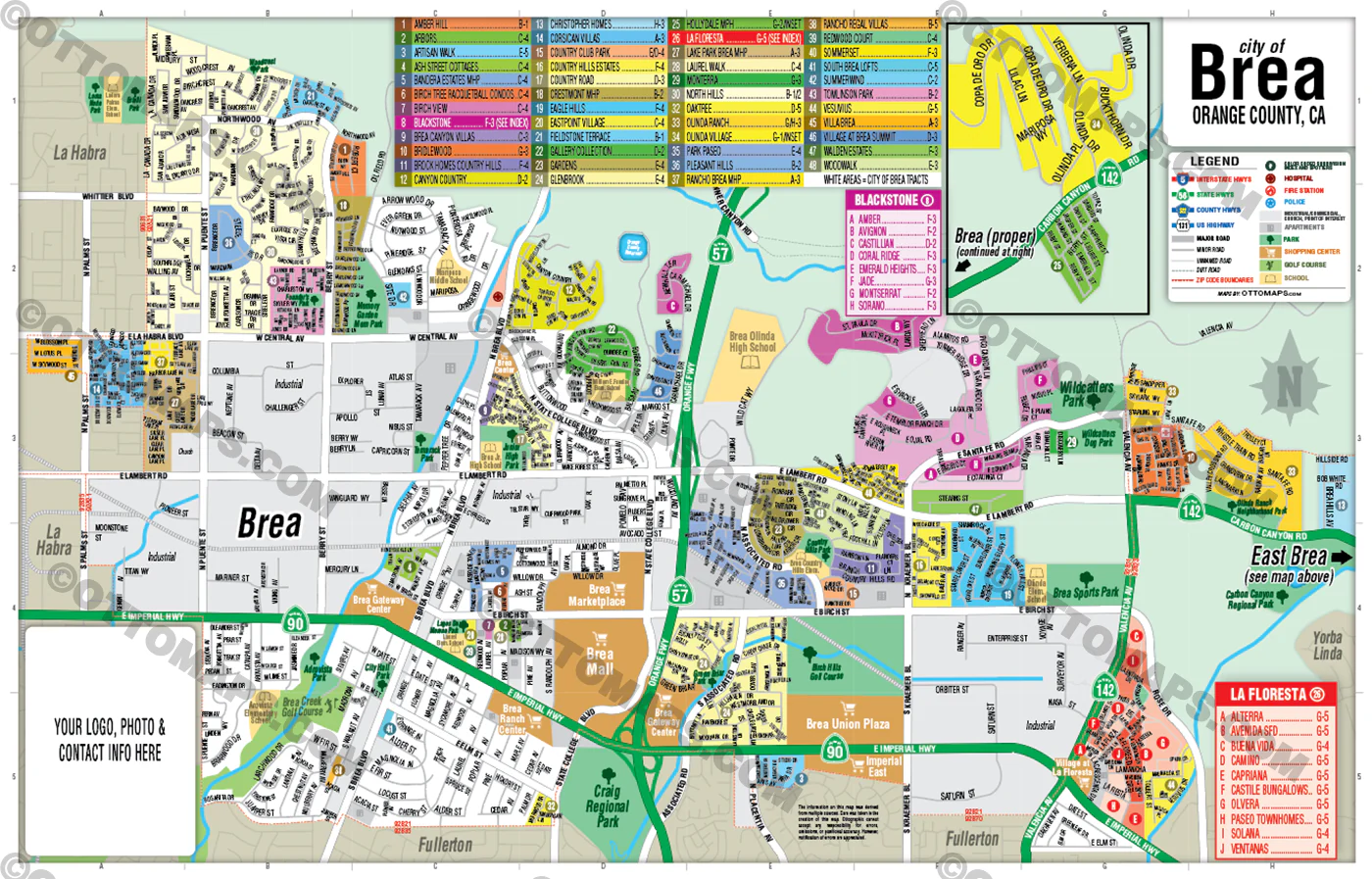
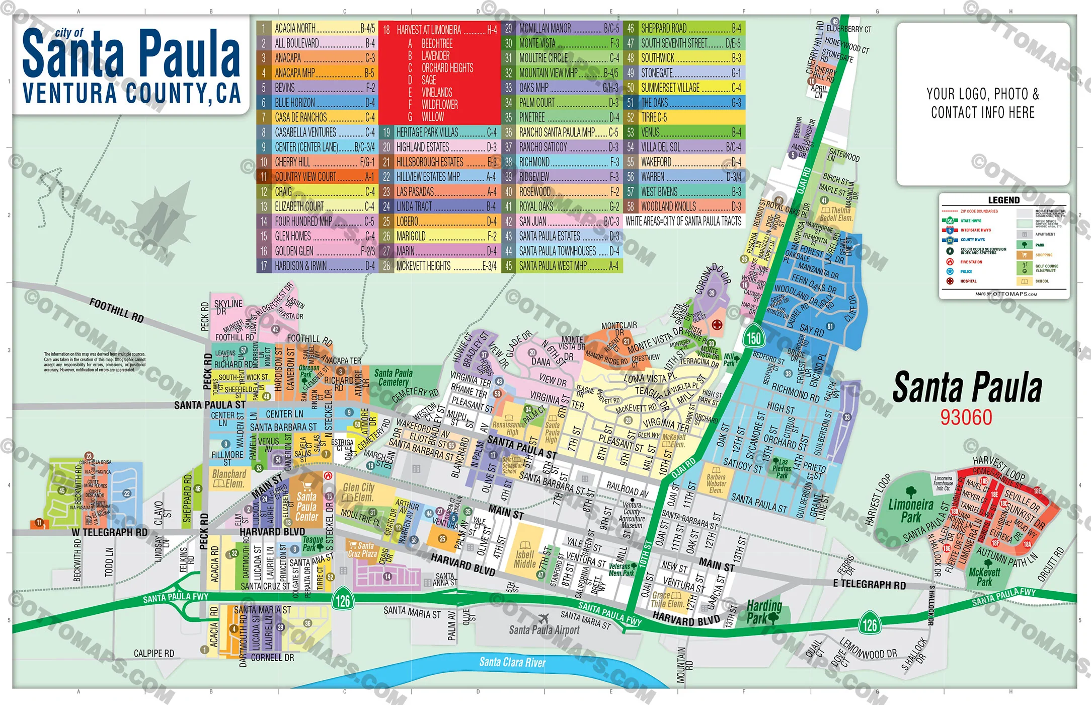
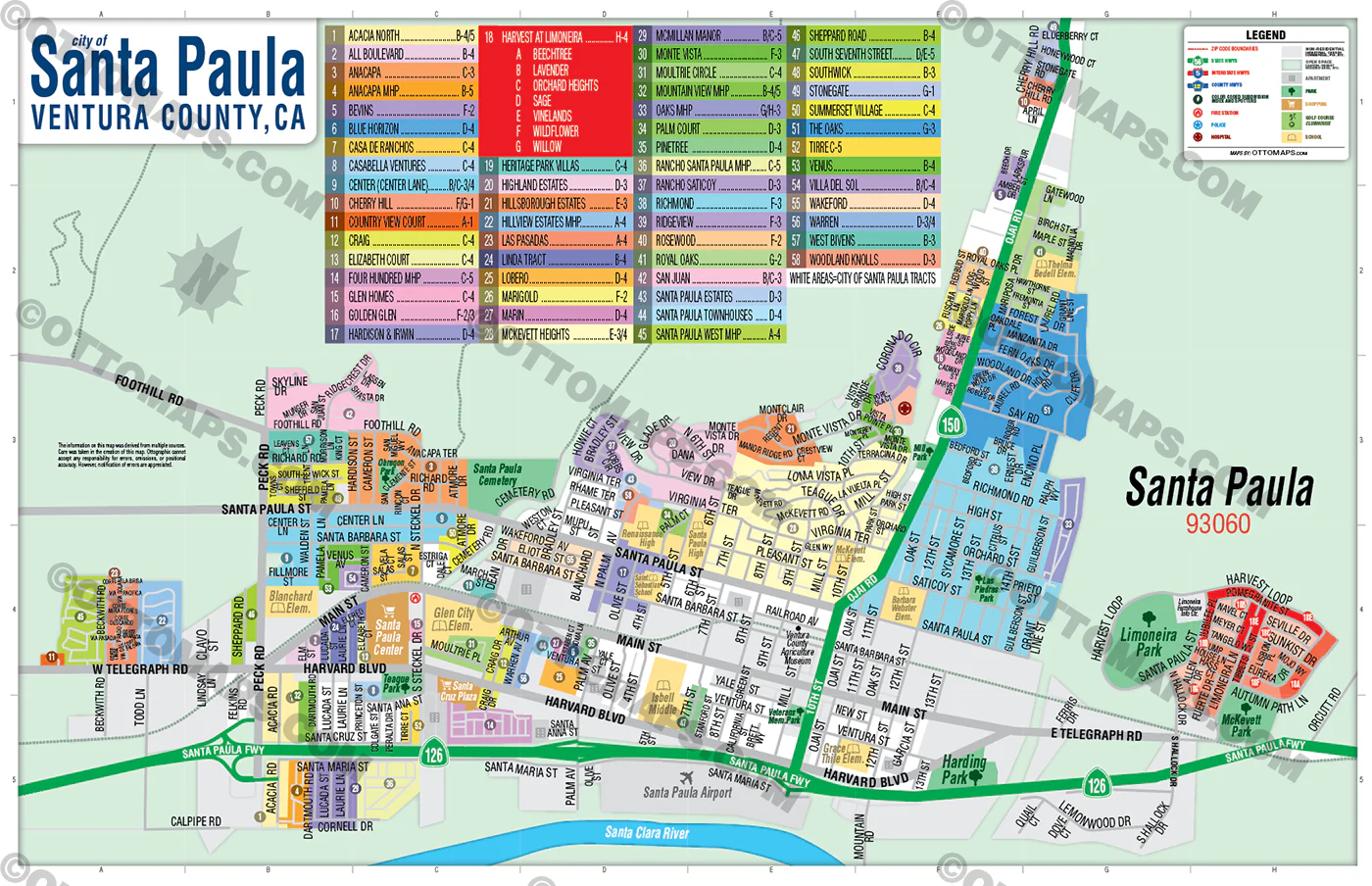
SANTA PAULA MAP POSTER PRINT
SANTA PAULA MAP FILES PDF and AI, editable, vector, layered, royalty free
PURCHASE INCLUDES:
- PDF Files - with Company Branding Box and without
- Adobe Illustrator Files and fonts (layered, editable)
- 11”x17” Vector File - enlarged to any size with out loss of quality
- Files are editable with any PDF editor
- Royalty Free / All Reproduction Rights Granted (not for resale)
- Prints not included, GET PRINTS HERE or recommend Vistaprint.com for multiple prints
- No sales tax!
COMMUNITIES:
- ACACIA NORTH
- ALL BOULEVARD
- ANACAPA
- ANACAPA MHP
- BEECHTREE
- BEVINS
- BLUE HORIZON
- CASA DE RANCHOS
- CASABELLA VENTURES
- CENTER (CENTER LANE)
- CHERRY HILL
- COUNTRY VIEW COURT
- CRAIG
- ELIZABETH COURT
- FOUR HUNDRED MHP
- GLEN HOMES
- GOLDEN GLEN
- HARDISON & IRWIN
- HARVEST AT LIMONEIRA
- HERITAGE PARK VILLAS
- HIGHLAND ESTATES
- HILLSBOROUGH ESTATES
- HILLVIEW ESTATES MHP
- LAS PASADAS
- LAVENDER
- LINDA TRACT
- LOBERO
- MARIGOLD
- MARIN
- MCKEVETT HEIGHTS
- MCMILLAN MANOR
- MONTE VISTA
- MOULTRIE CIRCLE
- MOUNTAIN VIEW MHP
- OAKS MHP
- ORCHARD HEIGHTS
- PALM COURT
- PINETREE
- RANCHO SANTA PAULA MHP
- RANCHO SATICOY
- RICHMOND
- RIDGEVIEW
- ROSEWOOD
- ROYAL OAKS
- SAGE
- SAN JUAN
- SANTA PAULA ESTATES
- SANTA PAULA TOWNHOUSES
- SANTA PAULA WEST MHP
- SHEPPARD ROAD
- SOUTH SEVENTH STREET
- SOUTHWICK
- STONEGATE
- SUMMERSET VILLAGE
- THE OAKS
- TIRRE
- VENUS
- VILLA DEL SOL
- VINELANDS
- WAKEFORD
- WARREN
- WEST BIVENS
- WILDFLOWER
- WILLOW
- WOODLAND KNOLLS
DETAILS:
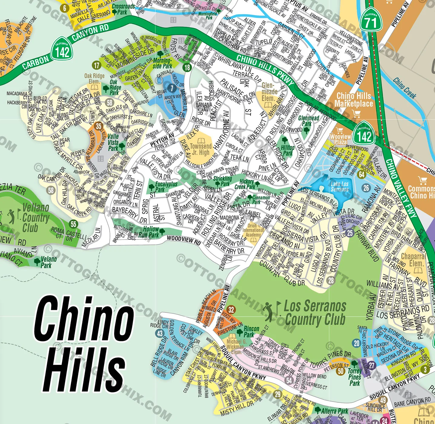
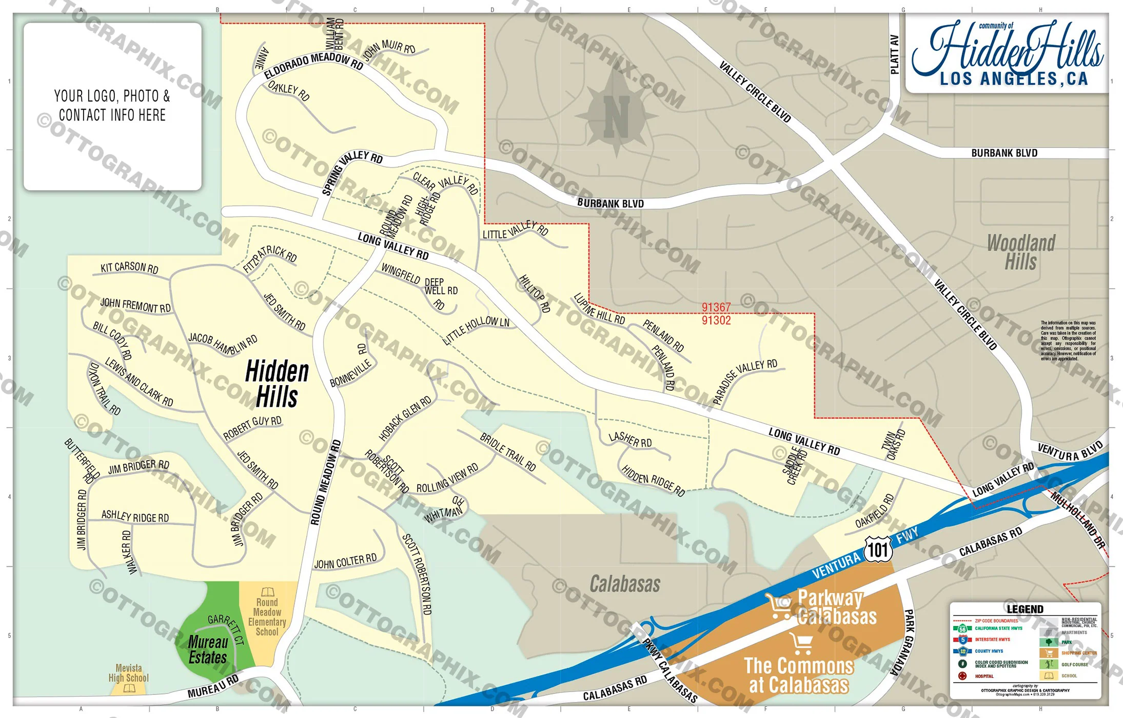
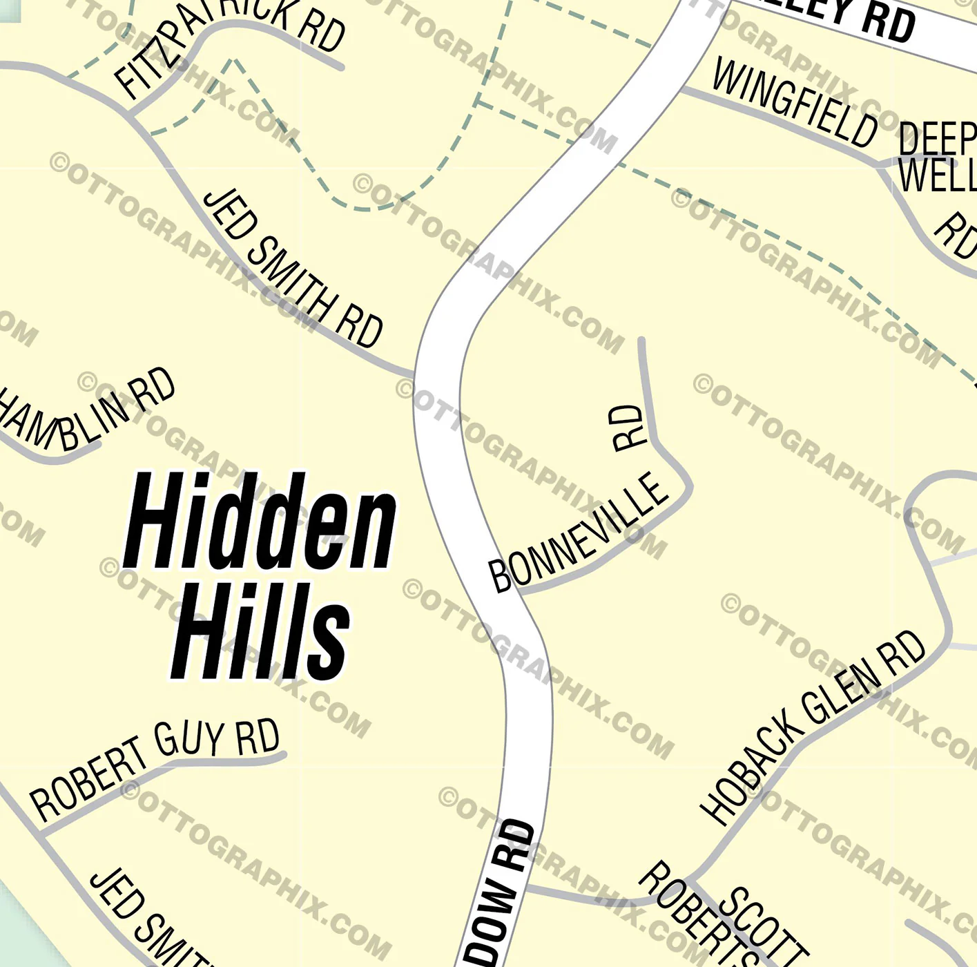
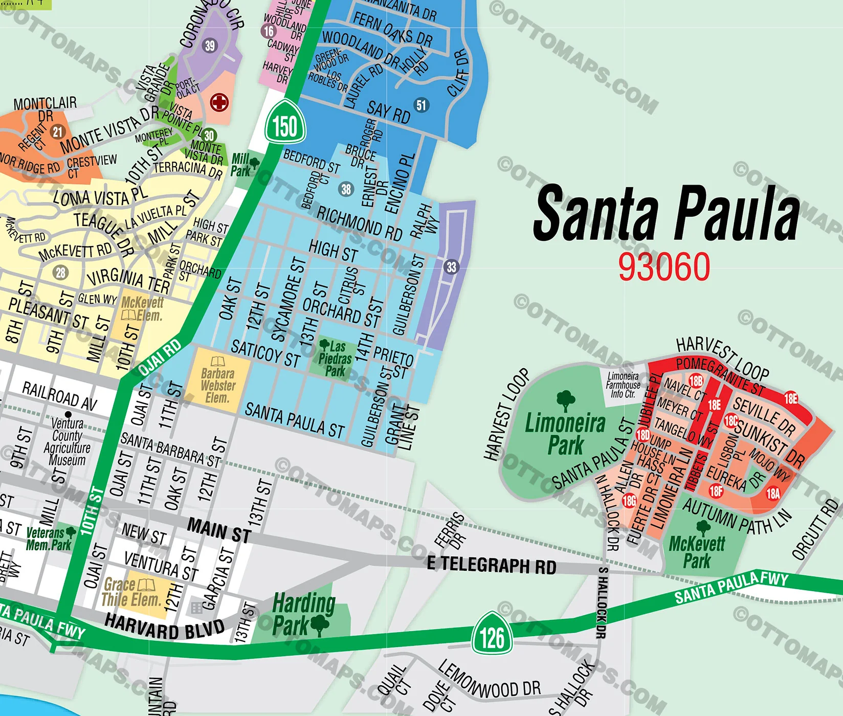
- Subdivision/Tract Boundaries and Index
- Full Street Detail
- Recreation Centers
- Parks
- Shopping Centers
- Golf Courses
- Schools
RIGHTS:
- Royalty Free
- Not for resale
- All reproduction rights granted
DISCLAIMER:
- The information on this map was derived from multiple sources. Care was taken in the creation of this map. Ottographix cannot accept any responsibility for errors, omissions, or positional accuracy. However, notification of errors are appreciated. If you find a mistake, Ottographix will fix it for no charge. Please contact us and we'll take care of it. https://ottomaps.com/pages/contact
- Maps are sold as-is. All necessary files are included for editing
- Additional customization is available from Ottographix at an additional cost. Please contact us for details and a free quote. https://ottomaps.com/pages/contact
$33.25
Original: $95.00
-65%Santa Paula Map, Ventura County, CA - FILES - PDF and AI, editable, vector, royalty free—
$95.00
$33.25Product Information
Product Information
Shipping & Returns
Shipping & Returns
Description
SANTA PAULA MAP POSTER PRINT
SANTA PAULA MAP FILES PDF and AI, editable, vector, layered, royalty free
PURCHASE INCLUDES:
- PDF Files - with Company Branding Box and without
- Adobe Illustrator Files and fonts (layered, editable)
- 11”x17” Vector File - enlarged to any size with out loss of quality
- Files are editable with any PDF editor
- Royalty Free / All Reproduction Rights Granted (not for resale)
- Prints not included, GET PRINTS HERE or recommend Vistaprint.com for multiple prints
- No sales tax!
COMMUNITIES:
- ACACIA NORTH
- ALL BOULEVARD
- ANACAPA
- ANACAPA MHP
- BEECHTREE
- BEVINS
- BLUE HORIZON
- CASA DE RANCHOS
- CASABELLA VENTURES
- CENTER (CENTER LANE)
- CHERRY HILL
- COUNTRY VIEW COURT
- CRAIG
- ELIZABETH COURT
- FOUR HUNDRED MHP
- GLEN HOMES
- GOLDEN GLEN
- HARDISON & IRWIN
- HARVEST AT LIMONEIRA
- HERITAGE PARK VILLAS
- HIGHLAND ESTATES
- HILLSBOROUGH ESTATES
- HILLVIEW ESTATES MHP
- LAS PASADAS
- LAVENDER
- LINDA TRACT
- LOBERO
- MARIGOLD
- MARIN
- MCKEVETT HEIGHTS
- MCMILLAN MANOR
- MONTE VISTA
- MOULTRIE CIRCLE
- MOUNTAIN VIEW MHP
- OAKS MHP
- ORCHARD HEIGHTS
- PALM COURT
- PINETREE
- RANCHO SANTA PAULA MHP
- RANCHO SATICOY
- RICHMOND
- RIDGEVIEW
- ROSEWOOD
- ROYAL OAKS
- SAGE
- SAN JUAN
- SANTA PAULA ESTATES
- SANTA PAULA TOWNHOUSES
- SANTA PAULA WEST MHP
- SHEPPARD ROAD
- SOUTH SEVENTH STREET
- SOUTHWICK
- STONEGATE
- SUMMERSET VILLAGE
- THE OAKS
- TIRRE
- VENUS
- VILLA DEL SOL
- VINELANDS
- WAKEFORD
- WARREN
- WEST BIVENS
- WILDFLOWER
- WILLOW
- WOODLAND KNOLLS
DETAILS:
- Subdivision/Tract Boundaries and Index
- Full Street Detail
- Recreation Centers
- Parks
- Shopping Centers
- Golf Courses
- Schools
RIGHTS:
- Royalty Free
- Not for resale
- All reproduction rights granted
DISCLAIMER:
- The information on this map was derived from multiple sources. Care was taken in the creation of this map. Ottographix cannot accept any responsibility for errors, omissions, or positional accuracy. However, notification of errors are appreciated. If you find a mistake, Ottographix will fix it for no charge. Please contact us and we'll take care of it. https://ottomaps.com/pages/contact
- Maps are sold as-is. All necessary files are included for editing
- Additional customization is available from Ottographix at an additional cost. Please contact us for details and a free quote. https://ottomaps.com/pages/contact