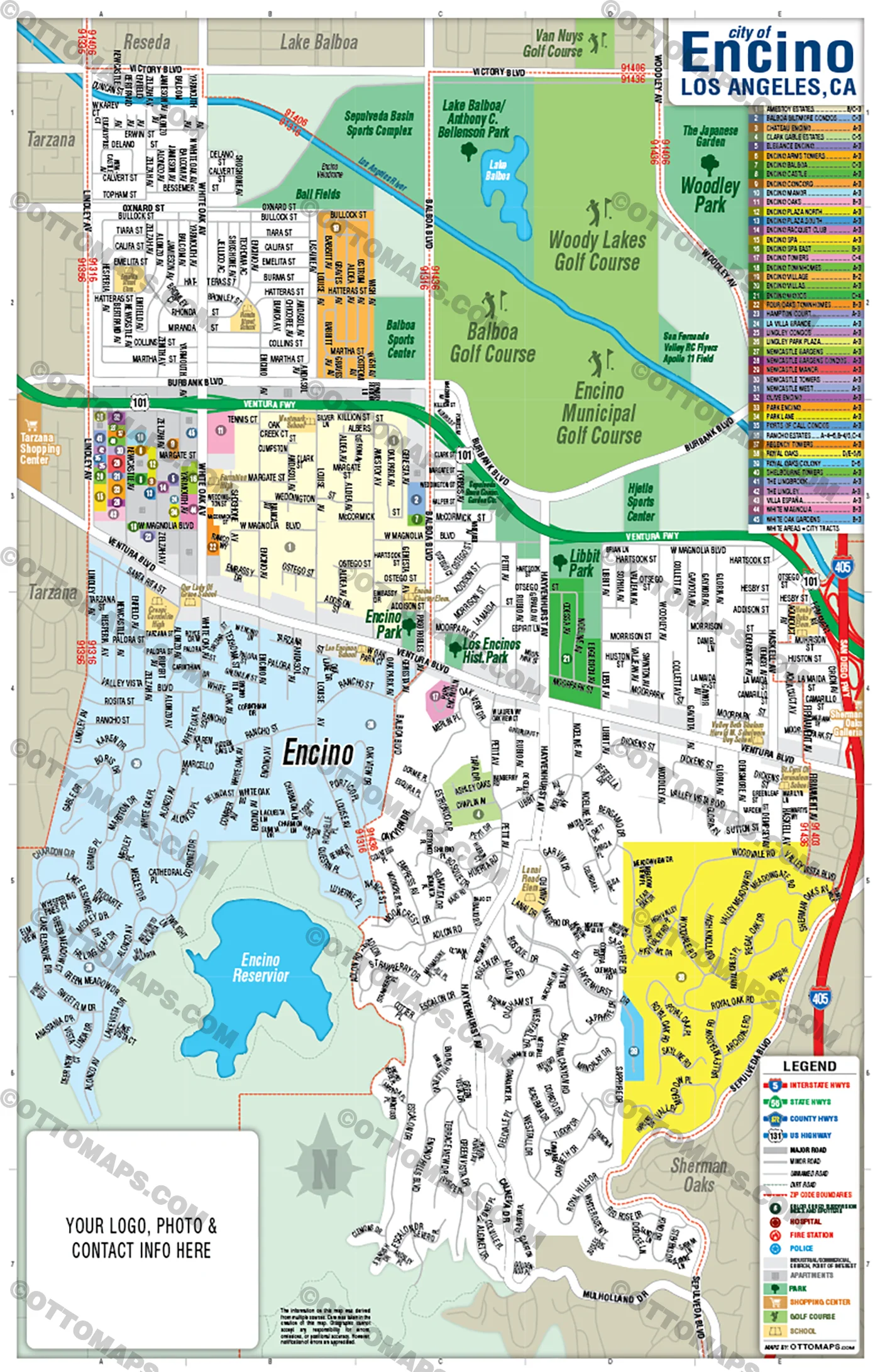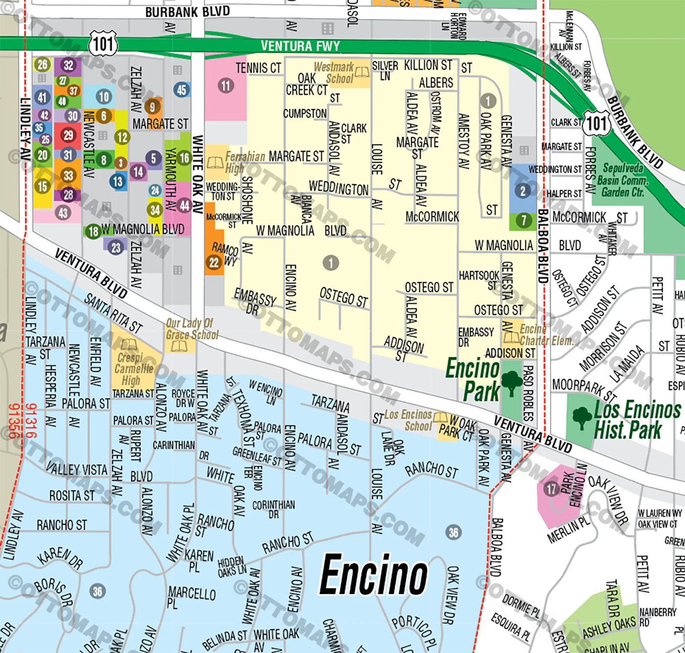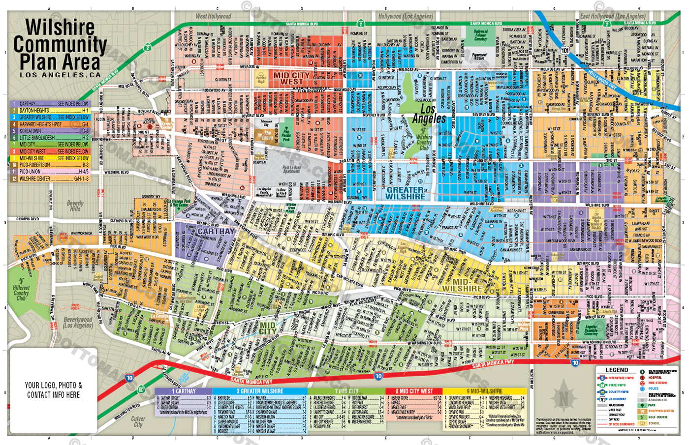
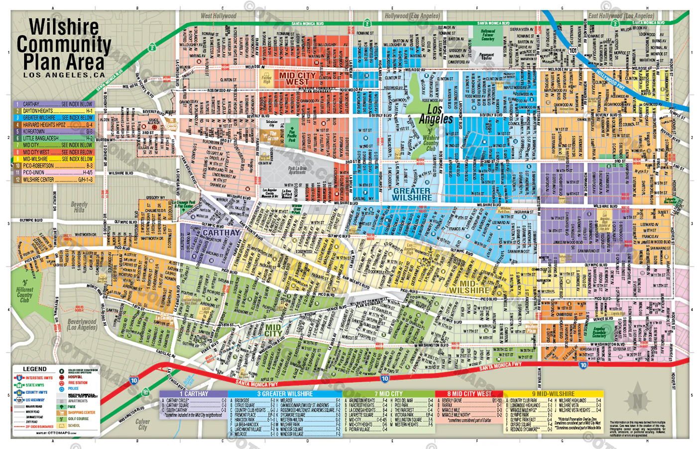
Wilshire Community Plan Map - FILES - PDF and Adobe Illustrator
includes Mid City, Mid City West, Mid-Wilshire and Greater Wilshire.
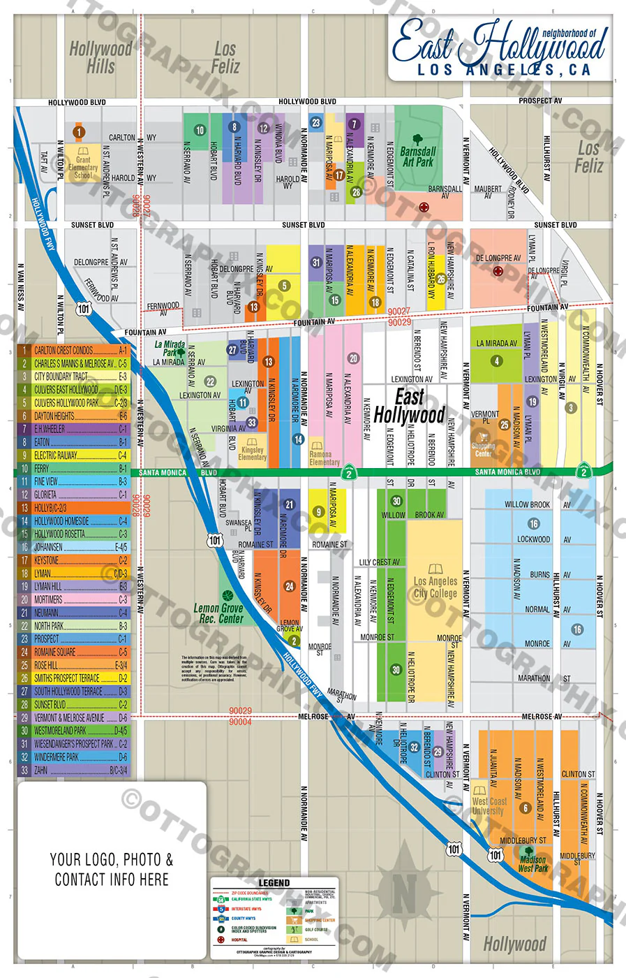
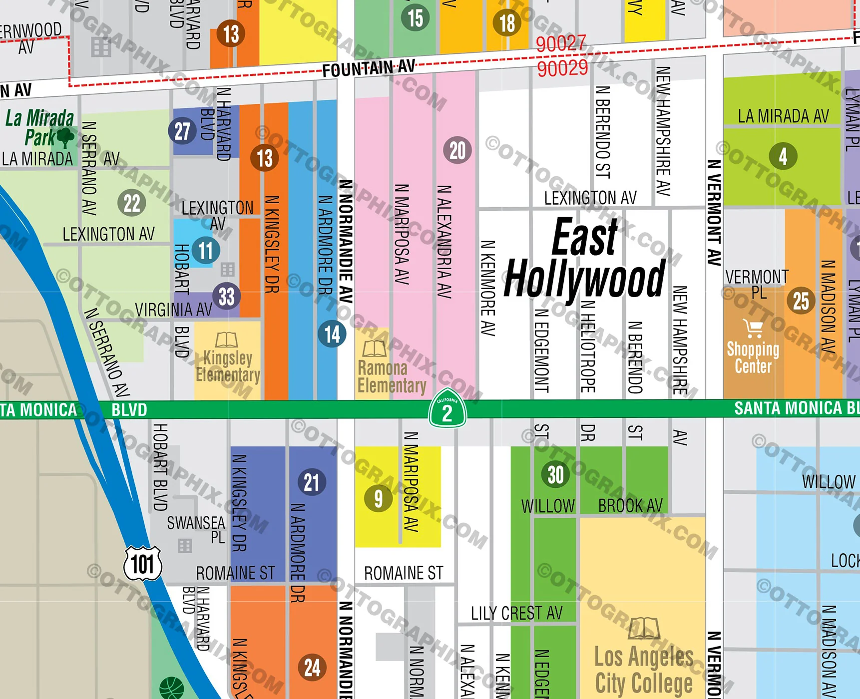
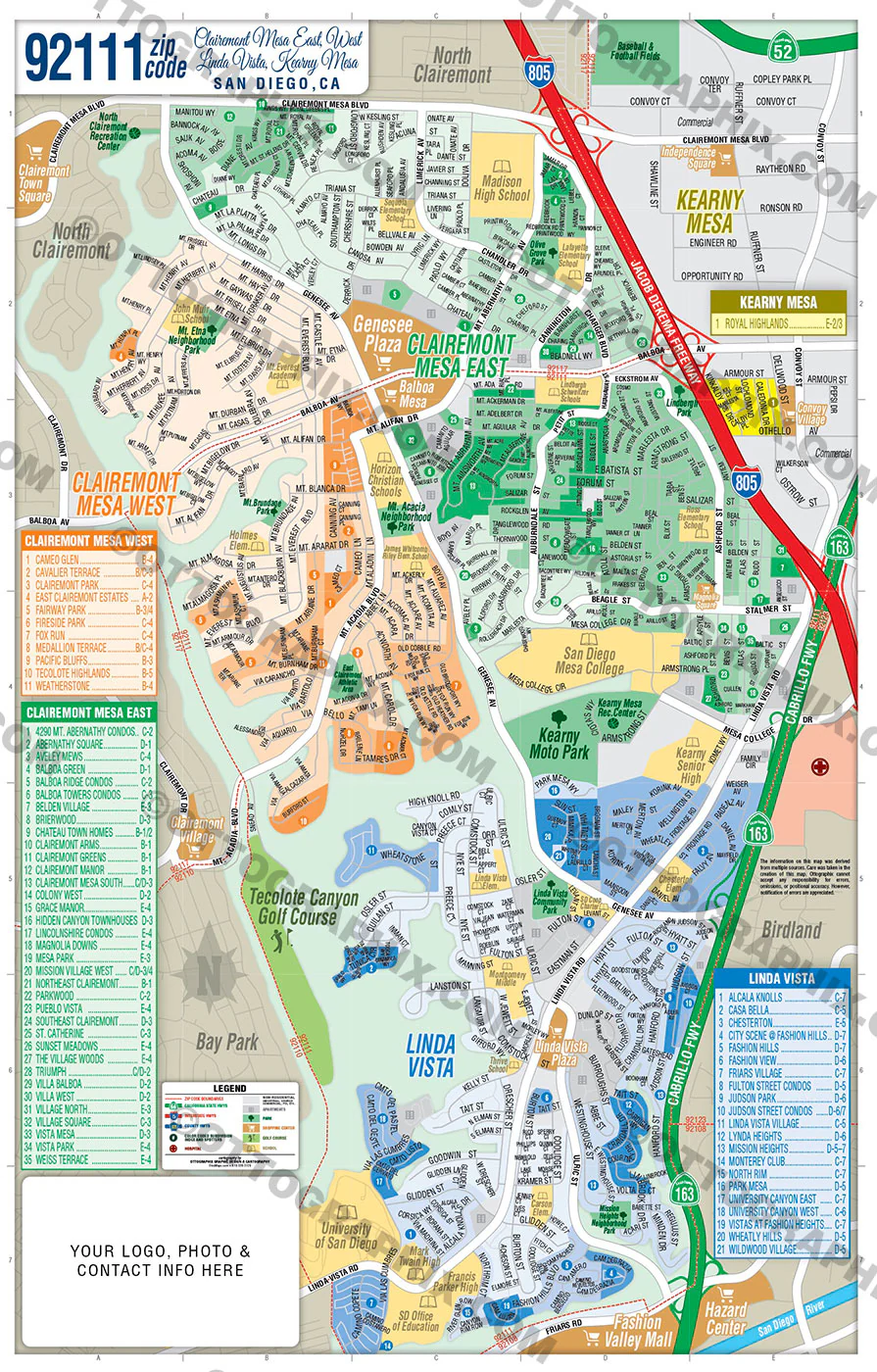
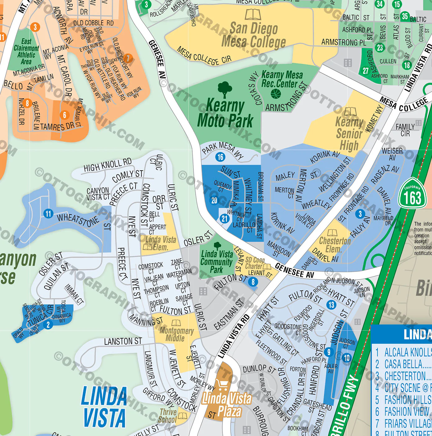
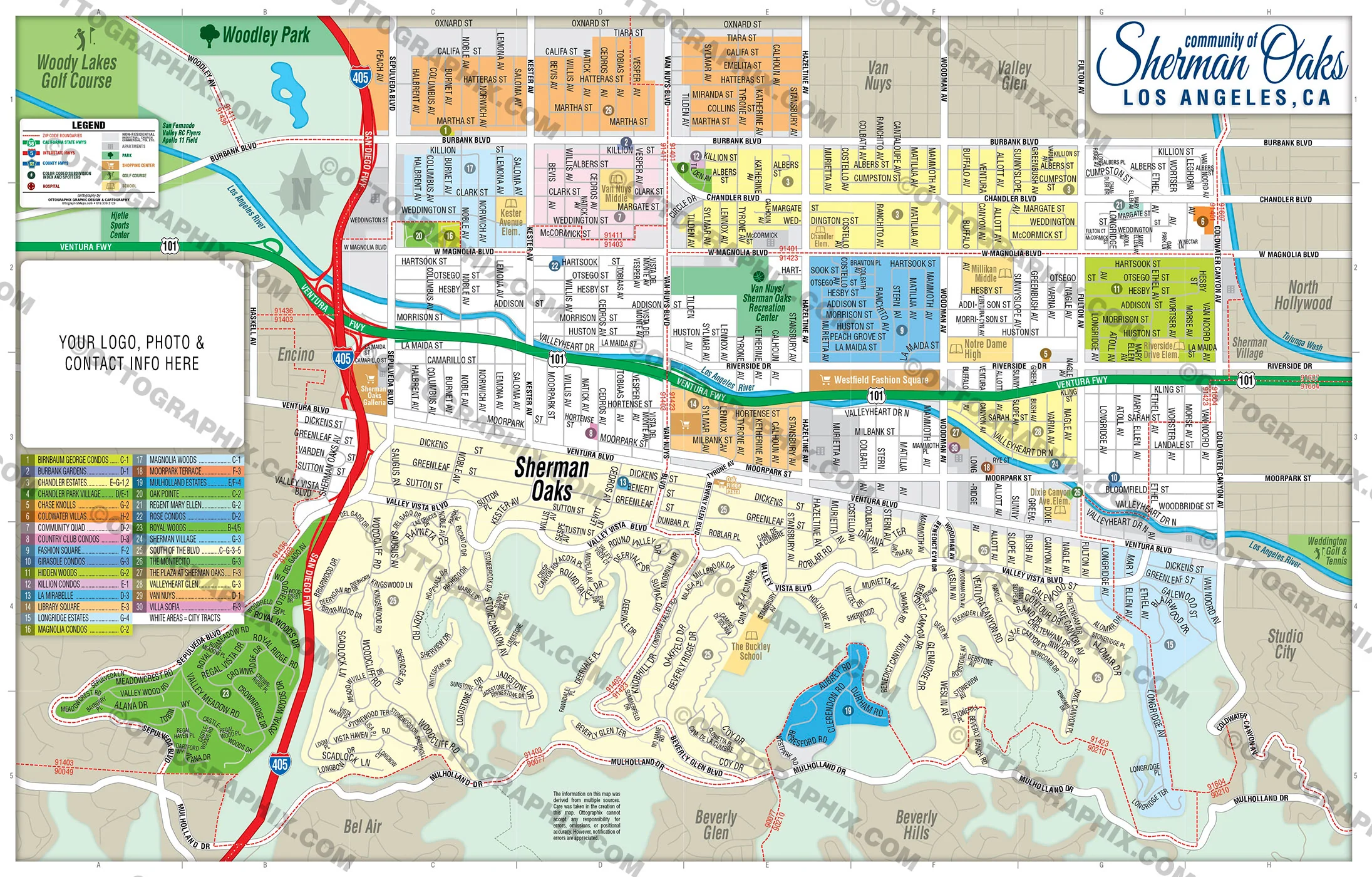
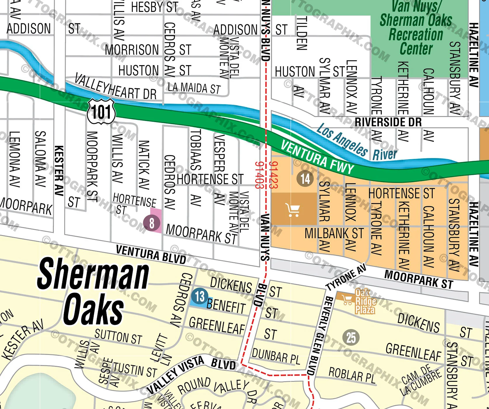
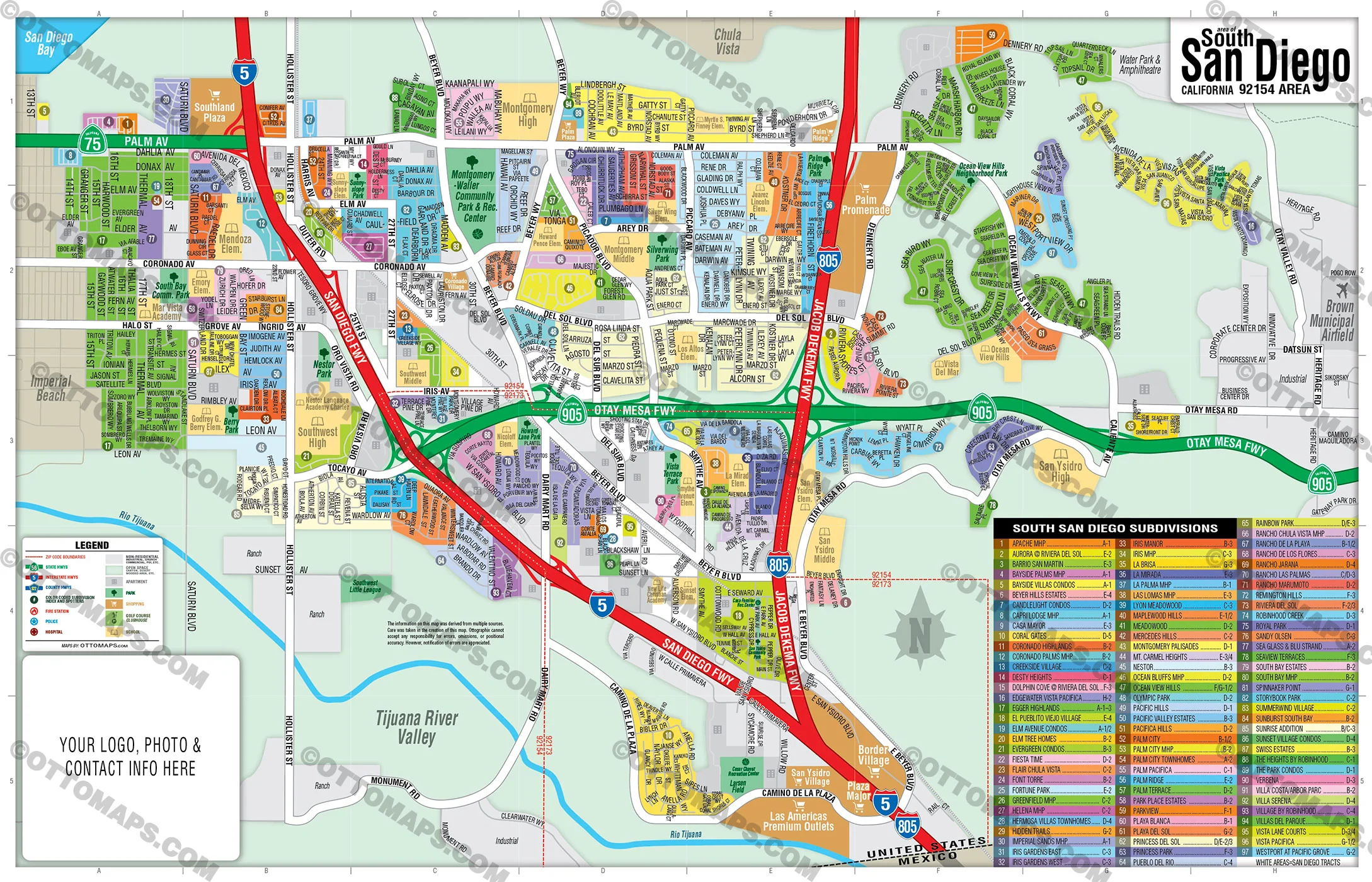
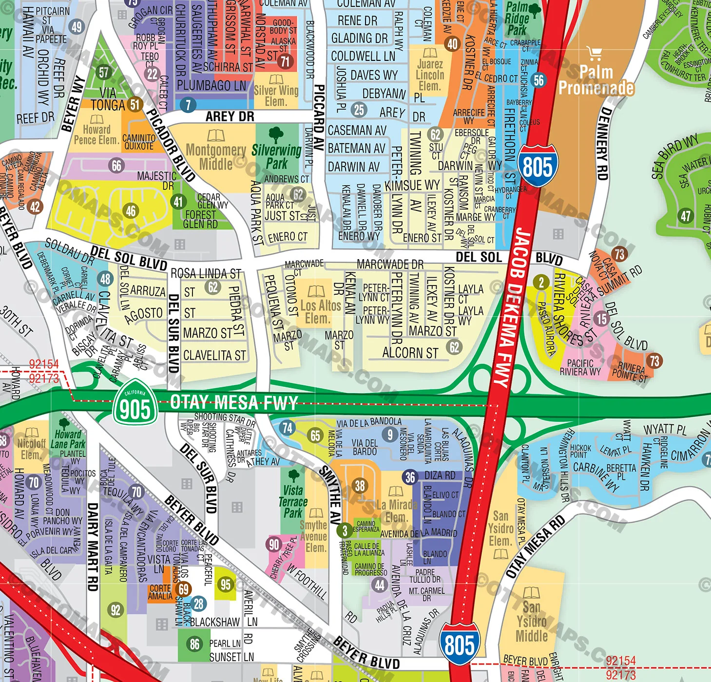
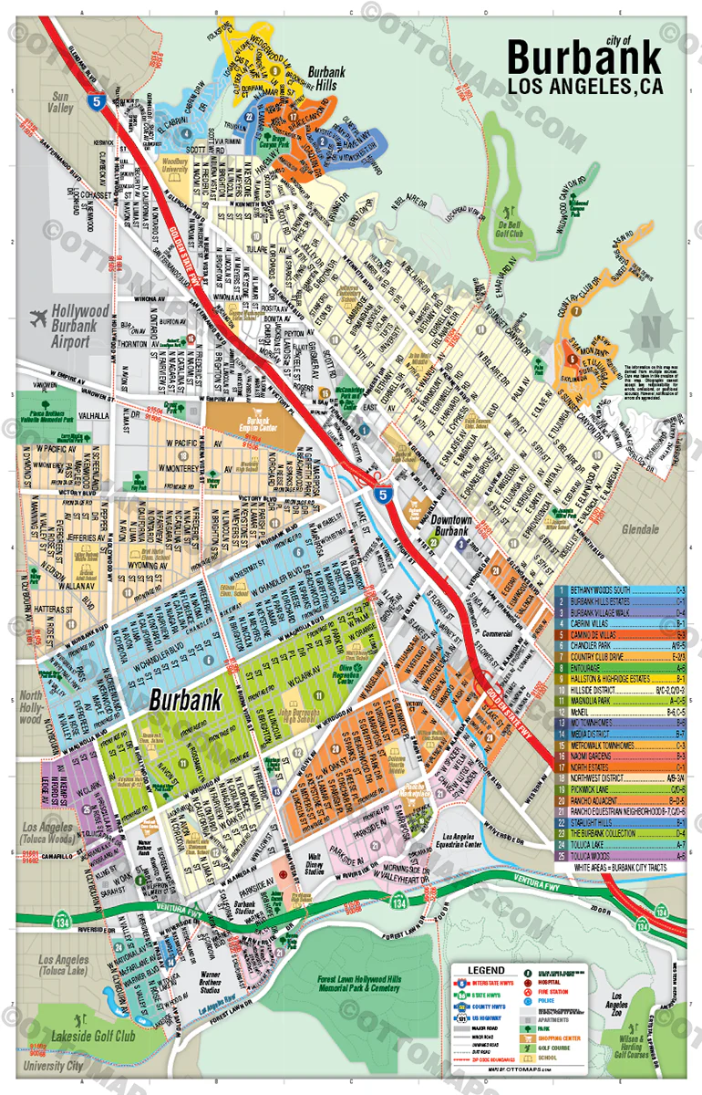
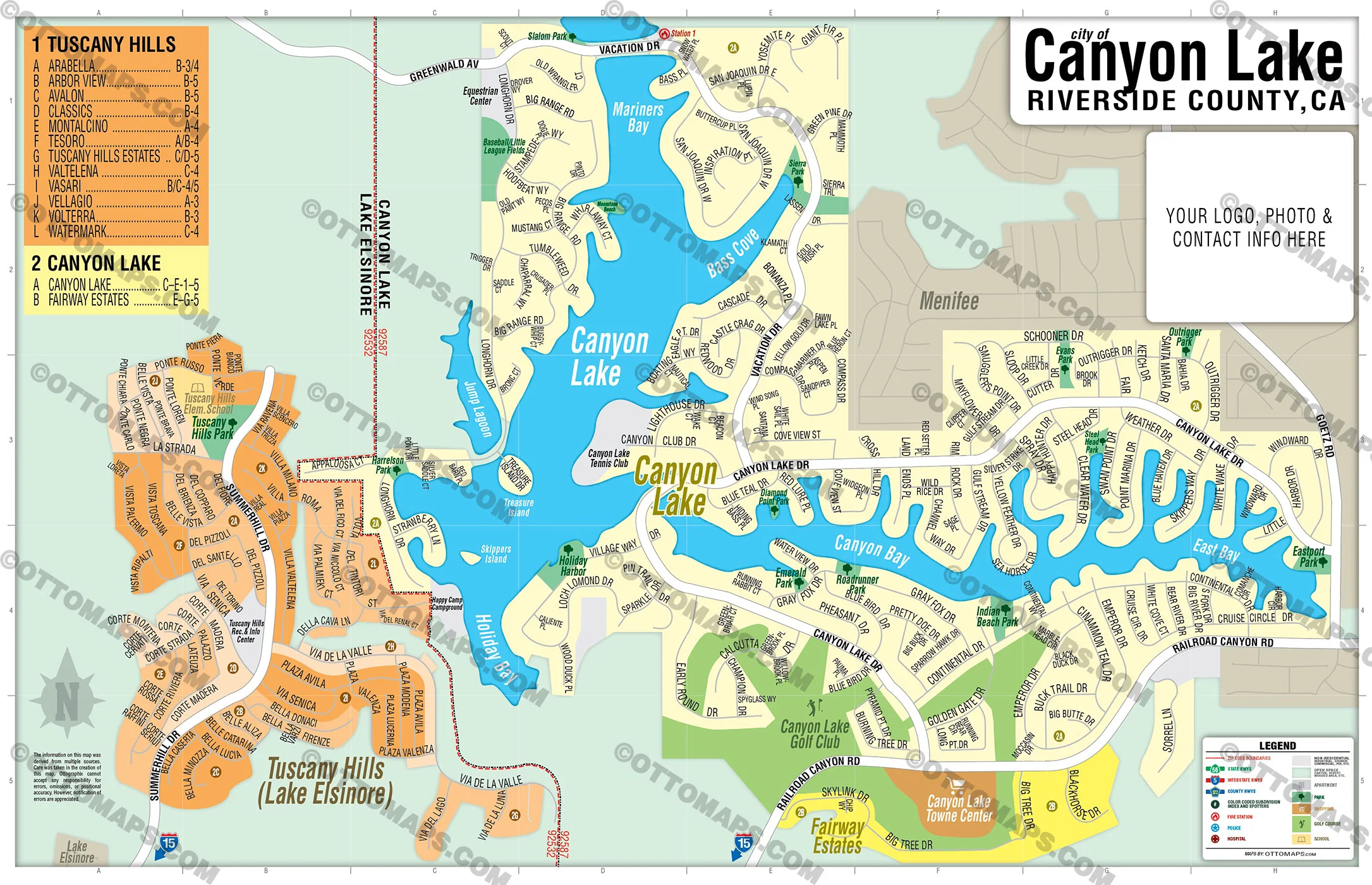
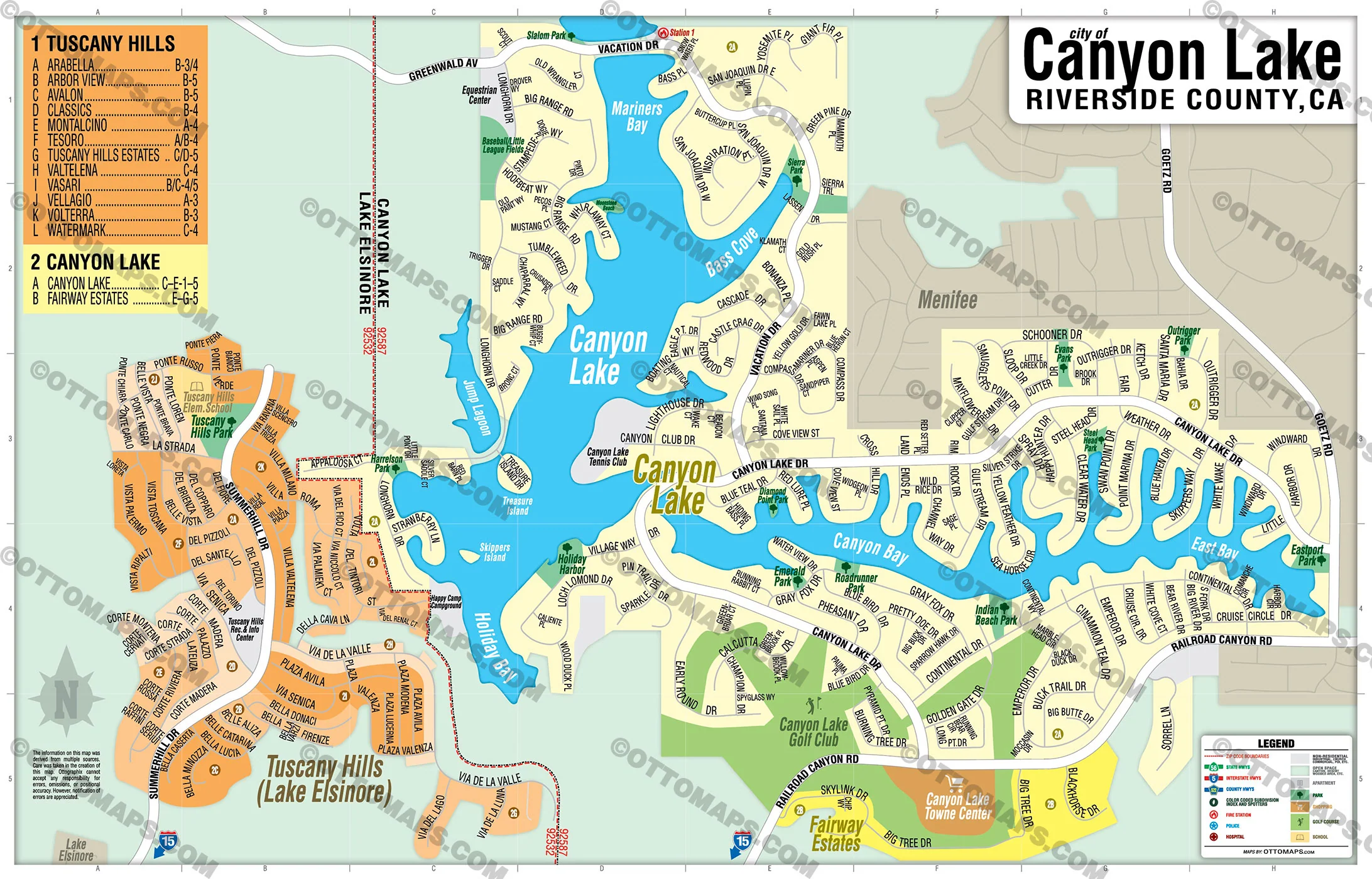
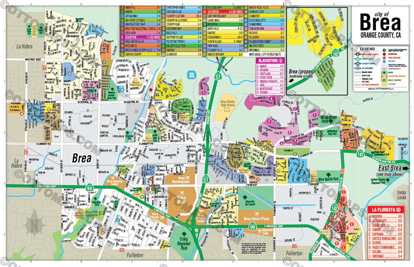
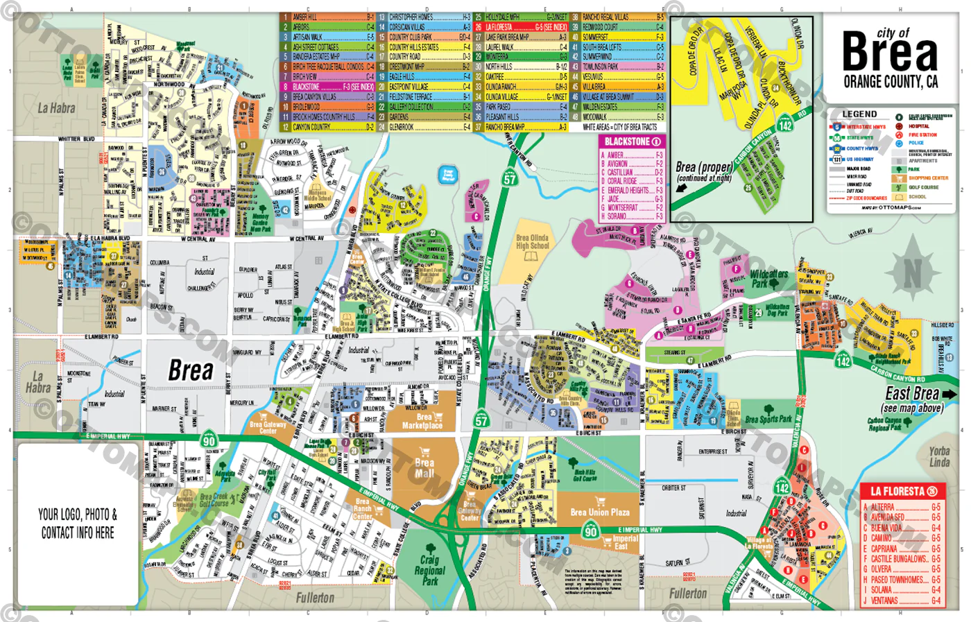
WILSHIRE COMMUNITY PLAN MAP POSTER PRINT
WILSHIRE COMMUNITY PLAN MAP FILES PDF and AI, editable, vector, layered, royalty free
PURCHASE INCLUDES:
- PDF Files - with Company Branding Box and without
- Adobe Illustrator Files and fonts (layered, editable)
- 11”x17” Vector File - enlarged or reduced to any size with out loss of quality
- Customization: Turn map layers on or off. Easily change Fonts and Colors
- Royalty Free / All Reproduction Rights Granted (not for resale)
- Prints not included, GET PRINTS HERE or recommend Vistaprint.com
- NO SALES TAX!
COMMUNITIES:
ARLINGTON HEIGHTS
BEVERLY GROVE
BROOKSIDE
Carthay
CARTHAY CIRCLE HPOZ
CARTHAY SQUARE HPOZ
CITRUS SQUARE
COUNTRY CLUB HEIGHTS
COUNTRY CLUB PARK HPOZ
DAYTON HEIGHTS
FAIRCREST HEIGHTS
FAIRFAX
FREMONT PLACE
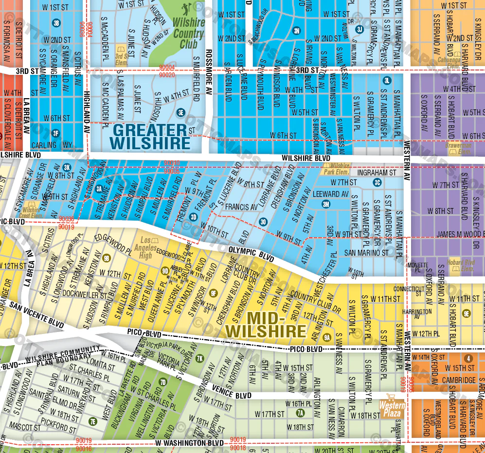
Greater Wilshire
HANCOCK PARK
HARVARD HEIGHTS HPOZ
KOREATOWN
LA BREA-HANCOCK
LA CIENEGA HEIGHTS
LAFAYETTE SQUARE HPOZ
LARCHMONT VILLAGE
LITTLE BANGLADESH
LONGWOOD HIGHLANDS
MELROSE
Mid City
Mid City West
MID-CITY
MID-CITY HEIGHTS
Mid-Wilshire
MIRACLE MILE
MIRACLE MILE HPOZ (MID-WILSHIRE/MID CITY WEST)
MIRACLE MILE NORTH HPOZ /FAIRFAX
OAKWOOD/MAPLEWOOD/ ST. ANDREWS
OLYMPIC PARK
OLYMPIC PARK EAST
OXFORD SQUARE
PARK MILE
PICFAIR VILLAGE
PICO DEL MAR
PICO PARK
PICO-ROBERTSON
PICO-UNION
REDONDO SYCAMORE/MIRACLE MILE
RIDGEWOOD-WILTON/ST. ANDREWS SQUARE
SOUTH CARTHAY HPOZ
SYCAMORE SQUARE
THE FAIRCREST
VICTORIA PARK
WELLINGTON SQUARE
WESTERN HEIGHTS HPOZ
WESTERN-WILTON
WILSHIRE CENTER
WILSHIRE HIGHLANDS
WILSHIRE PARK
WILSHIRE VISTA
WILSHIRE VISTA HEIGHTS
WINDSOR SQUARE
WINDSOR VILLAGE
CONTAINS:
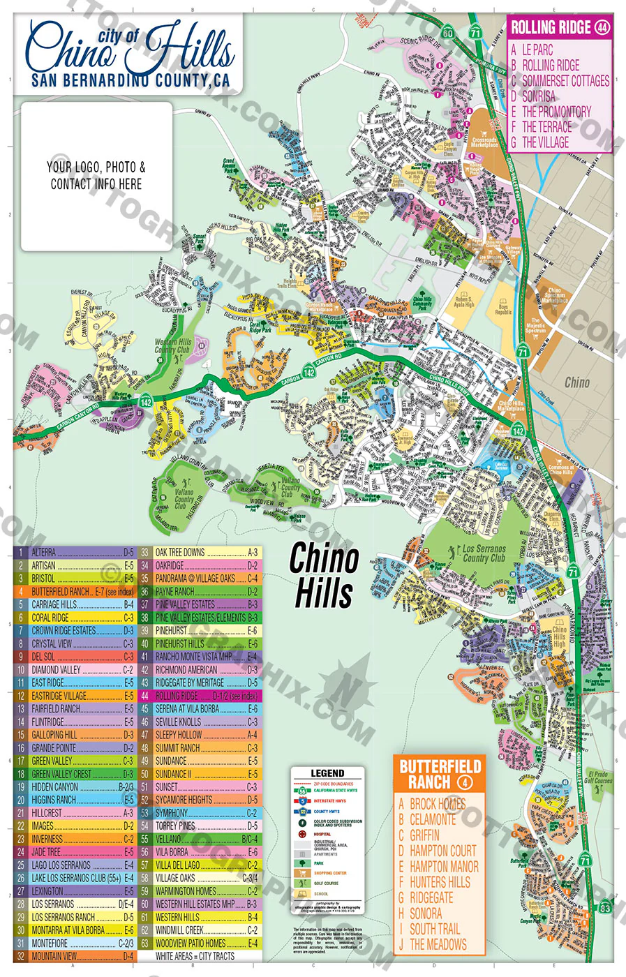
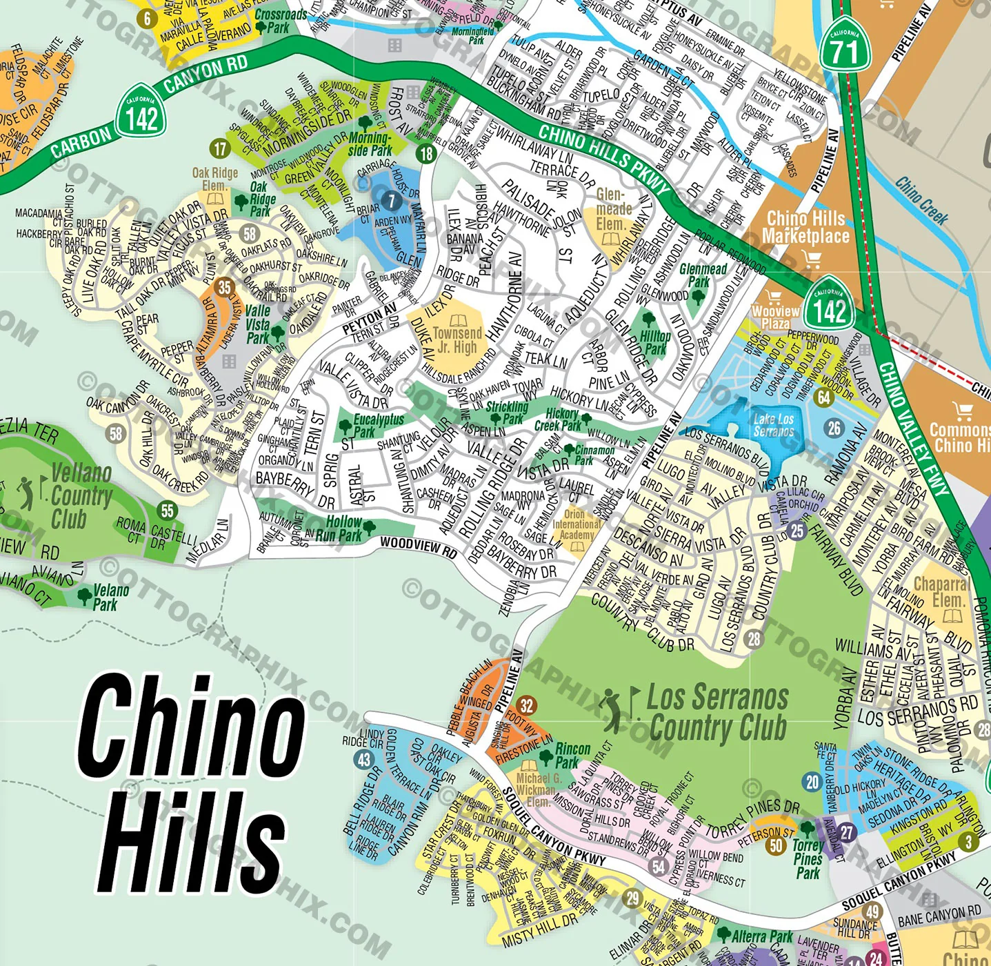
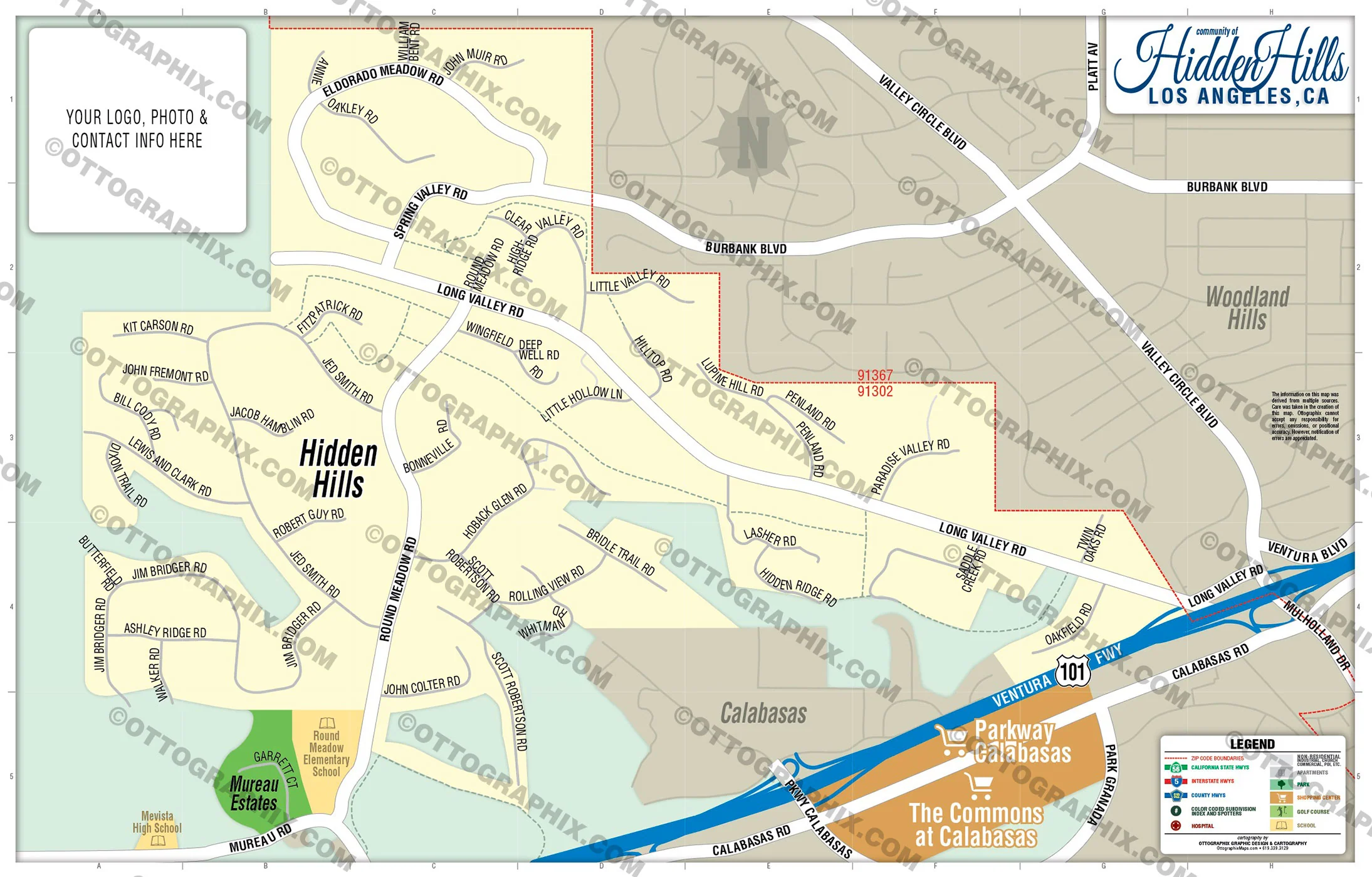
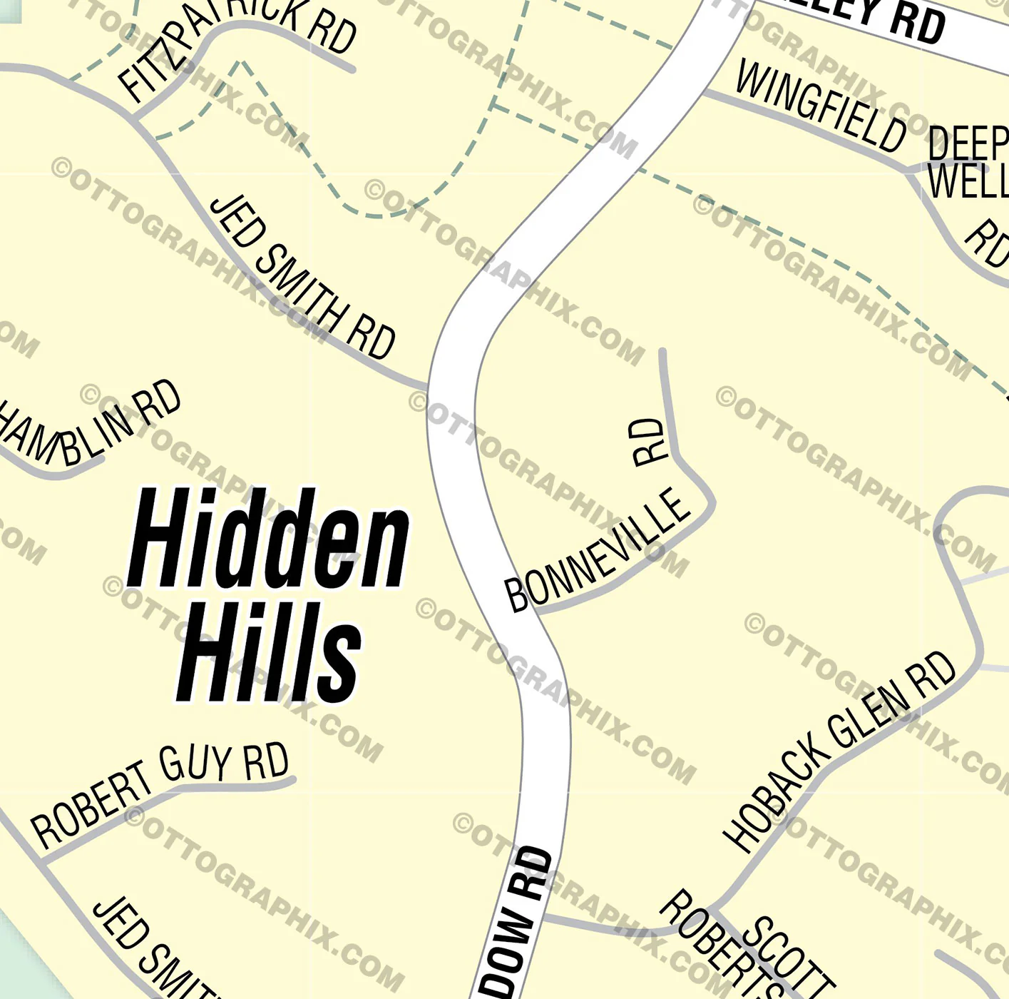
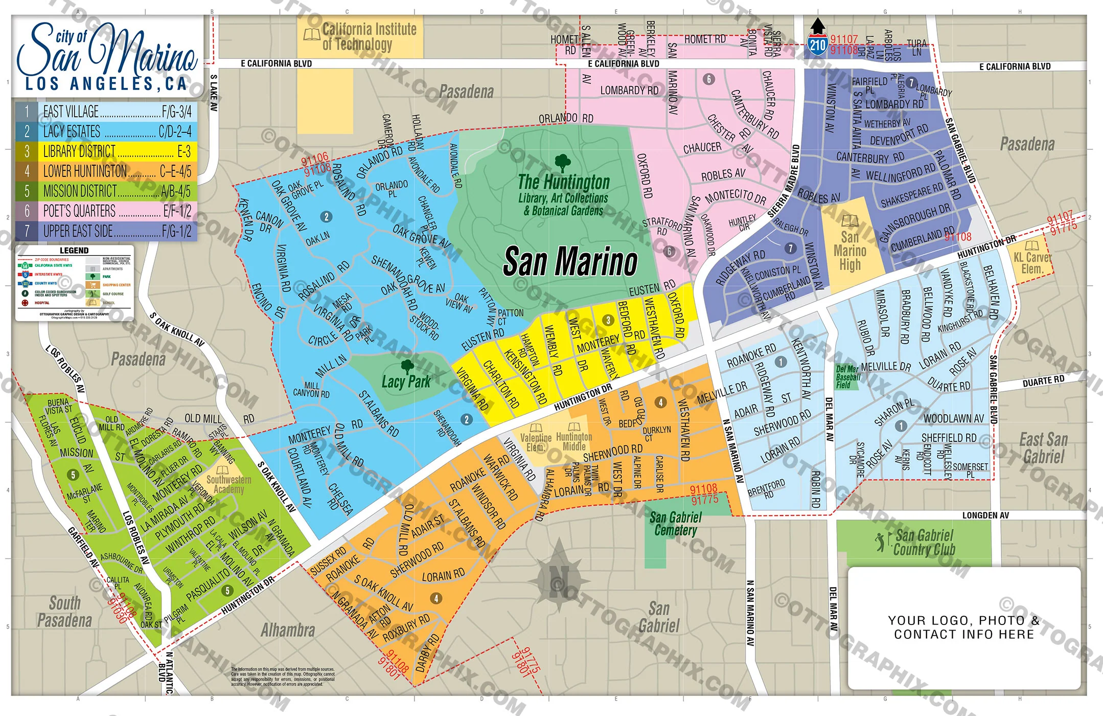
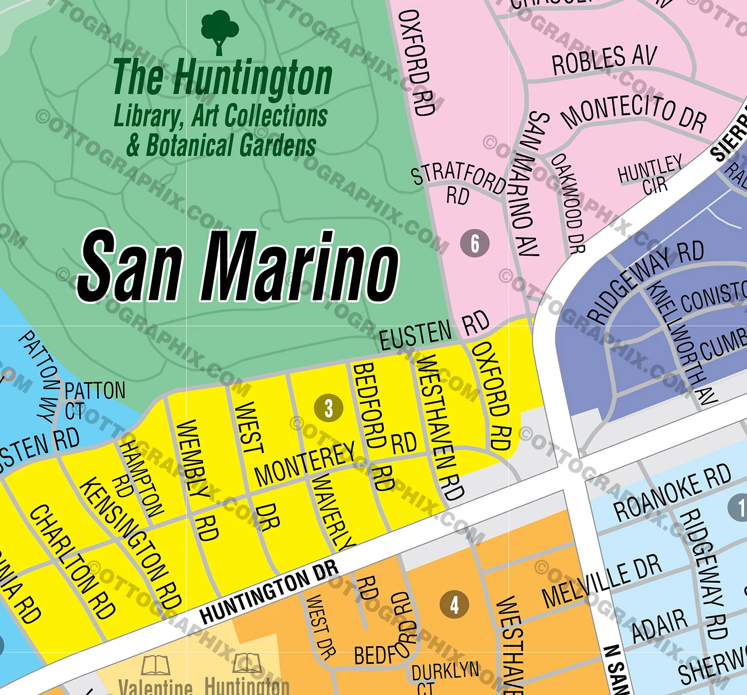
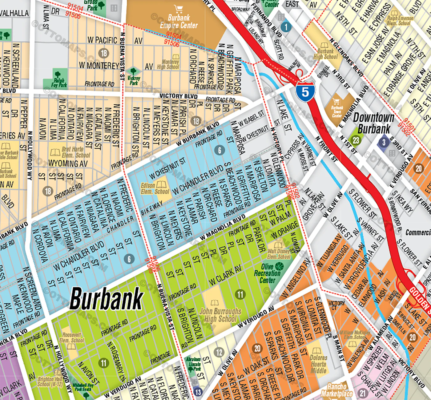
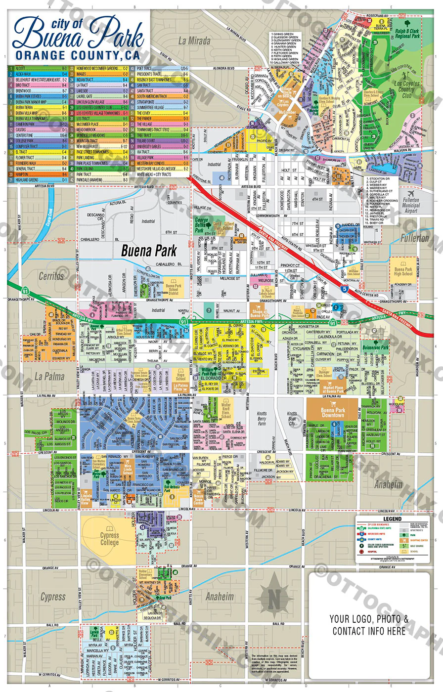
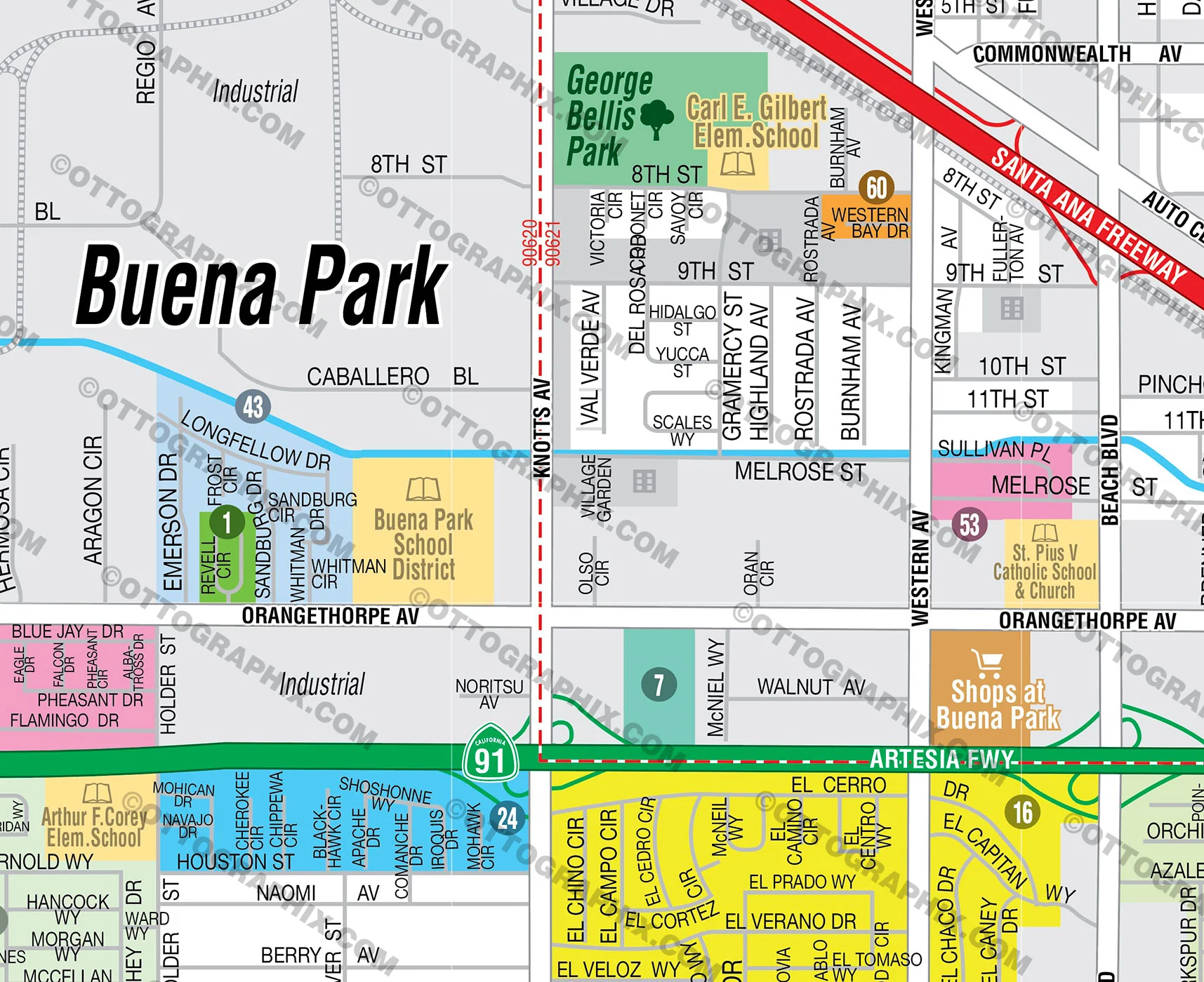
- Subdivision/Tract Boundaries and Index
- Full Street Detail
- Recreation Centers
- Parks
- Shopping Centers
- Golf Courses
- Schools
DETAILS:
- Zip Code Boundaries and Index
- Arterial Detail
- Parks
- County Area Boundaries
RIGHTS:
- Royalty Free
- Not for resale
- All reproduction rights granted
DISCLAIMER:
- This one was quite difficult as there are many interpretations of the boundaries of the neighborhoods in this area. It’s impossible to get them all 100% right because of all the conflicting info out there. However, I did extensive research and presented it with the best and most common result
- The information on this map was derived from multiple sources. Care was taken in the creation of this map. Ottographix cannot accept any responsibility for errors, omissions, or positional accuracy. However, notification of errors are appreciated. If you find a mistake, Ottographix will fix it for no charge. Please contact us and we'll take care of it. https://www.ottographix.com/contact.html, 619.339.3129, [email protected]
- Maps are sold as-is. All necessary files are included for editing
- Additional customization is available from Ottographix at an additional cost. Please contact us for details and a free quote. http://www.ottographix.com/contact.html, 619.339.3129, [email protected]
Original: $385.00
-65%$385.00
$134.75Product Information
Product Information
Shipping & Returns
Shipping & Returns
Description
includes Mid City, Mid City West, Mid-Wilshire and Greater Wilshire.
WILSHIRE COMMUNITY PLAN MAP POSTER PRINT
WILSHIRE COMMUNITY PLAN MAP FILES PDF and AI, editable, vector, layered, royalty free
PURCHASE INCLUDES:
- PDF Files - with Company Branding Box and without
- Adobe Illustrator Files and fonts (layered, editable)
- 11”x17” Vector File - enlarged or reduced to any size with out loss of quality
- Customization: Turn map layers on or off. Easily change Fonts and Colors
- Royalty Free / All Reproduction Rights Granted (not for resale)
- Prints not included, GET PRINTS HERE or recommend Vistaprint.com
- NO SALES TAX!
COMMUNITIES:
ARLINGTON HEIGHTS
BEVERLY GROVE
BROOKSIDE
Carthay
CARTHAY CIRCLE HPOZ
CARTHAY SQUARE HPOZ
CITRUS SQUARE
COUNTRY CLUB HEIGHTS
COUNTRY CLUB PARK HPOZ
DAYTON HEIGHTS
FAIRCREST HEIGHTS
FAIRFAX
FREMONT PLACE
Greater Wilshire
HANCOCK PARK
HARVARD HEIGHTS HPOZ
KOREATOWN
LA BREA-HANCOCK
LA CIENEGA HEIGHTS
LAFAYETTE SQUARE HPOZ
LARCHMONT VILLAGE
LITTLE BANGLADESH
LONGWOOD HIGHLANDS
MELROSE
Mid City
Mid City West
MID-CITY
MID-CITY HEIGHTS
Mid-Wilshire
MIRACLE MILE
MIRACLE MILE HPOZ (MID-WILSHIRE/MID CITY WEST)
MIRACLE MILE NORTH HPOZ /FAIRFAX
OAKWOOD/MAPLEWOOD/ ST. ANDREWS
OLYMPIC PARK
OLYMPIC PARK EAST
OXFORD SQUARE
PARK MILE
PICFAIR VILLAGE
PICO DEL MAR
PICO PARK
PICO-ROBERTSON
PICO-UNION
REDONDO SYCAMORE/MIRACLE MILE
RIDGEWOOD-WILTON/ST. ANDREWS SQUARE
SOUTH CARTHAY HPOZ
SYCAMORE SQUARE
THE FAIRCREST
VICTORIA PARK
WELLINGTON SQUARE
WESTERN HEIGHTS HPOZ
WESTERN-WILTON
WILSHIRE CENTER
WILSHIRE HIGHLANDS
WILSHIRE PARK
WILSHIRE VISTA
WILSHIRE VISTA HEIGHTS
WINDSOR SQUARE
WINDSOR VILLAGE
CONTAINS:
- Subdivision/Tract Boundaries and Index
- Full Street Detail
- Recreation Centers
- Parks
- Shopping Centers
- Golf Courses
- Schools
DETAILS:
- Zip Code Boundaries and Index
- Arterial Detail
- Parks
- County Area Boundaries
RIGHTS:
- Royalty Free
- Not for resale
- All reproduction rights granted
DISCLAIMER:
- This one was quite difficult as there are many interpretations of the boundaries of the neighborhoods in this area. It’s impossible to get them all 100% right because of all the conflicting info out there. However, I did extensive research and presented it with the best and most common result
- The information on this map was derived from multiple sources. Care was taken in the creation of this map. Ottographix cannot accept any responsibility for errors, omissions, or positional accuracy. However, notification of errors are appreciated. If you find a mistake, Ottographix will fix it for no charge. Please contact us and we'll take care of it. https://www.ottographix.com/contact.html, 619.339.3129, [email protected]
- Maps are sold as-is. All necessary files are included for editing
- Additional customization is available from Ottographix at an additional cost. Please contact us for details and a free quote. http://www.ottographix.com/contact.html, 619.339.3129, [email protected]